
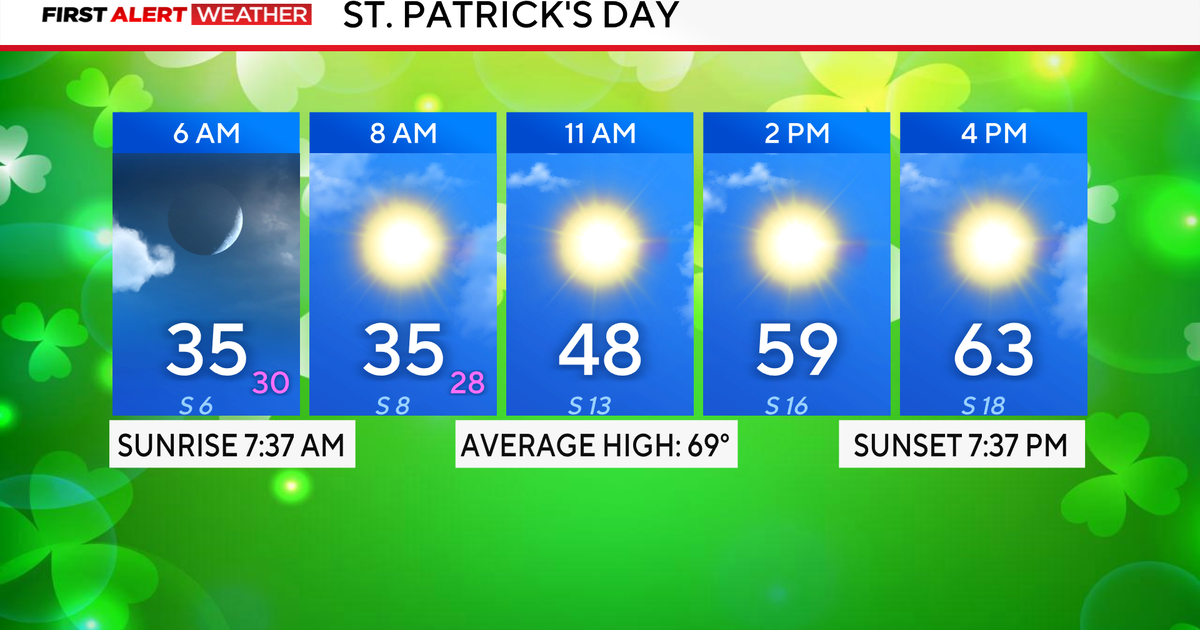
It’s another freezing start with temperatures in the 20s and 30s. A freeze warning is in place Tuesday until 9 a.m., and as a result, it is a First Alert Weather Day.
By the afternoon, it warms up nicely into the mid-60s for St. Patrick’s Day. There is an elevated fire danger along and west of I-35 due to gusty winds up to 30 mph and low levels of relative humidity.

After Tuesday, North Texas will see a big warm-up in the forecast. Highs rise near 80° on Wednesday and then soar to near 90° on Thursday as a ridge of high pressure dominates our weather pattern.

By Friday and into the weekend, highs rise and stay in the 90s, bringing DFW close to tying previous records or setting new ones. With no rain chances in the forecast and warm temperatures, it will be perfect for any outdoor or pool plans this weekend.
