
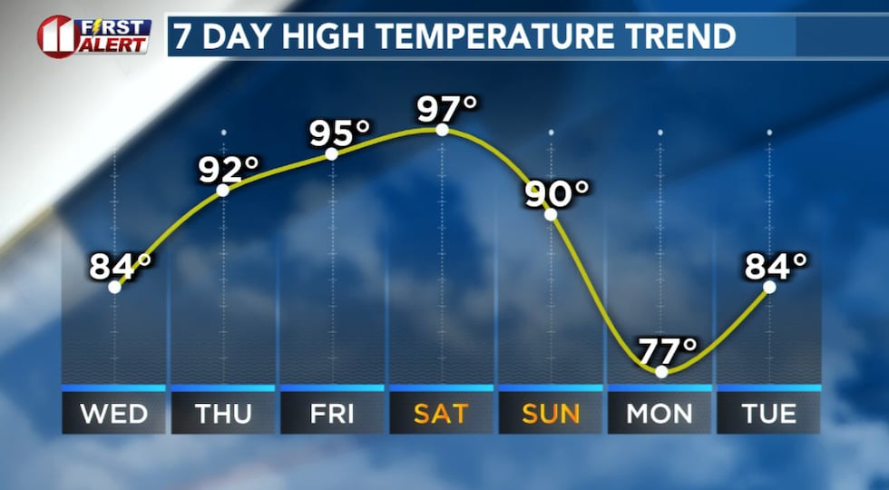
LUBBOCK, Texas (KCBD) – Starting Thursday and stretching through Saturday, temperatures across the South Plains will soar into the 90s. Some areas in the eastern viewing area may see highs around 100 degrees. This is exceptional for the time of year.
This time of year Lubbock averages a low near 40 and a high in the upper 60s to near 70 degrees.
 As Spring begins, temperatures will be more like Summer.(KCBD First Alert)
In the three day stretch mentioned, temperatures will peak 25 to 30 degrees above average, which means it is likely we’ll break temperature records during that period.
Out of the Ordinary
The driving feature is an upper-level ridge of high pressure. Now over the Desert Southwest, this ridge will slowly build toward the KCBD/FOX34 viewing area. The strength of this feature is well above what we typically see this time of year. It is a rare pattern.
The Bad News
Unfortunately, the high pressure will prevent any precipitation.
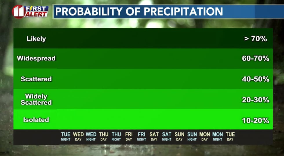 Dry weather will continue well into next week.(KCBD First Alert)
As of today, there is no signal for rain for at least the next seven days.
The Good News
Fortunately, the same pattern will keep winds on the light side through at least Saturday.
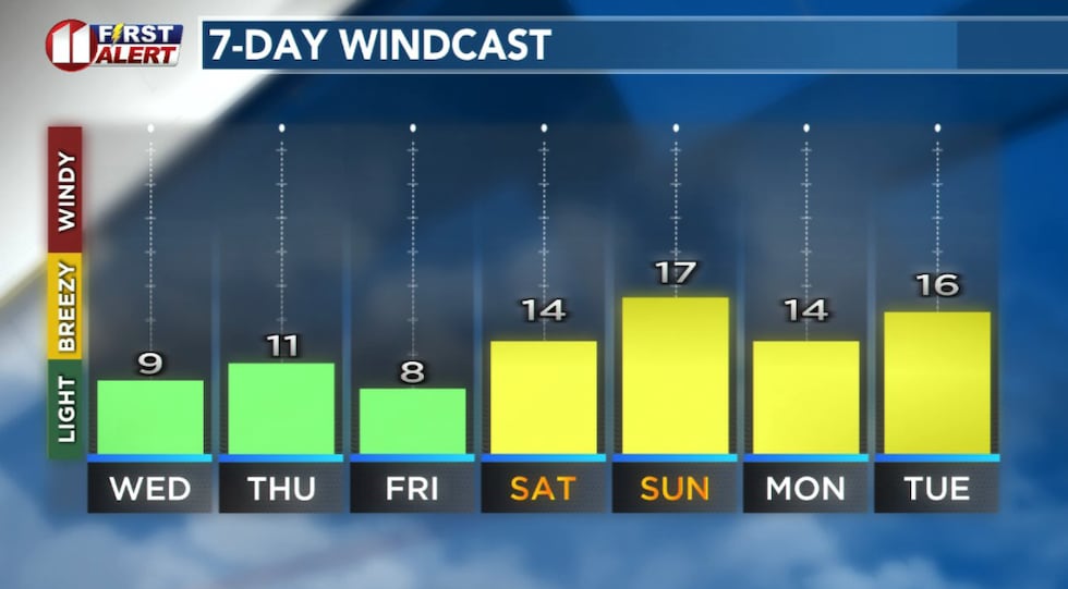 Winds will remain light the next several days as high pressure builds into West Texas.(KCBD First Alert)
So while it will be hot and dry, fire weather concerns will remain low.
Saturday will be the hottest day of the week, especially off the Caprock where highs could reach the low 100s.
The Cool Down
The ridge will start to break down Sunday, with a cold front expected to move through sometime during the day. Our current forecast reflects an afternoon arrival. If it is earlier, our forecast is too warm. If the front arrives alter, our forecast is too cool.
Next Week
Monday will bring a modest cooldown, but don’t expect a dramatic shift.
 For the time being at least, there is not another freeze in sight.(KCBD First Alert)
Above average temperatures and dry conditions are expected to continue well into next week.
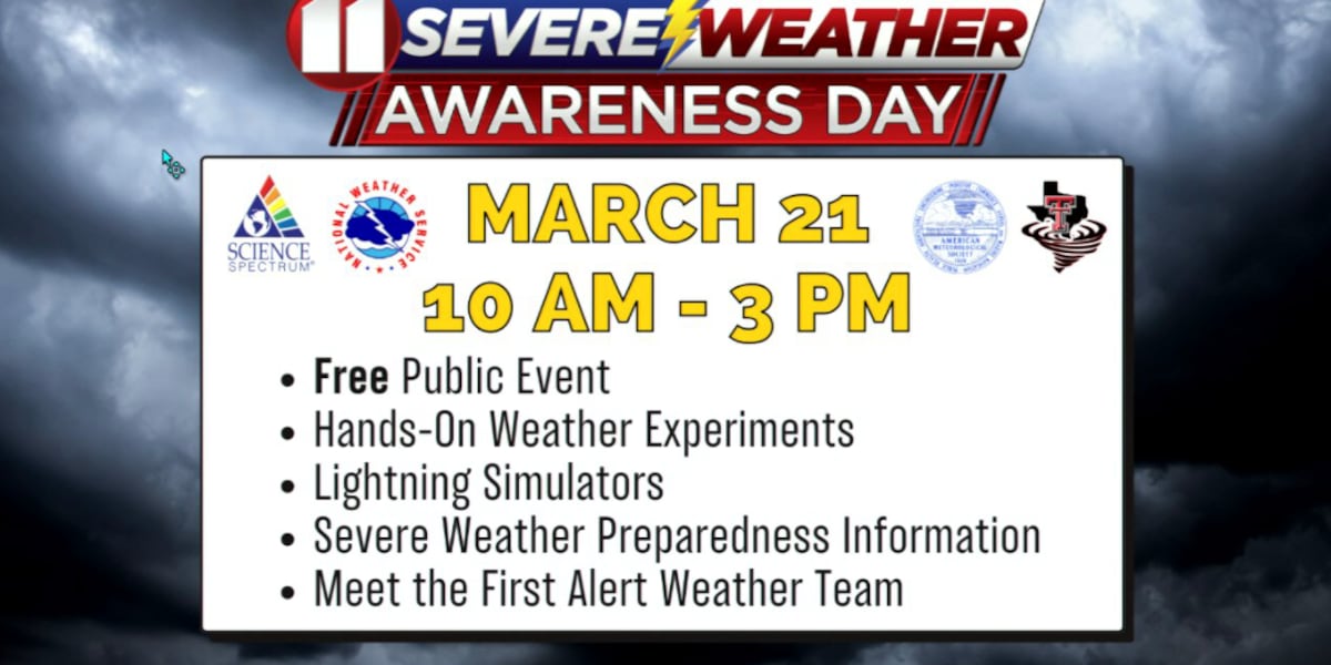
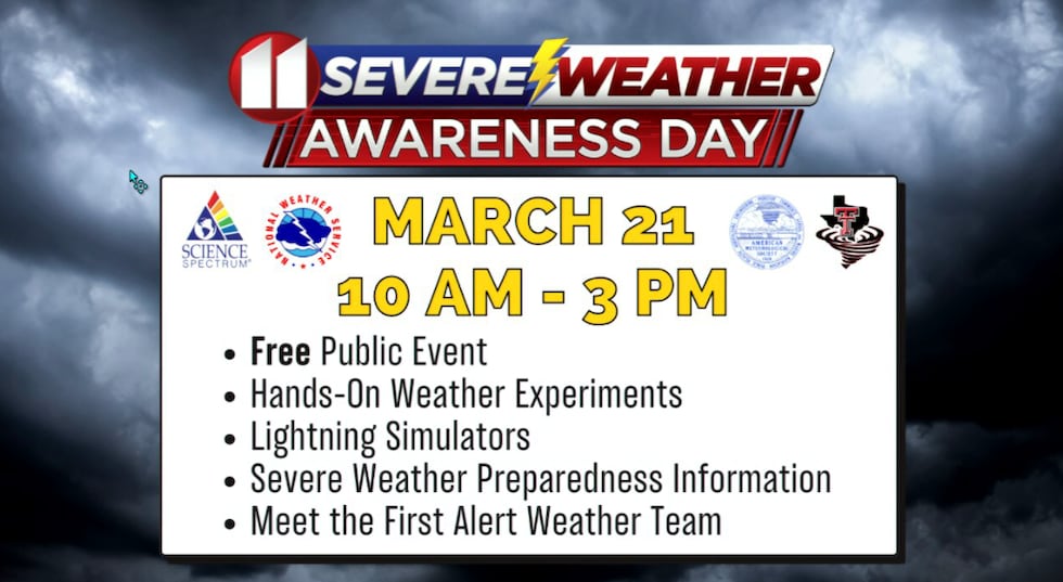
Severe Weather Awareness Day
Come meet the First Alert Weather team, learn about severe weather, check out storm chase and emergency response vehicles, and maybe win a weather-related door prize. IT’S ALL FREE!
 Come meet the First Alert Weather team, learn about severe weather, check out storm chase and emergency response vehicles, and maybe win a weather-related door prize. IT’S ALL FREE!(KCBD First Alert)
On This Date
On this date in 1979, a regional outbreak of severe storms with a few tornadoes struck from the southern South Plains north into the Texas Panhandle. From about 4 PM until 3 AM, at least eight tornadoes touched down, most after dark.
Perhaps the most significant tornado occurred in Crosby County around 12:45 AM. Storm spotters observed a medium-sized tornado develop just southwest of Crosbyton before lifting temporarily while passing over the city. The tornado, however, quickly touched down again just north of the city where it damaged a house and injured two people. Continuing northeast, the tornado destroyed two houses and damaged barns and outbuildings.
Earlier, hail up to golf ball size damaged windows and buildings near the South Loop in Lubbock. This same storm spawned a small tornado shortly after midnight on the northeast side of Lubbock before disappearing just south of the airport. Damage was reported over several square blocks, with severe damage to three homes and one large business.
Other locations that reported tornadoes included Silverton, Abernathy, Plainview, and Matador. No injuries or damage were reported with these latter tornadoes as they remained over open country.
(Source: National Weather Service, Lubbock)
Copyright 2026 KCBD. All rights reserved.