
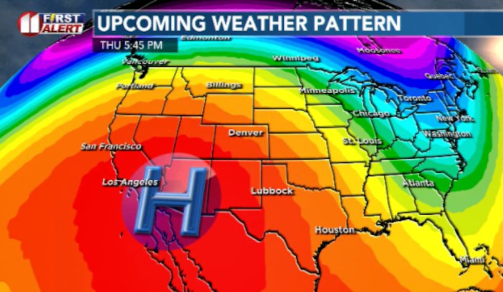
LUBBOCK, Texas (KCBD) – An unusually early and strong high-pressure system is expected to set up just to the west of Texas, creating an opportunity to set several new record high temperatures for much of the South Plains heading into this weekend.
TONIGHT
Clear skies and mild as temperatures hang out in the upper 40s and lower 50s. Winds remain light and quiet overnight.
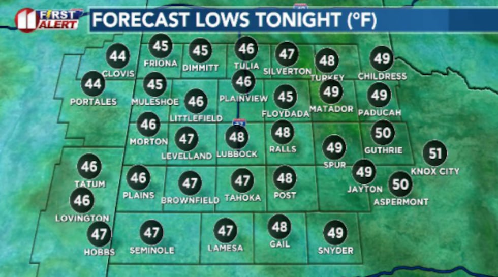 Mild overnight lows in the mid to upper 40s expected for the South Plains.(Dylan Smith)
THURSDAY
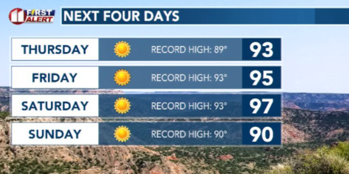
We begin the first of several opportunities to break high record temperatures.
 High pressure influences our next few days followed by a cold front to kick off next week. However, extended models are indicating more warm/hot weather next week.(Dylan Smith)
High temps are expected to reach into the low to mid 90s. The current record is 89°. Nothing but sunshine and calm, quiet winds generally less than 10 to 15 mph.
 An early-season high pressure dome is setting us up for several days of record high temperatures(Dylan Smith)
UPCOMING WEATHER PATTERN
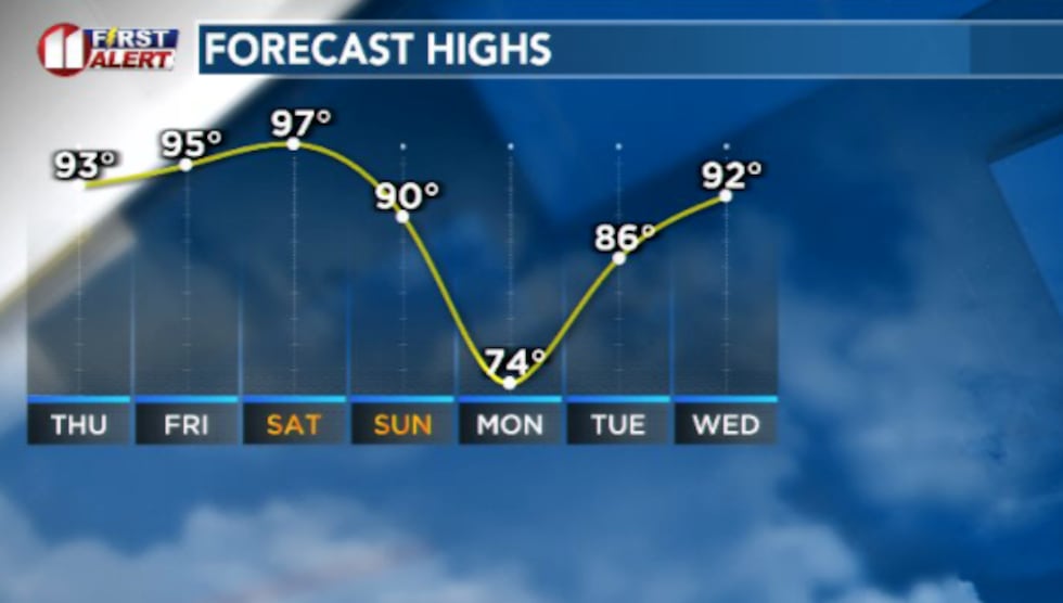
High pressure will continue to dominate our high temperatures for the rest of the week and upcoming weekend. Mid-90s are anticipated for Friday, Saturday and potentially Sunday. Sundays highs will be dictated by the arrival of a cold front.
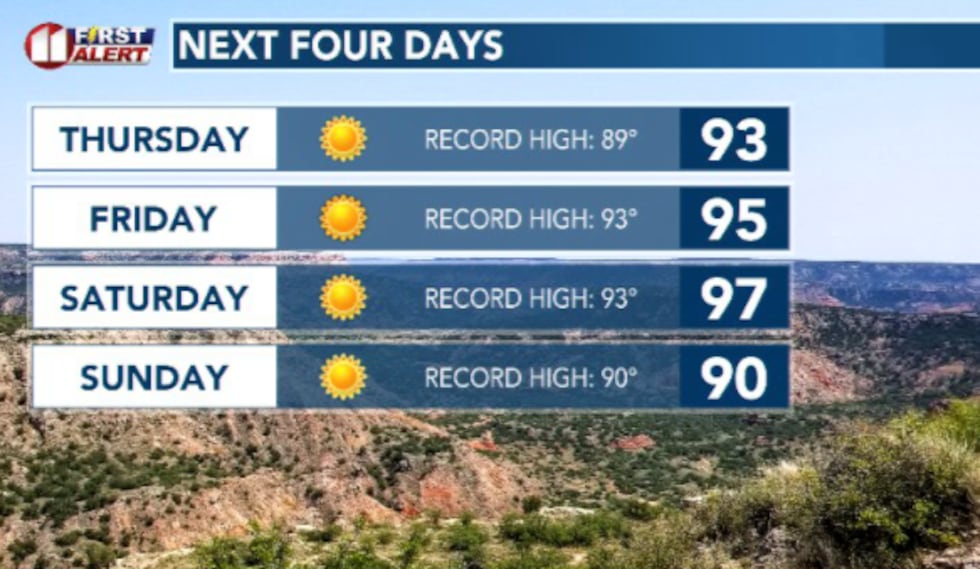 There’s a good shot at at least tying or breaking record highs over the next 3 to 4 days.(Dylan Smith)
That front will bring in a short-lived round of cooler air for Monday before temperatures skyrocket once again to the 80s and then 90s as we move into the middle of next week.
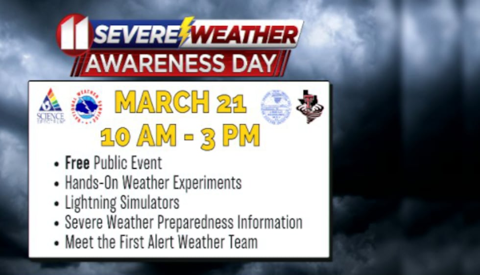 Come join us at the Science Spectrum for hands on learning about severe weather!(Dylan Smith)
DON’T FORGET! We’re having our annual Severe Weather Awareness Day this Saturday from 10am-3pm. Come out and meet the KCBD weather team and learn severe weather safety tips and what to look out for when severe weather strikes!
TODAY IN WEATHER HISTORY:
The first of a two day severe event arrived for the South Plains. A large line of supercells developed from Childress to near Aspermont. These produced lots of hail and strong winds with even some funnel clouds observed. There was also the evidence that gustnadoes developed around some of these storms.
Copyright 2026 KCBD. All rights reserved.