
Listen to an audio version of this story:
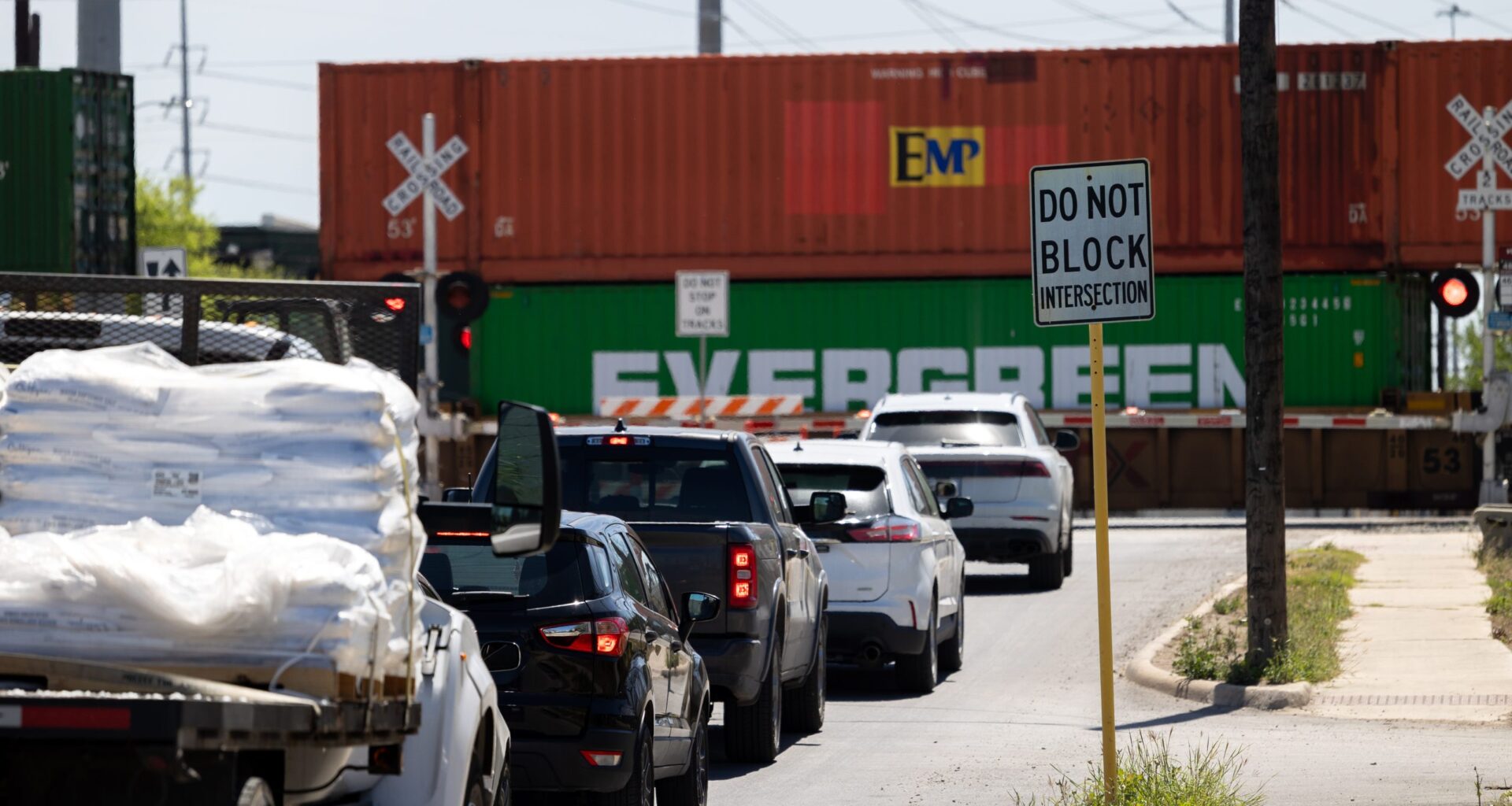
For many San Antonio drivers, getting stuck behind a train isn’t a matter of if — but when. With roughly 500 street-level railroad crossings across the city, passing or stalled trains can bring traffic to a standstill with little warning.
City officials are now looking to change that, advancing a proposal through the Governance Committee on Wednesday, to study the feasibility of a real-time notification system that would alert drivers when trains are approaching or blocking crossings — potentially through navigation apps like Waze, Apple and Google Maps.
The proposal, filed by District 2 Councilman Jalen McKee-Rodriguez, directs city staff to explore partnerships with rail operators, navigation platforms and technology firms, as well as the use of sensors or other detection systems.
“I get stopped by trains all the time and I wonder what would make this easier for me?” McKee-Rodriguez said. ”And so I was thinking, I wish my GPS would tell me that a train was either on its way or would stop somewhere, then I would have avoided coming this way and I know that’s the story so many other people have.”
Beyond inconvenience for drivers, blocked crossings can also create public safety challenges when emergency vehicles are unable to pass through intersections when responding to calls.
“If they get stuck there they have to then route that call to a different station,” McKee-Rodriguez said. “Making sure that everyone has access to this information, including our public safety departments, I think will be a really worthwhile cause.”
While rail grade separation projects — using overpasses or underpasses to move crossings off street level — have been completed across the city or are underway, McKee-Rodriguez said their cost and scale make them difficult to implement broadly.
A recent Texas Department of Transportation estimate places the cost of raising a crossing at Zarzamora Street and Frio City Road at $65.7 million.
“We just realistically don’t have the resources or opportunities to do that at every railroad in the city,” McKee-Rodriguez said.
While some crossings are connected to the city’s traffic signal system to detect train activity through a partnership with rail operators, Public Works Director Art Reinhardt said those account for less than 10% of crossings citywide.
“We can detect train activity that will speak to our traffic signal system and modify how the signal system operates,” Reinhardt said. “It can potentially give extended green times to clear the crossing to prevent people from being stuck on the crossing, or also prohibit certain movements to protect people from entering into the crossing.”
Reinhardt said developing a real-time notification system will require coordination with rail companies, which control much of the data related to train movement.
Rail operators may be reluctant to share real-time train location data due to security concerns, including the transport of sensitive or hazardous materials, Reinhardt said.
Because of those limitations, the city may need to focus on only detecting whether a crossing is blocked rather than tracking trains directly.
Reinhardt said there are also cost and legal considerations that will need to be evaluated as part of the study, including potential funding for equipment, software and ongoing maintenance, as well as liability concerns if the system fails to provide accurate information.
The proposal calls for identifying potential pilot locations at high-impact crossings, particularly those with frequent blockages or near emergency response routes, and developing performance metrics to measure effectiveness.
City staff will now study the proposal’s feasibility and are expected to bring recommendations, including potential costs and partnerships, to the Transportation and Infrastructure Committee at a later date.