

Click the player above for a livestream of current radar and weather cameras.
LUBBOCK, Texas (KCBD) – After several days of gray skies and off-and-on rain, we’re in for a stretch of sunshine.
But don’t get too comfortable, a series of cold fronts next week will keep temperatures on a roller coaster, with chilly mornings and a few near-freezing starts.
 Low pressure churning into Oklahoma will keep things cloudy tonight(KCBD)
Scattered showers and a few rumbles of thunder are still hanging around this evening, mainly for the eastern side of our viewing area. Most of the activity will taper off by around sunset as an upper-level low spins east into Oklahoma.
That same system has been slow to move, pulling in just enough moisture to keep clouds lingering tonight. Areas off the Caprock may stay mostly cloudy overnight, while spots farther west could briefly clear out. With the air still moist from recent rain, patchy fog is likely to form after midnight and linger into Sunday morning.
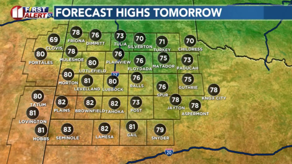 Highs tomorrow(KCBD)
Sunday will bring a tale of two forecasts. As surface low pressure develops over eastern New Mexico, winds will shift out of the west across the Caprock, helping skies clear and temperatures climb.
Farther east, cooler easterly winds will keep clouds hanging around longer. The result will be a sharp temperature contrast with warmer, drier air in and around Lubbock, but cooler and cloudier toward Childress.
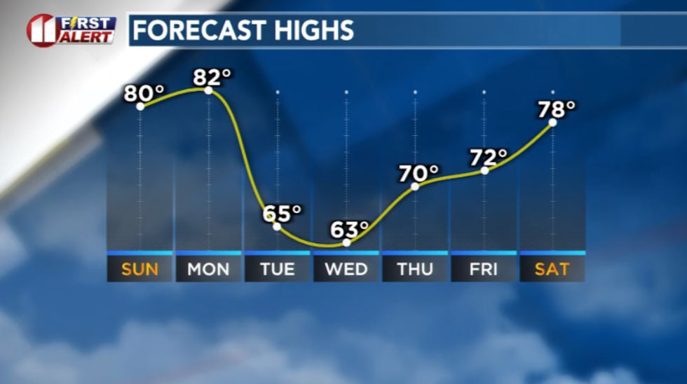 High next week will drop to below average for late October(KCBD)
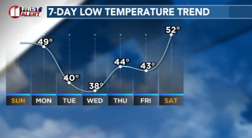 Low temperatures next week will be near freezing for some(KCBD)
By Monday, the pattern flips again. A cold front is expected to slide through late Monday or earlier Tuesday, followed by a stronger front Tuesday night into Wednesday. Behind it, temperatures will fall below normal for late October, with near-freezing mornings possible midweek.
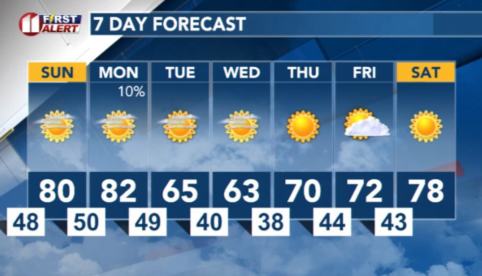 7 Day Forecast(KCBD)
Copyright 2025 KCBD. All rights reserved.