
Week after week, month after month, San Antonio continues to record significantly below average precipitation. So far this March, the Alamo City has recorded just 0.44-inch of rainfall, way below the March average of 2.31 inches.
March will likely go down as the seventh consecutive month with below-average rainfall. During that time (since Sept. 1), San Antonio has accumulated just 5.13 inches of rain, which is less than 30% of the city’s normal rainfall during that time frame.
Astonishingly, San Antonio has not recorded even a half-inch of rain on a single day since Oct. 24 – 149 days ago. That is San Antonio’s fifth-longest such dry streak in the past 80 years.
The lack of rain has continued to result in falling lake levels throughout South-Central Texas. Canyon Lake has fallen by more than a foot and a half since the start of the year, and it is now less than 60% full for the first time since before the July 2025 Hill Country floods. Medina Lake has fallen by more than two feet so far this year, and is now merely 4% full.
Unfortunately, rain chances will stay very low for much of this week. However, weather models are starting to hint at potential higher rain chances by next week. Here’s the latest.
Monday’s forecast
San Antonio will be treated to very pleasant weather Monday morning, as temps likely hover in the upper 50s to low 60s between 5 and 9 a.m. Mostly sunny skies will allow temps to rise steadily into the upper 70s by noon.
Thankfully, high pressure is expected to weaken on Monday, leading to slightly cooler afternoon temperatures than what the region experienced over the weekend. San Antonio will top out in the mid- to upper 80s, with light southeast winds coming in at 5-10 mph. Rain chances, though, will stay slim to none.
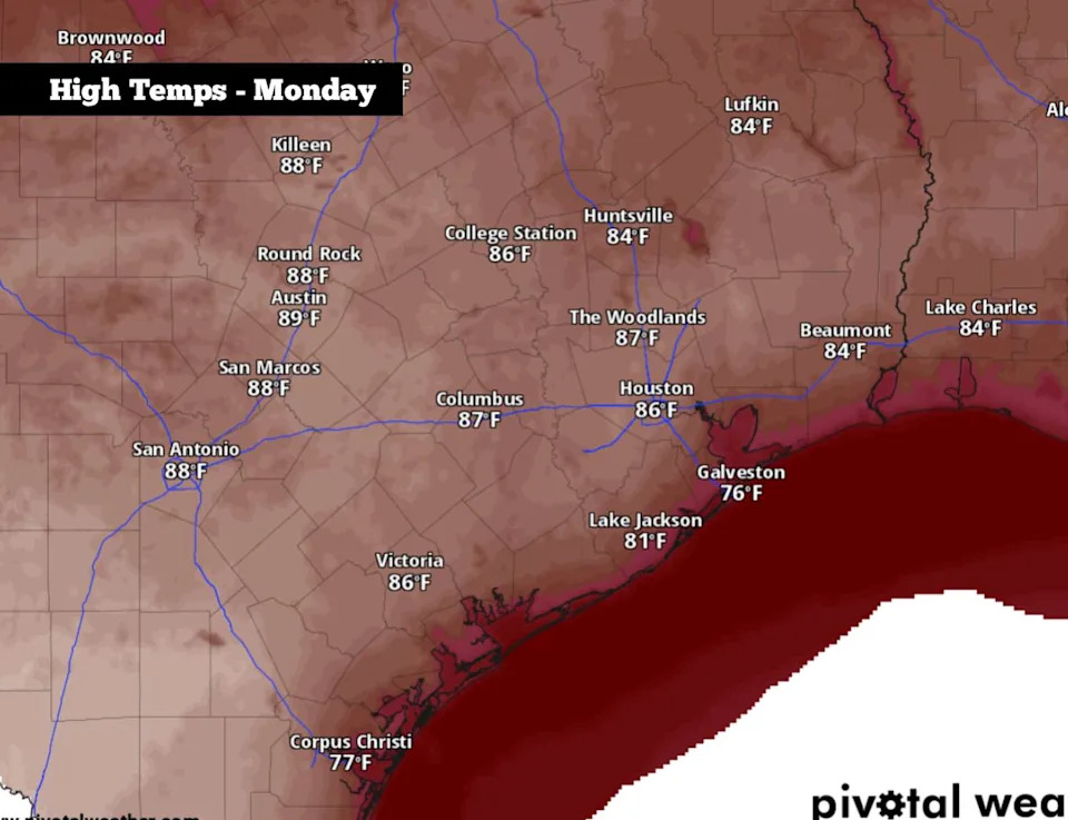
Shown are the expected high temperatures across South Texas on Monday. (Pivotal Weather)
Hot and dry this week
Weather conditions are expected to stay very similar on Tuesday, albeit with a touch more cloud cover. San Antonio will start the day near 60 degrees before afternoon highs once again reach into the upper 80s.
By Wednesday and Thursday, high pressure will again strengthen over Texas, leading to a slight uptick in temperatures. Highs will top out in the low 90s, while low temps are expected to sit in the low to mid-60s. Rain chances will also stay near zero, as high pressure suppresses cloud formation.
Changes coming soon?
Weather models are now indicating that a cold front will likely move through the region sometime between Friday afternoon and Saturday morning. There is still a good deal of uncertainty in regards to how strong the front could be, but it does have the potential to be significant, possibly bringing a 10-20 degree drop to both high and low temperatures.
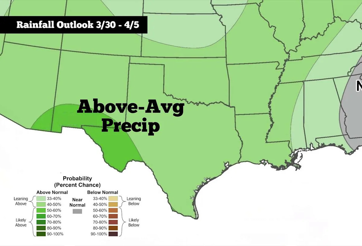
This could also be the start of a changing weather pattern that brings higher storm chances into South Texas. According to the Climate Prediction Center, San Antonio has about an 80% chance of near to above-average rainfall during the week of March 30-April 5.
Additionally, April marks a time of the year where the threat of large hail and damaging winds increases across Texas. Be sure to stick with expressnews.com/weather for daily updates as the upcoming forecast becomes more clear.
This article originally published at South Texas is way too dry, but here’s when storm chances may finally rise..