
LUBBOCK, Texas (KCBD) – Today is our one-day break from the heat, before we return to more summer-like weather. While today is noticeably cooler, the typical temperature range here this time of year is around 40 in the morning and 70 in the afternoon. Of course, March usually brings a wide range in conditions.
With an upper-level ridge building in overhead from the southwest, it will return to sunny and hot weather next few days.
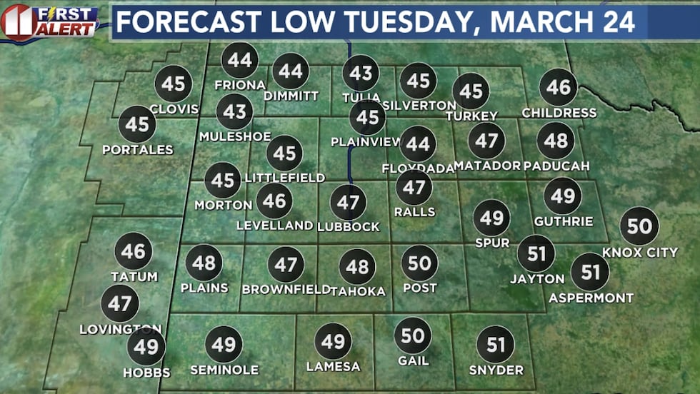
Tuesday morning’s low will be near 47.
 Forecast low Tuesday morning(KCBD)
By the afternoon it will climb to the upper 80s to low 90s, mostly sunny, steady S/SW wind 12-20mph. It won’t be quite as hot farther east, though it may feel a little hotter. There will be more humidity over the eastern half of our area. There will be somewhat of a dry line developing, though this isn’t the type of setup like where we’re waiting for springtime thunderstorm development.
Lower numbers west (dew point in the 20s) shows where the driest air will be, allowing the temperature to climb a little faster. Behind that dry line, the wind will be more westerly through the afternoon.
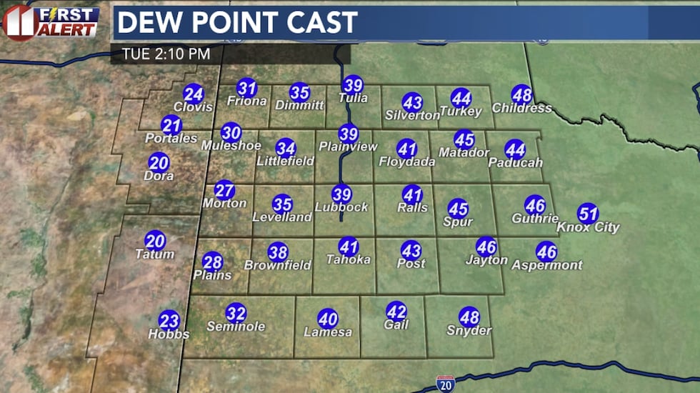 Dew point model projection Tuesday(KCBD)
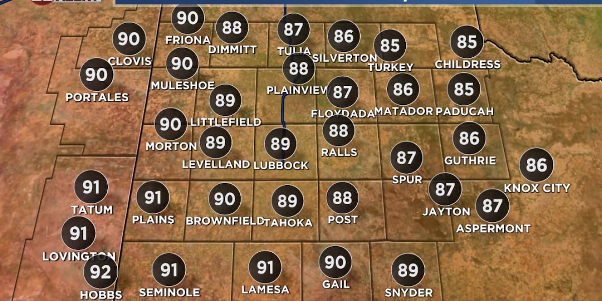
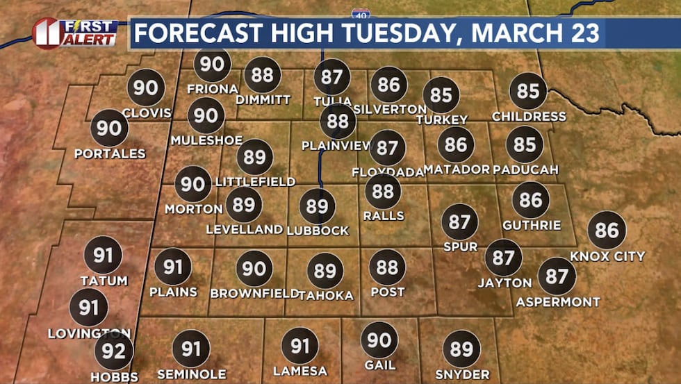
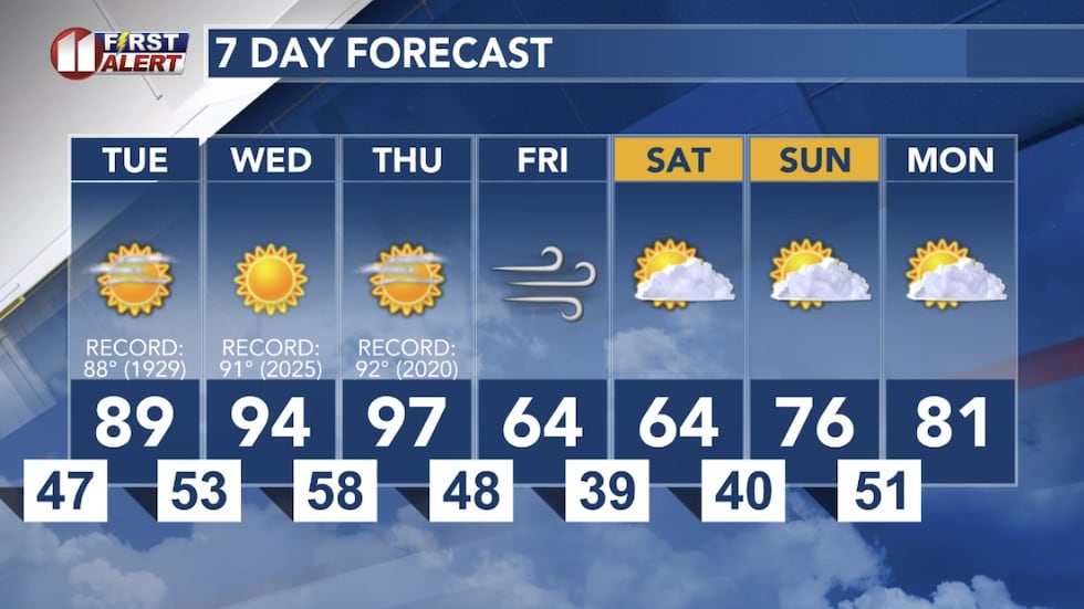
We’re forecasting 89 in Lubbock. The record for tomorrow’s date is 88, set in 1929. Records go back here a little more than a century.
 Forecast high Tuesday(KCBD)
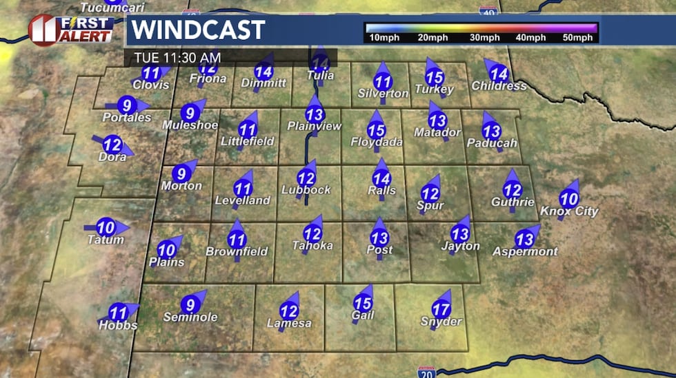 Computer model projection mid-day Tuesday(KCBD)
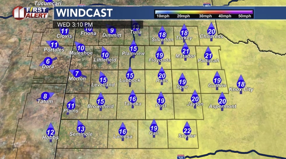
The wildfire risk will be elevated Tuesday afternoon. It will get even hotter Wednesday and Thursday, with the wind also getting a little stronger each day. As a result, the wildfire risk will trend higher day by day.
 Computer model projection Wednesday afternoon(KCBD)
Wednesday we’re forecasting 94. Record for the date is 91, set last year. Thursday’s forecast of 97 would break the daily record by five degrees, set in 2020.
Next front
If you aren’t ready for summer weather to stick around, good news. A strong cold front will move across the region either late Thursday or early Friday. There will be more clouds Friday, and it will be about 30 degrees cooler than Thursday. It will feel even cooler because of the wind, N/NE sustained 20-35mph, with higher gusts. Friday will likely top out in the mid 60s.
Saturday will be cooler, then back to the upper 70s Sunday.
Dry outlook
This will be another dry week. Looking ahead, some computers are showing an upper-level storm system bringing some rain early to mid part of next week. But this far out, and with as dry as it’s been, we aren’t too optimistic at this point.
 Lubbock First Alert Forecast(KCBD)
Rain gauge giveaway
How much rain will we get next few months? No, we’re not trying to pass forecasting duties to you. But we are trying to help you win $1,000.
The Hartman Roofing Rain Gauge Giveaway is back. Click here – to enter your rain projection, and also to enter to win a rain gauge. Deadline to enter the rain guess is April 12. Good luck!
Copyright 2026 KCBD. All rights reserved.