
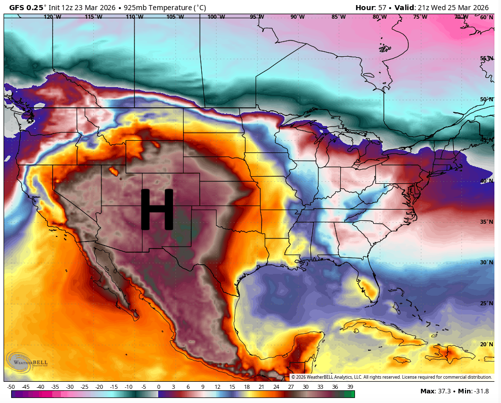
A persistent heat dome has taken control of the upper levels of the atmosphere across the desert Southwest and southern Plains, dominating weather Tuesday, including right here in Texas. The result has been a stretch of unseasonably warm and dry March weather more typical of midsummer than early spring.
Temperatures are running above average across two-thirds of the country, putting nearly 200 daily record highs at risk from the West Coast to the Great Plains. Texas alone could see heat records in more than 30 locations challenged Tuesday through Friday.
In Central Texas, the weather pattern is pushing Austin temperatures up to 10 to 15 degrees above normal and has kept the city rain-free for 12 days and counting.
While the heat and lack of rainfall have defined much of March, early signs indicate that a pattern change is on the horizon, with a more active weather pattern setting up through early April.
We’ll wake up to mostly cloudy skies, calm winds and temperatures near 60 degrees Tuesday. Skies will begin to clear around lunchtime, leading to mostly sunny skies with afternoon temps climbing into the upper 80s.
Water vapor-driven dew point temperatures will remain in the 50s, meaning there won’t be much atmospheric moisture, or humidity, so it will feel like a dry heat during the day. Winds will stay light out of the south at 5 to 10 mph.
Clouds will build back in late Tuesday night along and east of the Interstate 35 corridor. Overnight lows will drop into the upper 50s across the Hill Country and settle into the 60s in the Austin metro area.
Wednesday and Thursday will be similar to Tuesday, with dry and very warm weather continuing. Expect morning temperatures in the 60s and afternoon temps in the 90s.
We could challenge a few records in Austin, though, particularly at Austin-Bergstrom International Airport on Wednesday, where the record is 88 degrees, set in 2020. However, the 127-year-old city record of 95 degrees, set in 1899, will likely hold.
By Thursday, records at both Austin weather observation sites could be in jeopardy, with highs near 92 degrees, the current record set in 1950 at the airport and in 2022 at Camp Mabry.
Winds will increase out of the south each day with gusts of up to 20-25 mph. This, along with the ongoing extreme drought levels in the region, will lead to a moderate to high wildfire threat this week, according to the Texas A&M Forest Service.
After a warm and cloudy start to the morning, a cold front will move across the region Friday. Temperatures will be cooler behind the front, but we won’t feel much of a difference until the weekend. Friday’s temps will still climb into the mid- to upper 80s as the front moves through.
This front could bring a little rain to Central Texas Friday night into early Saturday. For now, rain chances remain low at around 20%, but those could increase if forecast models suggest more aggressive weather with precipitation.
We do expect much cooler air to settle in over the weekend, with temperatures peaking only in the 60s and 70s on Saturday, followed by 70s to near 80 degrees on Sunday.