
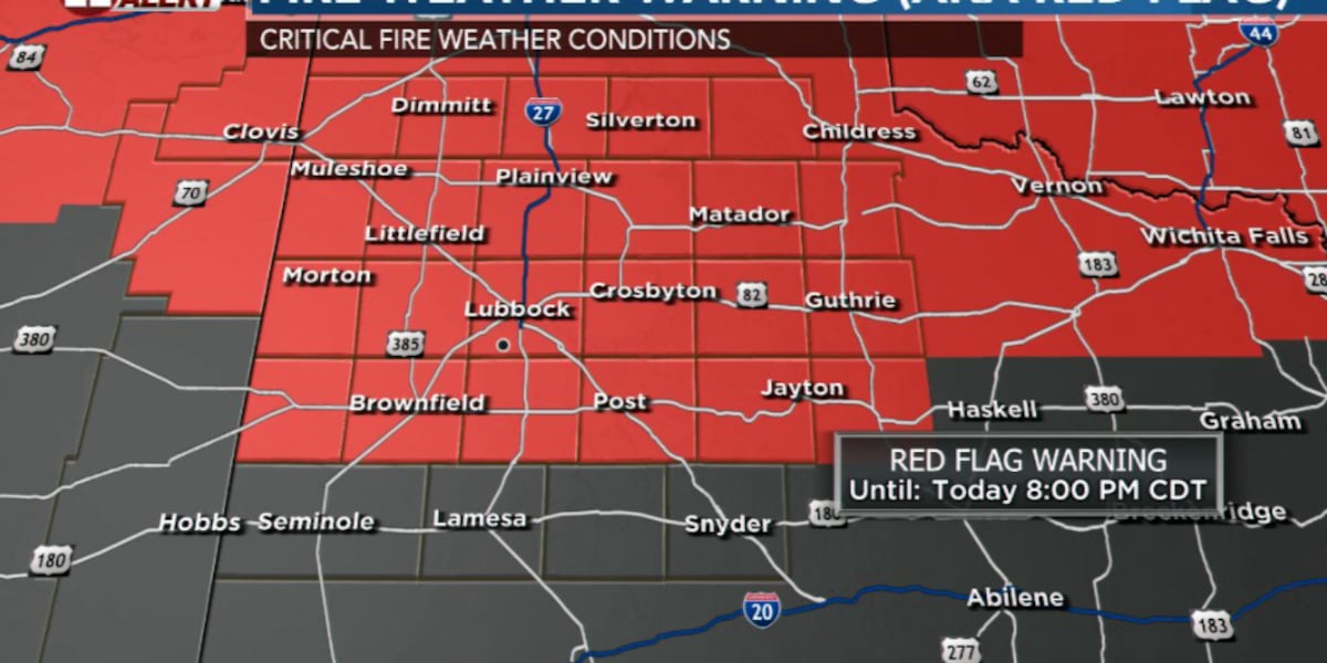
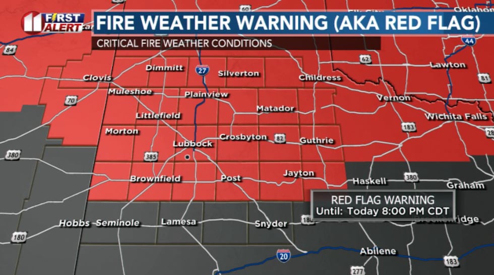
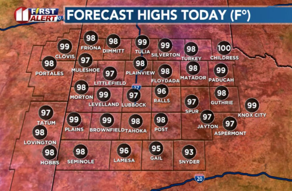
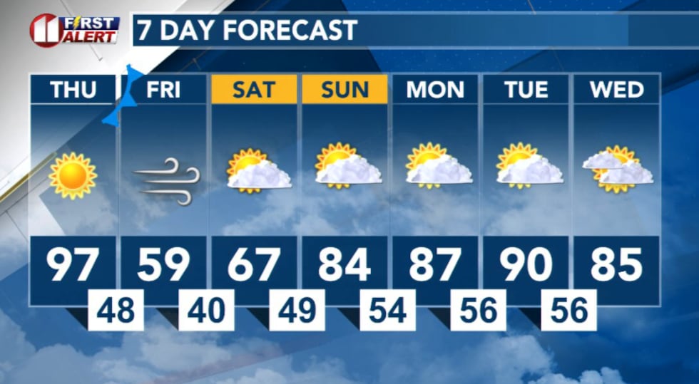
LUBBOCK, Texas (KCBD) – Record high temperatures are expected Thursday. The combination of heat, low humidity and gusty winds will make any fires spread rapidly and be difficult to control, creating a critical fire weather threat across the area.
 KCBD(KCBD)
Highs will be in the upper 90s today. The record for Lubbock’s high temperature today is 92° set back in 2020, that will likely be broken this afternoon.
 KCBD(KCBD)
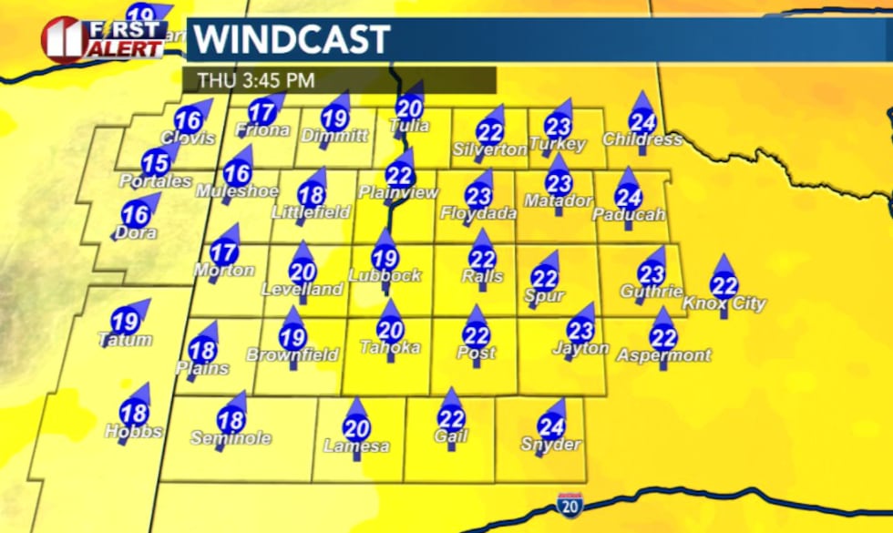
A Red Flag warning has been issued for majority of the viewing area with relative humidity values expected to drop as low as 4%. Strong southwesterly winds will pose a hazard to any potential wildfires as they blow 15 to 25 mph from the southwest with gusts up to 35 mph.
 KCBD(KCBD)Friday: Powerful cold front and dangerous winds
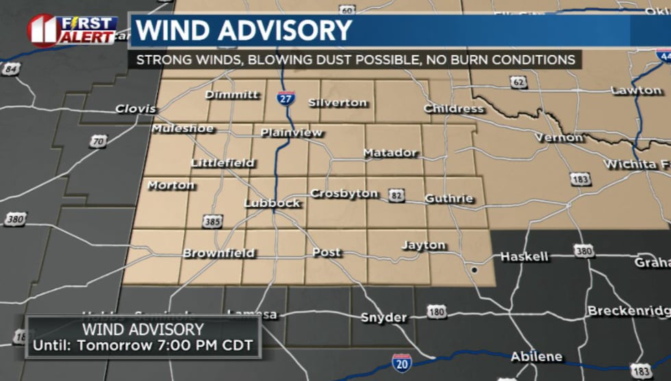
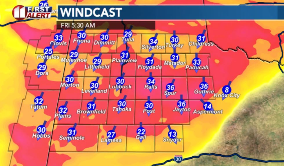
A strong cold front will blast through the region Friday, bringing advisory-level winds. The National Weather Service has issued a Wind Advisory valid from 1 a.m. Friday through 7 p.m. Friday.
 KCBD(KCBD)
Widespread winds of 30-40 mph with gusts to 55 mph are expected, with locally higher gusts possible.
 KCBD(KCBD)
Blowing dust is also expected to concentrate along the front overnight Friday into early morning hours, though conditions are expected to improve through the pre-dawn hours.
Weekend: Much cooler
Much cooler temperatures are forecast Friday through the weekend as the cold front moves through and high pressure builds in behind it.
 KCBD(KCBD)
Copyright 2026 KCBD. All rights reserved.