
After several weeks of hot and dry weather to start autumn, Southeast Texas is finally starting to see some very welcome changes. On Saturday, Houston recorded nearly 2 inches of rain, which broke a streak of 30 consecutive days without rain – the city’s fifth-longest dry streak since 2000.
It’s been hot, too. So far this October, Houston’s average high temperature has been 90.3 degrees, which was on pace for the city’s hottest October ever. Thankfully, that record won’t be broken, as weather models now agree that a rather significant cold front will hit Houston by the middle of the week, and it may have you reaching for a jacket for the first time in months.
Sunday forecast
After Saturday’s heavy rain, Southeast Texas is set to dry out today. A pleasant morning is expected as temperatures hover in the mid- to upper 60s under partly cloudy skies through 9 a.m. By the middle of the day, skies will start to clear, likely becoming mostly sunny by the afternoon.
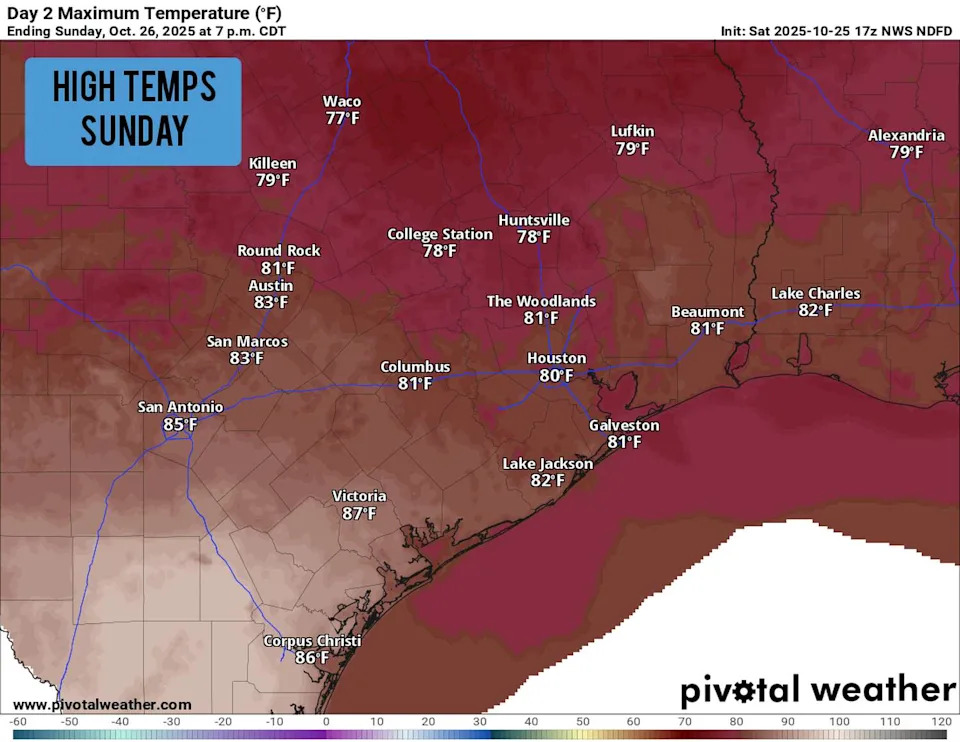
Shown are the expected high temperatures across Southeast Texas on Sunday. (Pivotal Weather)
Temperatures will rise slowly, likely only reaching 75 degrees by noon to 1 p.m. Afternoon high temperatures are expected to reach only the upper 70s to near 80 degrees, which is near-average for late October. Rain chances will be near zero through the afternoon, as a result of Saturday’s low pressure system continuing off to the east.
Monday: Another beautiful day is expected to start the workweek. Morning low temps will start in the low to mid-60s across the Houston area, warming steadily into the low 80s by the afternoon. Humidity levels will stay relatively high, but rain chances will remain slim to none.
Cold front incoming
Tuesday may end up being Houston’s warmest day of the week as high temperatures top out in the low to mid-80s. However, a cold front will start pushing through Texas Tuesday morning, arriving in Houston by the evening.
North winds will surge into Southeast Texas at 15-25 mph, bringing significantly colder air into the region. By Wednesday morning, Houston temperatures are expected to fall into the upper 50s. A few scattered showers are possible as the front moves through, but rain chances will only be around 20%.
Temperatures will be slow to rise on Wednesday, likely topping out in the upper 60s to near 70 degrees. The front will send dry air into the region too, making for sunny skies and very low humidity values.
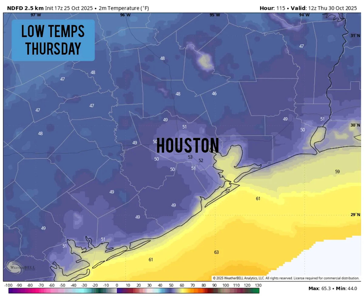
The chilliest weather is expected late Wednesday and into Thursday morning. Low temps are likely to fall to around 50 degrees in the Houston area, with many areas outside of the city falling into the upper 40s. Areas like Conroe, Huntsville, and College Station will see low temps near 45 degrees. You’ll definitely want a jacket or coat before walking out the door.
Temperatures will stay cool Thursday afternoon, likely topping out in the upper 60s to low 70s once again, under bright sunshine. After another chilly start Friday morning, afternoon highs will warm a few more degrees, into the mid-70s.
Temperatures will trend warmer this weekend, but things will stay seasonably cool as lows sit in the 50s while high temperatures rise into the upper 70s to low 80s.
This article originally published at After drying out today, a strong cold front targets Houston this week. Here’s when..