
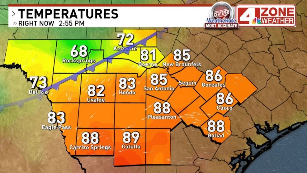
SAN ANTONIO – Heat relief is hours away after a hot week! Cold front is now moving into our viewing area and heading south but this cold front is not like the last front or stronger fronts we’ve seen in recent months.
Cold front as of 3PM this afternoon
Here’s what to expect…
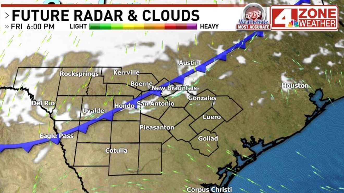
The front moves across Bexar County 5PM – 7PM with a narrow zone of clouds along it. Doubtful we’ll see any showers pop up along the front but it may produce a random sprinkle or shower as it sinks south through 9PM.
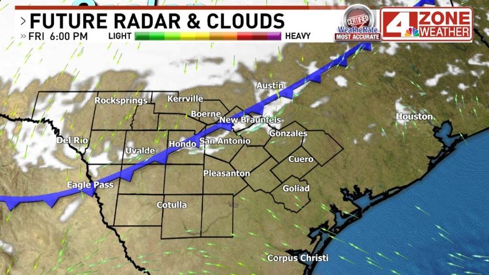
Front moving into Bexar County early this evening
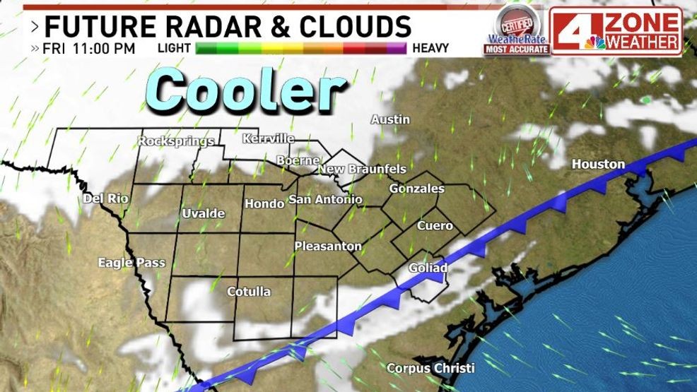
Cold front by 11PM tonight
Winds will strengthen from the north behind the front with gusts in the 30 – 40mph range which is a far cry from the gusts we had well over 50mph with our last front. These winds will last through midnight then slowly weaken into Saturday morning to a gusty breeze. Later in the day Saturday, winds will be much weaker.
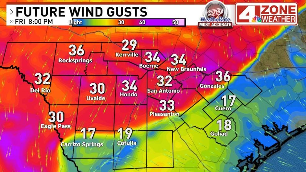
Gusty evening winds behind front
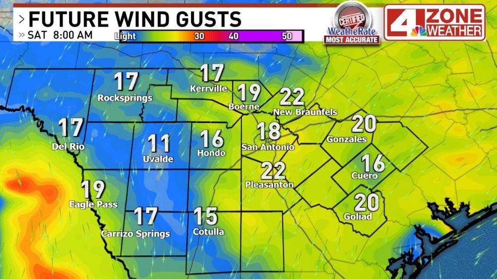
Future wind gusts Saturday morning
Temperatures will cool rather quickly this evening for those outdoors to enjoy their Friday evening. You might consider a light jacket if you plan to be out past 9PM as temperatures will fall into the 60s then eventually 50s while humidity is lowering too.
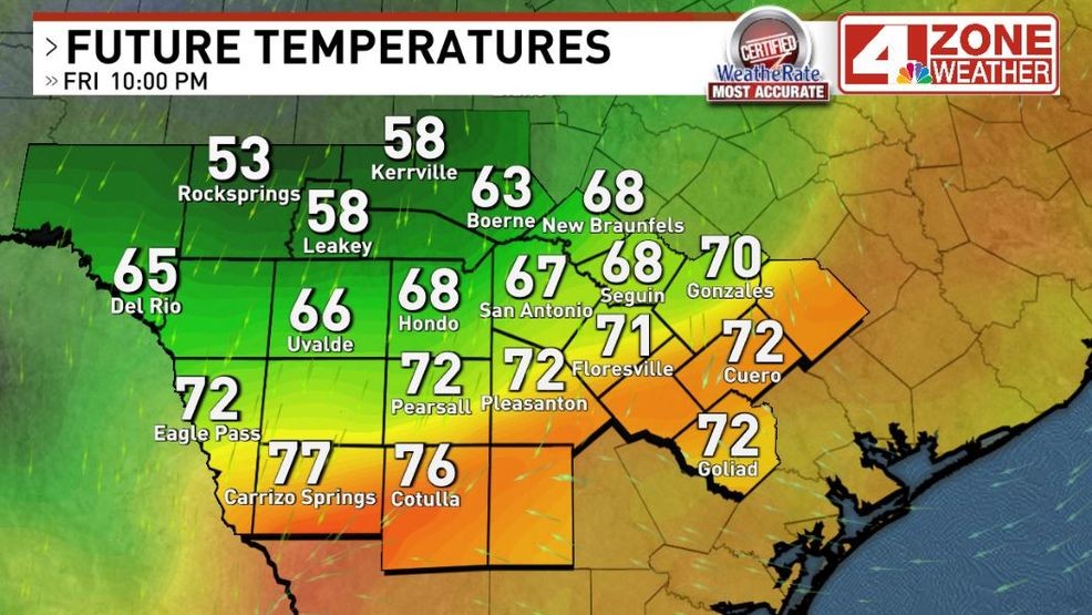
Future temperatures 9PM – 10PM
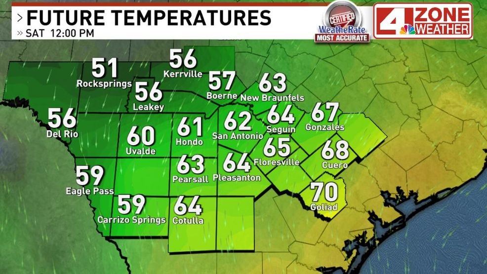
Future temperatures midday Saturday
Saturday morning starts in the 50s with some 40s in the Hill Country. Areas of sprinkles or misty rain possible especially in Hill Country to the Edwards Plateau where a trace to .10″ of rain may fall including some spots in our western zone. In Bexar County, not much rain expected but some sprinkles are possible in the morning or even a little morning mist from low clouds.
By the afternoon, just cloudy skies with sprinkles or mist ending in our viewing area. Depending on how stubborn the clouds are will determine how cool we are. If we see big breaks of sun mid to late afternoon, we’ll warm into the 70s. If clouds hold through 6PM, we’ll easily stay in the cool 60s. Right now, my feel is a few peeks or late breaks of sun into early evening to give us a bump to the upper 60s.
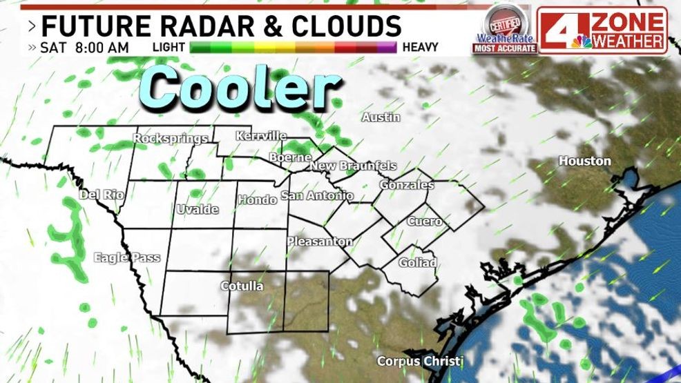
Saturday morning clouds with areas of sprinkles or misty rain possible
Comment with Bubbles
BE THE FIRST TO COMMENT
Sunday starts cool in the 50s then warms nicely to 80 to 82 with low humidity and sunshine.