
This map of Southeast Texas shows Friday’s forecast highs.
Pivotal Weather
Houston gets a brief taste of near-perfect spring weather this weekend, as a passing cold front knocks down humidity and delivers much more comfortable temperatures — at least for a day.
It won’t last long. Gulf moisture returns quickly and, after a prolonged dry stretch, we’ll need to pay attention to when the next real chance of rain arrives.
Cooler and less humid Saturday
Saturday’s noticeable drop in humidity makes it a classic “open the windows” kind of day.
Article continues below this ad
Dew point temperatures, an indicator of how much moisture is in the air, will fall into the upper 30s north of Houston to the upper 50s closer to the coast. That’s about as refreshingly dry as it gets for late March and a sharp contrast to the muggy weather earlier in the week.
SEASON OUTLOOK: AccuWeather’s 2026 hurricane season forecast is out. Here’s what it means for Texas.
Temperatures remain seasonable, climbing into the upper 70s to near 80 degrees during the afternoon. With mostly sunny skies and dry air in place, it will feel significantly more comfortable than recent days. Outdoor plans should have no weather issues, and it’s a rare opportunity to enjoy spring in Houston without the humidity.
By Sunday, that brief taste of dry air begins to fade.
Article continues below this ad
Winds shift back onshore, pulling Gulf moisture inland once again. Humidity levels will gradually increase, and overnight temperatures will turn milder as the atmosphere begins to recharge with moisture.
Showers return next week
The bigger question is when Houston might finally see meaningful rain after a prolonged dry stretch.
Early next week, a more active and seasonable spring pattern begins to take shape as a stubborn ridge of high atmospheric pressure weakens. This allows small weather disturbances to move through Texas and bring at least a slight chance of rain by Wednesday.
For now, rain chances look scattered and relatively light, meaning not everyone will see measurable rainfall and widespread soaking totals remain uncertain.
Article continues below this ad
However, the setup becomes more promising toward the end of next week. A stronger system developing out west could increase both moisture and atmospheric lift across the state, potentially leading to better rain chances heading into Easter weekend. While details are still coming into focus, the overall trend suggests improving opportunities for rain.
What weather can Houston expect in April?
April is expected to trend warmer than normal across Texas, including the Houston area, as spring patterns take hold and temperatures steadily climb.
In a typical April, Houston’s average highs rise from 77 degrees at the start of the month to 83 by the end. Overnight lows also get warmer, from the upper 50s into the mid-60s. The month also averages just under 4 inches of rain, making it an important transition period into the wetter part of the year.
Article continues below this ad
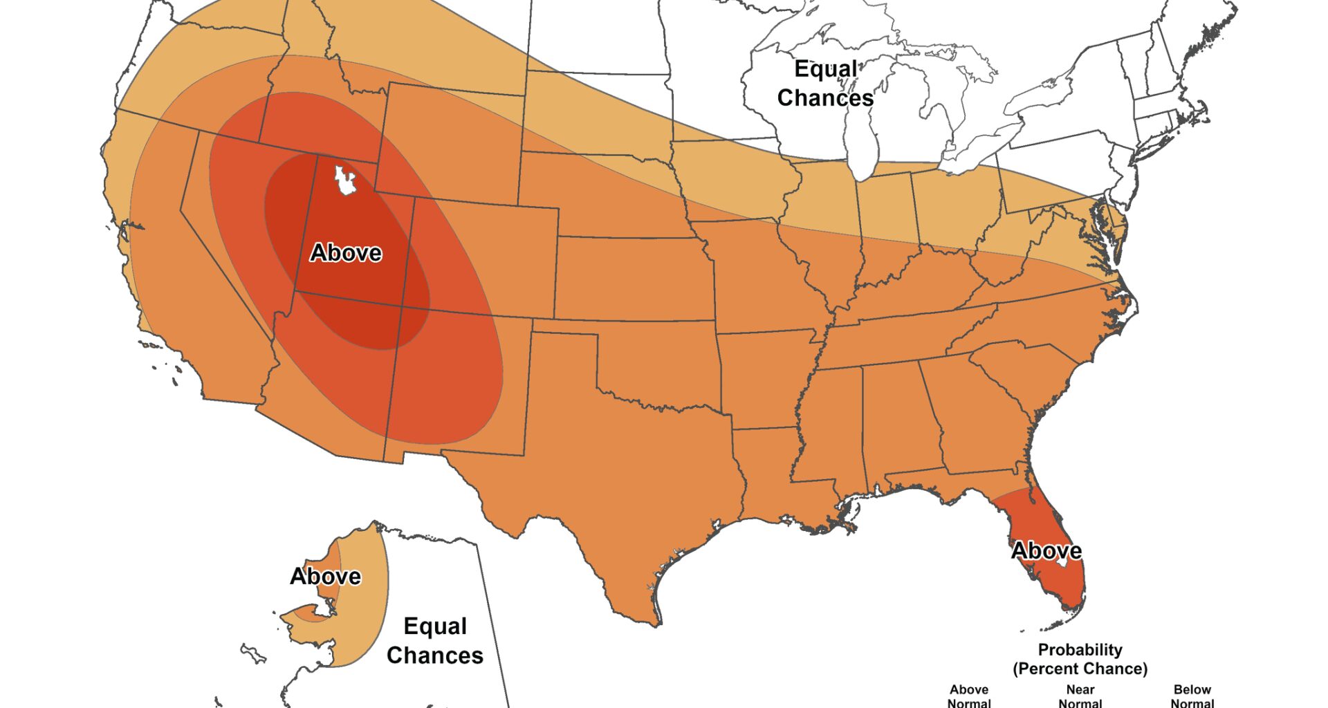
This map of the continental United States shows the temperature outlook through April from the National Weather Service’s Climate Prediction Center. Above-normal temperatures are expected (shown in orange and red) in much of the country and Texas.
NOAA’s Climate Prediction Center / Pivotal Weather
This map of the continental United States shows the rainfall outlook through April from the National Weather Service’s Climate Prediction Center. Above-normal rainfall is possible across the eastern half of Texas (shown in green).
NOAA’s Climate Prediction Center / Pivotal Weather
This year, rainfall signals are less certain, but Texas will likely see more frequent opportunities for showers and storms compared to March. Rather than steady, widespread rain, expect periodic systems that bring bursts of rainfall, especially across eastern parts of the state.
Overall, April should feel more like a typical Texas spring — warmer, increasingly humid and gradually more active — even if it takes time to fully ease ongoing dry conditions.