
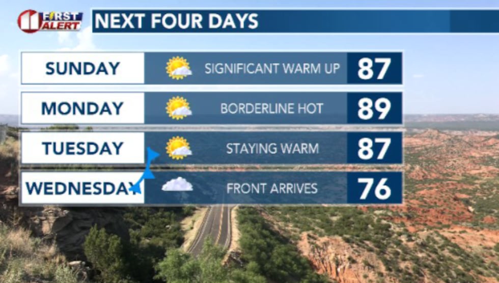
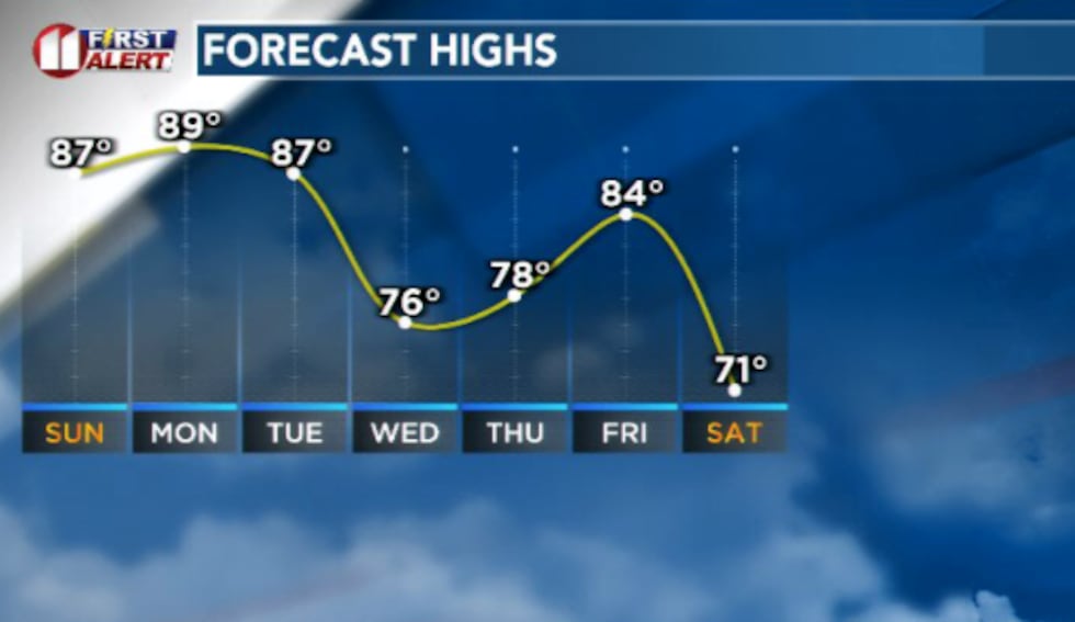
LUBBOCK, Texas (KCBD) – A sharp warm up is in store as we move into Sunday, setting us up for another shot at breaking records by Monday afternoon.
 Temperatures skyrocket tomorrow and stay elevated through Tuesday before a cold front arrives mid-week.(Dylan Smith)
TONIGHT
Overnight lows will be about as chilly as last night, bottoming out in the 40s for most of the area.
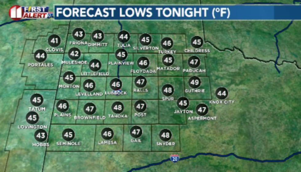 A mild, cool night is on its way. Clearer skies and lighter winds will help us stay about as chilly as last night.(Dylan Smith)
Winds stay a light breeze around 5 to 15 mph.
SUNDAY
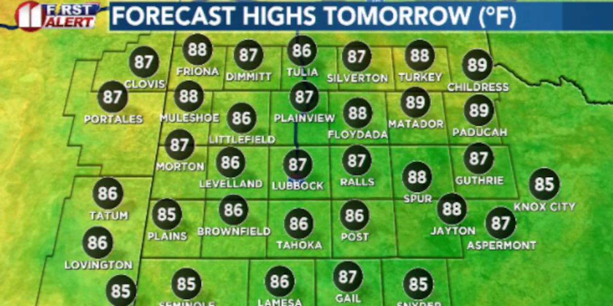
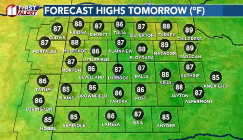
A gorgeous, warm day is in store! High temperatures will spike into the mid to upper 80s by the afternoon.
 A significant warm up in heading our way over the next 24 hours.(Dylan Smith)
This will be paired with a good breeze of around 15 to 25 mph.
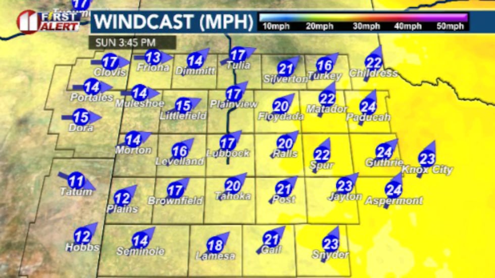 Winds will pick up to a strong breeze, kicking up elevated fire conditions for the South Plains(Dylan Smith)
Due to the dryness and the winds we’ll likely see enhanced fire weather danger and possibly some advisories or warnings for fire weather issued at some point.
NEXT WEEKS WEATHER PATTERN
High temperatures for the first half of the week, and consequently through the end of March, will remain elevated for this time of year in the mid to upper 80s and lower 90s.
 A pair of cold fronts over the next week will try to keep high temps closer to seasonal(Dylan Smith)
Winds will pick up as well. A cold front arrives by Wednesday for April fools day, dropping temperatures a few degrees and potentially introducing some shots of rain mid-week. A second cold front appears to be possible heading into Easter weekend next weekend.
Copyright 2026 KCBD. All rights reserved.