
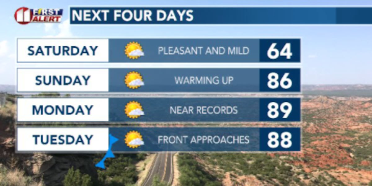
LUBBOCK, Texas (KCBD) – A potent cold front arrived overnight last night to usher in a big wave of cold air. We also saw 50 to 60 mph gusts at times throughout the day Friday. This chilly weather comes to an end after tomorrow morning as we see a sharp warm up in store.
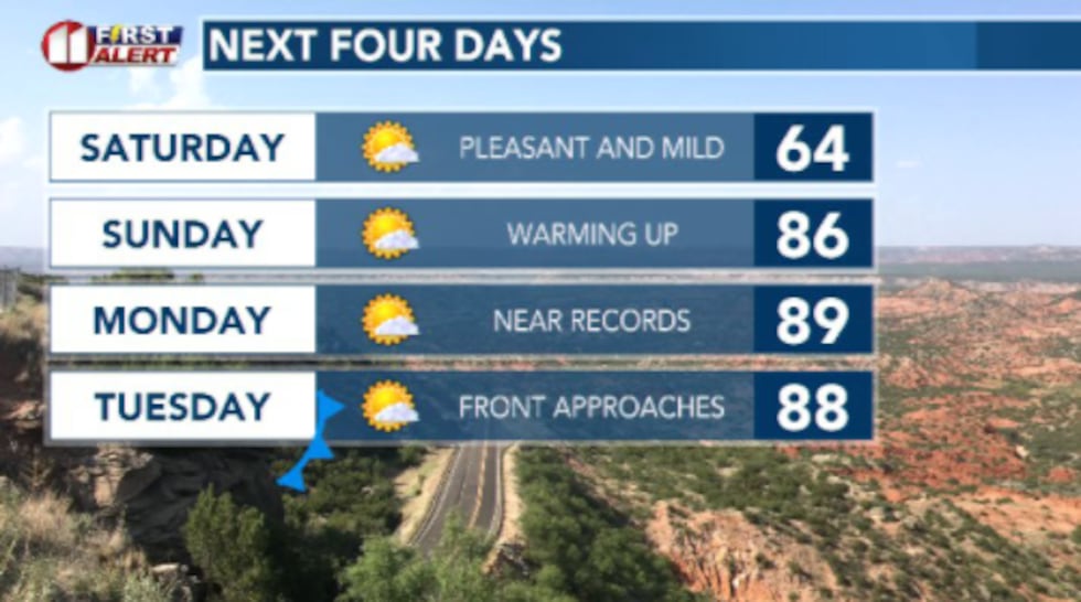 Saturday will still be a bit cool but we’ll see temperatures rebound quickly Sunday and into next week.(Dylan Smith)
TONIGHT
Temperatures will be a little chilly depending on where you are. We’ll see a general 30s in the northwest counties to the mid 40s for our southeastern counties.
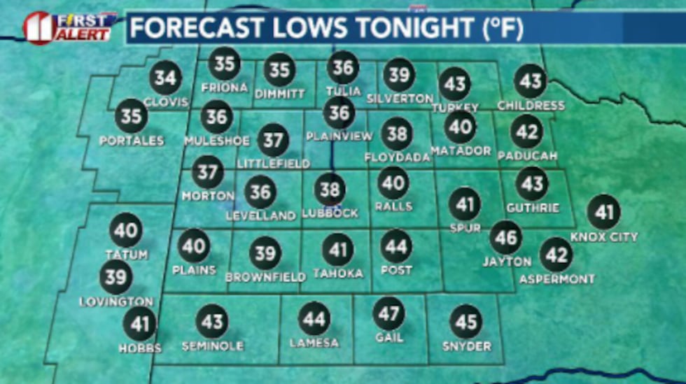 Temperatures for many will drop into the 30s. Our southeastern counties will be a bit more mild in the 40s thanks to cloud cover and continued winds.(Dylan Smith)
Winds will stay breezy but continue to slow throughout the night.
SATURDAY
Picture perfect day of Spring weather across the South Plains.
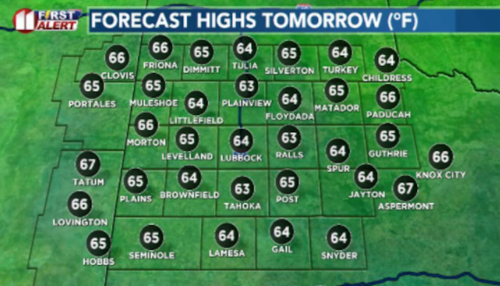 We’ll see a decent warm up from Fridays highs in the 50s. Plenty of beautiful and calmer weather is in store(Dylan Smith)
High temperatures will reach into the mid 60s with sunshine and a light breeze to greet you as you head out the door.
SUNDAY
Temperatures will continue to spike back into the 80s for the afternoon hours. Winds stay a decent breeze around 10 to 20 mph.
NEXT WEEKS WEATHER PATTERN
A warm start to the week in the 80s and lower 90s will be interrupted by a cold front mid-week that will try to keep things a bit more seasonal than the last week and a half have been.
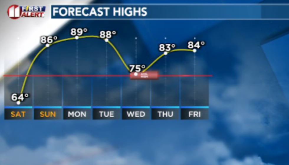 Temperatures will climb once again into the 80s for the first half of next week with a mid-week cold front to keep things more temperate.(Dylan Smith)
Still not much in the way of rain chances in store the South Plains for the next week.
Copyright 2026 KCBD. All rights reserved.