
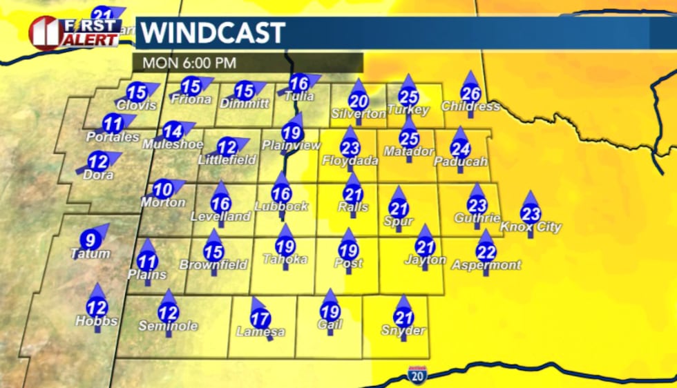
LUBBOCK, Texas (KCBD) – Hot temperatures and gusty winds will keep critical fire danger in place across the South Plains through Tuesday as unseasonably warm March weather persists.
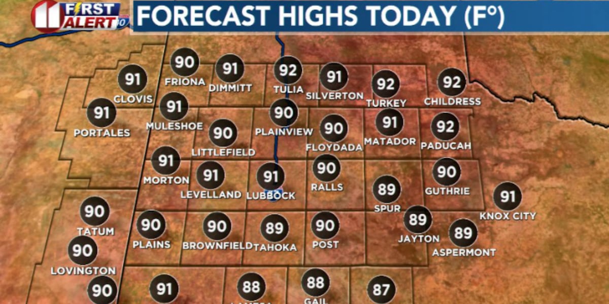
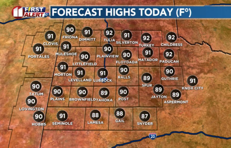
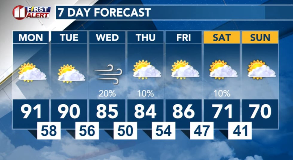
Afternoon highs Monday are expected to reach the low to mid-90s for most locations, with Lubbock threatening its record high of 91° set in 2010.
 KCBD(KCBD)
The combination of heat, low humidity and breezy southerly winds will create elevated to low-end critical fire weather conditions areawide Monday afternoon and evening. A Rangeland Fire Danger statement has been issued from 12 p.m. to 9 p.m.
 KCBD(KCBD)
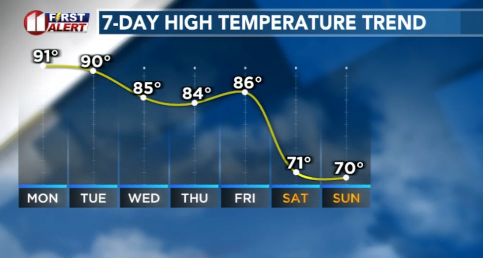
Tuesday will bring a similar pattern, with highs again climbing into the low to mid-90s east of the dryline. While record highs are possible, temperatures may fall slightly short of the March 31 records. The critical fire danger will persist west of the dryline, where warm, dry and breezy conditions will continue to pose a significant threat.
 KCBD(KCBD)Storm Chances Return Late Week
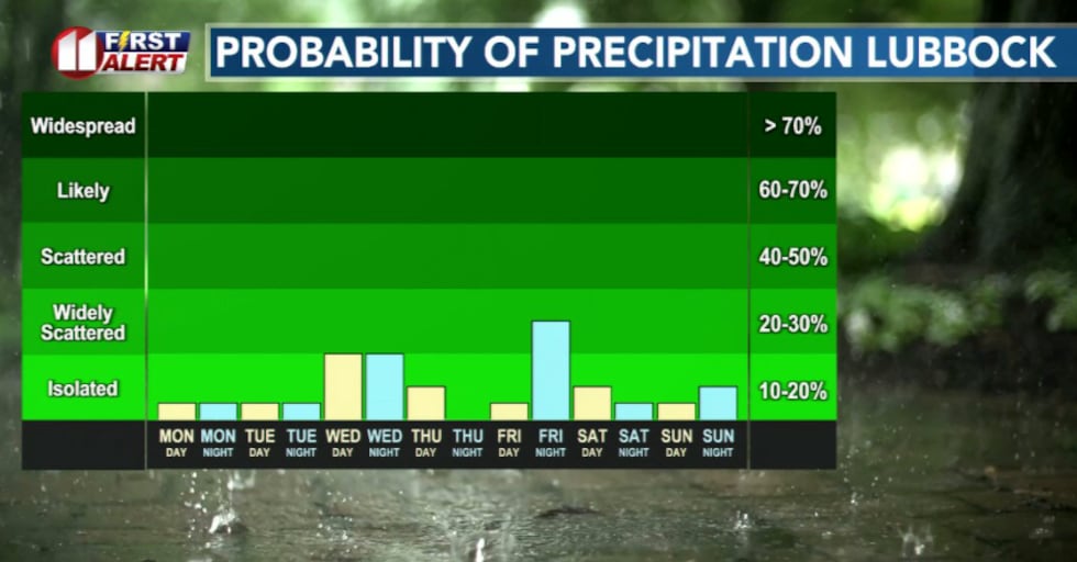
A slight chance of showers and thunderstorms is possible Wednesday and Thursday, particularly east of the Caprock where a sharper dryline and subtle upper-level support may allow isolated to scattered storms to develop. Should storms develop, a strong storm or two cannot be ruled out.
 KCBD(KCBD)
More organized thunderstorm chances will return late Friday into early Saturday, again favoring areas east of the Caprock as another weather system approaches.
What You Should Do
During critical fire weather periods, avoid any outdoor burning and be cautious with equipment that could spark fires. Keep pets indoors during peak heating hours and ensure you have plenty of water available.
 KCBD(KCBD)
Copyright 2026 KCBD. All rights reserved.