
Nearly 400 Harris County schools could move to higher-risk flood zones, according to new maps released by the Federal Emergency Management Agency.
The new maps dramatically expand Harris County’s 100-year and 500-year floodplains, moving hundreds of schools and other critical facilities into higher-risk flood designations. Experts say affected school districts — including Cy-Fair, Houston and Pasadena ISDs — could face growing flood insurance costs, expensive mitigation projects and tighter limits on how they build or expand campuses. The maps could prompt school leaders to rethink how they build, make facilities more resilient and even which campuses to close if enrollment declines.
The increased risk for schools is also significant because the campuses often serve as community hubs and as critical facilities during disasters. When they close or are damaged by flooding, entire communities can lose access to education, shelter or services, Avantika Gori, an assistant professor of civil and environmental engineering at Rice University, said.
“Even smaller floods can have a significant economic impact in the sense of disruption,” Gori said. “We might sustain a lot more damage to our critical facilities, and rebuilding is extremely costly … specifically for schools.”
FEMA posted a draft of Harris County’s updated floodplain boundaries on its website in February after years of delay. The agency is now getting feedback from local officials before a broader public review. If approved, the new maps would mark the first comprehensive update in nearly 20 years.
Flood maps show where flooding is most likely to happen during major storms. FEMA creates them with help from local governments, using rainfall data, terrain features and models that predict how water moves.
The new maps would more than double the number of total Harris County properties that fall at least partially within a 100-year floodplain — meaning they have a 1% chance of flooding in any given year.
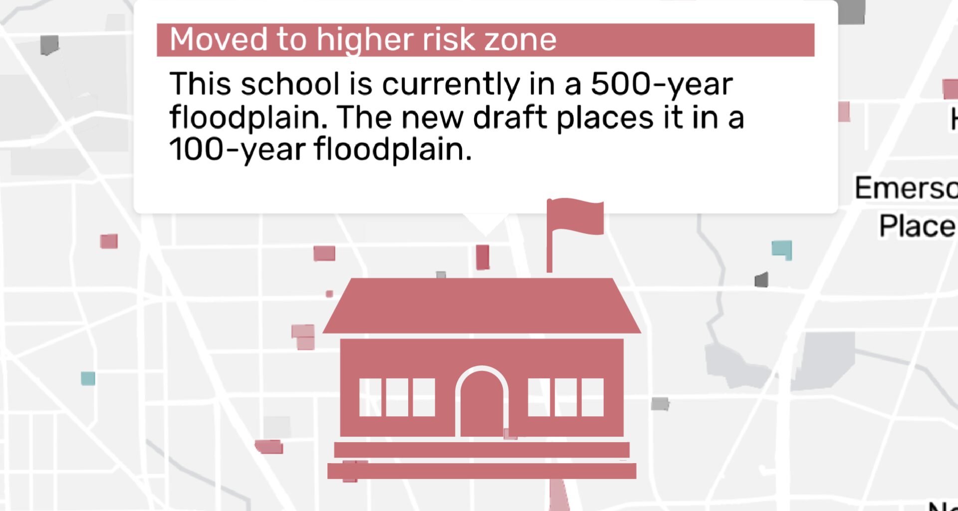
Among those properties moving to higher-risk zones are 386 schools, pushing the number of total public, private and charter Houston-area campuses in a floodplain or floodway to over 700.
Districts face higher risks, costs
According to a Houston Chronicle review of the maps, several Houston-area districts could face greater flood risk and costs associated with the new designations, including Aldine, Cy-Fair, Houston, and Pasadena ISDs.
In HISD, nearly 90 campuses would now fall under higher hazard levels – more than any other public school district. Nearly 40 schools in Cy-Fair ISD would also become more flood-prone, while Pasadena ISD would see around 20 with higher flood designations.
The new floodplain maps already reflect a reality many Harris County residents have already lived through, Woodell said.
After Hurricane Harvey, HISD temporarily moved students from nine campuses to other locations due to flood damage. Administrators put repair costs around $700 million. Hurricane Beryl, which had strong wind and some isolated flooding, caused HISD $9 million in damages in 2024.
Sheldon, Clear Creek and Humble ISDs also sustained flood damage after Harvey, leading to costly repairs and rebuilds.
“That is really just a graphic representation of the risk that communities already know exists on the ground,” Woodell said. “These maps aren’t anything new to a lot of people who have lived through multiple flood events.”
The new maps could mean more expensive insurance and limits on construction for school districts. But experts say it could also prompt schools and local authorities to consider more flood prevention plans to keep these critical facilities safe and accessible when disaster strikes.
Rising insurance costs
For years, school districts have had to deal with rising property insurance prices for flood damage. Insurance costs for districts have increased by 44% statewide since 2020, according to the Texas Education Agency.
HISD — the state’s largest district — has $7.52 billion in public property across more than 300 square miles. This month, its state-appointed Board of Managers approved a $22.6 million contract for wind, hail, flood and earthquake insurance.
Cy-Fair ISD said it has seen flood-mitigation costs and insurance expenses rise in the past decade due to the increasing frequency and severity of catastrophic flooding in the region. Between last school year and this year, its flood insurance premium went up about $1,000 to $59,359.
“The district is still awaiting clarity on how Harris County’s new draft flood maps may affect future premiums,” Cy-Fair ISD said in a statement.
Cy-Fair ISD purchases flood insurance through the National Flood Insurance Program, which is federally subsidized and helps reduce the financial impact.
As premiums rise, more districts are getting insurance with high deductibles, according to Dan Huberty, CEO of the education consulting firm MoakCasey and former GOP lawmaker from Humble. That means districts would pay more out-of-pocket for flood damage before insurance kicks in — which could become an issue if a district already has budget deficits.
Huberty, who also served on Humble ISD’s school board, said some districts are setting aside money in their fund balance to prepare for emergency situations.
Duncan Klussman, a clinical associate professor of education at University of Houston and former Spring Branch ISD superintendent, said running a school district comes with many operational costs to keep facilities running and in good condition — an area he said is not talked about much by lawmakers when it comes to education funding.
He said it’s likely that schools will need more financial support to keep schools prepared for flooding, especially as more move to higher flood risk zones.
“You’ve got a whole operational side of running a school district,” Klussman said. “It’s like a major business, and you have that whole operational side … you just don’t hear that often being talked about.”
In 2025, state lawmakers approved $1.2 billion for a newly-created fund to spend on “fixed” costs that districts must cover, like payroll, fuel and insurance.
Huberty said the fact lawmakers included insurance expenses shows just how much they have increased and how schools may need more money to pay for it.
“As we go into hurricane season coming up again, districts are having to prepare for that,” Huberty said. “And I think it will prove out that there probably is a request or need for additional resources to pay for those specific items.”
New rules and costs
Harvey prompted Harris County to pass new building requirements. Later, HISD became the first area district to adopt those codes when it demolished and rebuilt four schools destroyed by the storm.
Those rebuilds posed unique challenges, said Raleigh Sullivan, managing principal at Pfluger Architects. The architecture firm was hired to rebuild four HISD schools – with limited funding and a tight turnaround. In the meantime, nearly 3,000 students from those schools had to attend class at other schools or cramped temporary facilities.
The codes required all new construction located in a 100-year floodplain to be elevated two feet above the 500-year floodplain, and each campus was raised above ground so water could easily flow underneath.
Architects today prioritize resilience and flexibility more than they once did, which the Harvey rebuilds reflected, Sullivan said.
“(Architects) would think of them as single purpose, like, ‘This school is going to be a school, and that’s it. It’s always going to be this classroom,’” Sullivan said. “We’re starting to look at it in terms of resiliency.”
Other districts have since followed. When Katy ISD designs new schools and major renovations, it installs comprehensive drainage and detention systems to support flood mitigation, the district said in a statement.
Katy ISD said it also purchases additional acreage for each new campus to ensure campuses “are built with long-term resiliency in mind.”
The new flood designations — which are still going through a review process — would not trigger any immediate changes at existing schools. The new codes would kick in if a district expands or rebuilds a campus with a higher risk designation.
More flood prevention measures for schools include underground drainage, detention ponds or flood walls.
For example, Humble ISD received $25 million from FEMA in 2019 to help build flood gates and waterproof the brick exterior of Kingwood High School, a campus that was prone to flooding and suffered $75 million in water damage after Harvey. The district also contributed an additional $3 million to the project.
But operations like flood gates can be too expensive for cash-strapped school districts, Gori said.
“It’s unlikely that schools within their current budget restrictions would be able to implement those really effective solutions,” Gori said.
The power for more change lies with the county or flood control district, not schools, Gori said.
Implications of the new flood maps
While the new FEMA maps would push hundreds of schools into higher risk areas, more than 130 would fall into a lower risk zone. That includes more than 40 HISD and Alief ISD schools along a pocket of southwest Houston stretching from Fort Bend County to Bellaire.
Those improvements largely came from Project Brays,a $480 million long-term project that the Harris County Flood Control District and Army Corps of Engineers conducted to curb flood risks along Brays Bayou.
Woodell said the new maps could prompt more groups to invest in large-scale flood prevention projects.
“We saw significant improvements and reductions in the flood plain in the proximity of that project,” Woodell said. “It’s a great proof point for the fact that these projects work … (it) really did make a big difference for that community.”
Schools could also use the maps to update their disaster plans, including where to relocate students if their campus floods, Gori said. That happened to several schools after Harvey. Students from Kingwood High School spent six months at Summer Creek High School.
FEMA encourages communities to treat schools as essential critical facilities that remain operational during disasters, and Harris County could use the new maps to ensure that roads to and from schools remain accessible during floods, Gori said.
Gori said the maps could also inform school closures, as districts across the region close schools due to declining enrollment. HISD, Fort Bend, Spring and Aldine ISDs have all moved to close campuses next school year. In HISD, most of those schools are not located in a floodplain and would not move to a higher risk area under the new map.
“I think closure criteria is really important, and could, in part, be informed by these maps,” Gori said. “When do you close? That’s very difficult, because you want to keep kids in school as much as possible, but you don’t want to put anybody in a dangerous situation.”
About the data in this story
The Houston Chronicle sourced floodplain data from the Federal Emergency Management Agency. Floodplains appear in the data as a series of zones with different risk designations in the event of a flood.
Harris County has not had a comprehensive flood map overhaul since 2007. Although FEMA has made small, incremental updates to the maps since then (the data used in this story is based on a study conducted in November 2019 and was last revised in January 2026), the current maps rely on rainfall data that is two decades out of date.
Years in the making, the latest draft maps use higher rainfall estimates and more advanced modeling techniques, significantly expanding flood zone boundaries. The draft flood maps shown on this page were provided by FEMA to local communities for a review period. These maps are early in the development process and will be refined further before being published as preliminary maps.
Assigning risk to properties
The Chronicle overlaid the current and draft flood maps, and parcel boundaries sourced from the Harris Central Appraisal District to measure the effect of the new maps on the risk faced by properties across the county.
A property was considered affected if any part of its parcel boundary intersected a flood zone in either the current or draft maps. Properties were then categorized based on how their risk designations changed from one map to another.
For properties that span multiple flood zones – say, for example, a property that sits across a 100-year floodplain and a 500-year floodplain – we calculated a combined exposure score for each map and compared the two.
You can see the full list of current and draft flood zones affecting any property by clicking on it in the map.