
LUBBOCK, Texas (KCBD) – The first full week of spring is shaping up to be an active one across Lubbock and West Texas, with warm temperatures, strong winds, and multiple chances for rain and thunderstorms.
The rain late Monday is the first to fall this month. Lubbock had not received even a trace up until the thunderstorms rolled through. The storms produced localized heavy rain, small hail, and strong wind gusts.
Up until today’s rain, Lubbock was on track to record it’s driest March on record (since 1911). In the record there is no March with no rain (0.00″) whatsoever. There are, however, 10 Marches with just a trace. Today’s rain total, as of this post, at the Lubbock Airport (the City’s current site of weather record), is 0.14″. Including those already mentioned, there now are 27 Marches that were drier than 2016.
The Shallowater TTU Mesonet weather station recorded a wind gust to 72 mph while the Lubbock Airport recorded a 67 mph gust.
Isolated Evening Storms
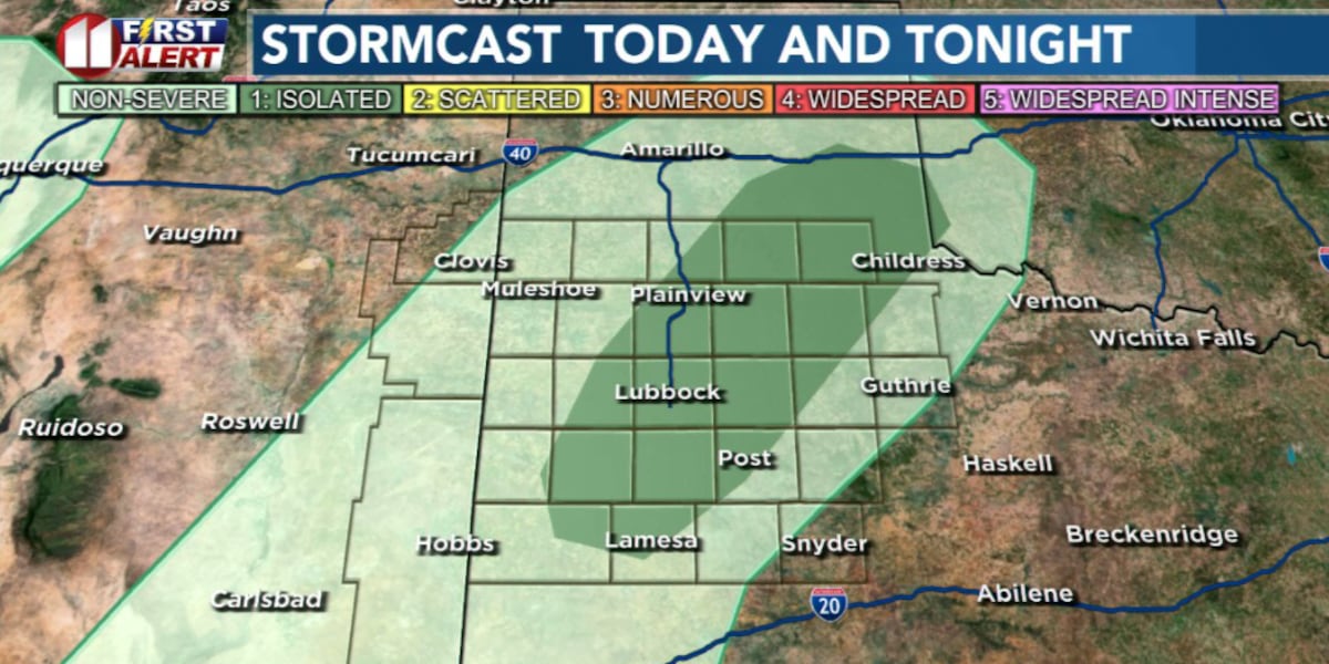
A few isolated showers and thunderstorms, drifting slowly east, may linger until after sunset, mainly over the eastern viewing area. Strong wind gusts are the main concern.
 A few isolated showers and thunderstorms, drifting slowly east, may linger until after sunset, mainly over the eastern viewing area. Strong wind gusts are the concern.(KCBD First Alert)
After the storms the night will be mild with lows in the low 50s to low 60s.
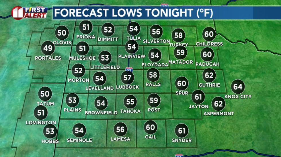 Mild overnight temperatures, though a bit breezy.(KCBD First Alert)
Winds will remain breezy as moisture continues to flow into the area from the south.
More of the Same
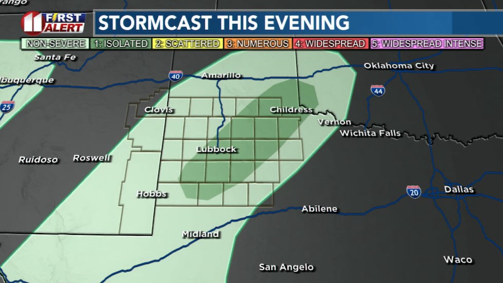
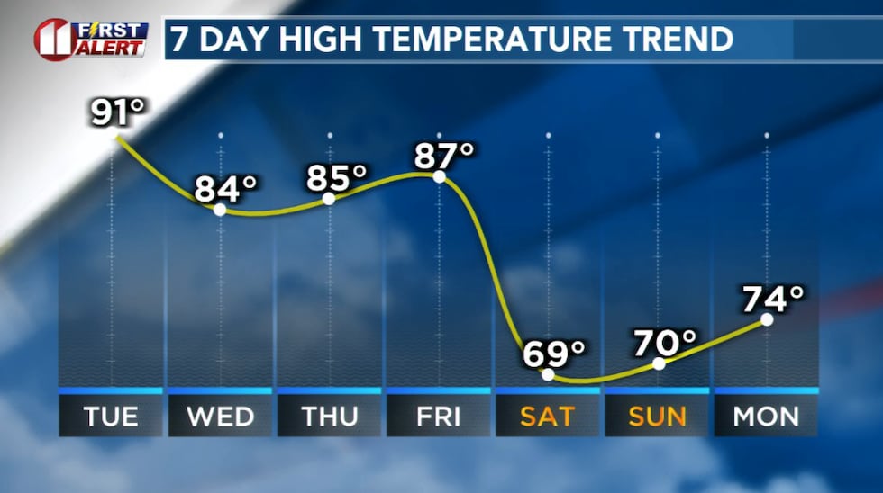
Tuesday will be much like Monday. Highs will again be much above average for the last day of March. Isolated to widely scattered thunderstorms may develop again, mainly along and east of the Caprock.
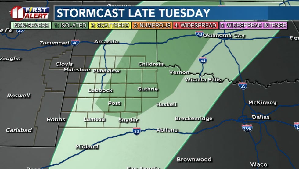 Tuesday will be much like Monday, though isolated to widely scattered storms are more likely near and east of the Caprock.(KCBD First Alert)
The dryline, the boundary between dry air to the west and moist air to the east, will shift a bit farther east as the day goes on, which could allow for stronger storms east of I-27.
Any storms that do develop may bring strong wind gusts, hail, and localized heavy rain.
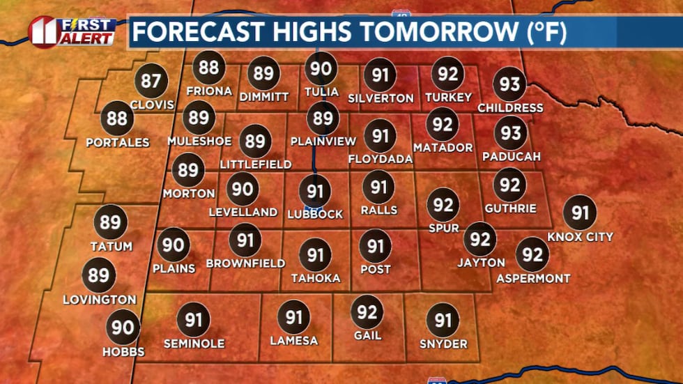 Another hot day, much like Monday.(KCBD First Alert)
The fire danger will remain elevated to near-critical in the dry air west of I-27, so the usual fire precautions apply.
A Better Rain Chance
Our weather may get more interesting midweek. A strong weather system will move into the area Wednesday afternoon, bringing stronger winds and a better chance for rain. We could see scattered rain showers and a few thunderstorms develop, especially off the Caprock.
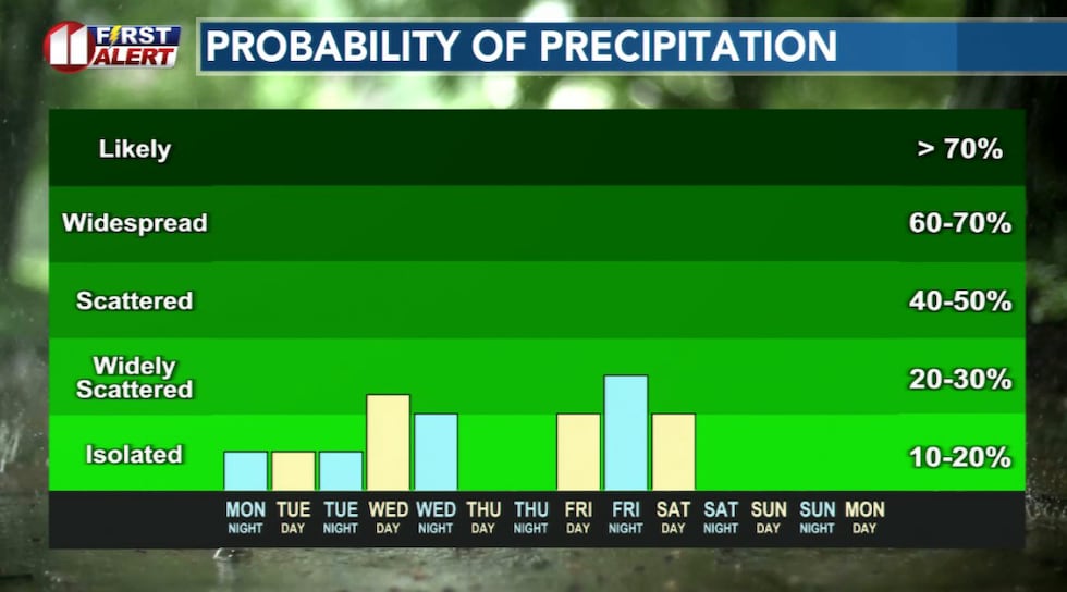 Multiple chances, albeit slight, this week.(KCBD First Alert)
Temperatures will still be warm, but the system will bring some moisture with it. It’s too early to say there will be widespread beneficial rain, but at least there’s a better chance for measurable precipitation.
A Breather
Thursday looks to be the calmest day of the week. We’ll see more sunshine but less wind as a ridge of high pressure moves overhead.
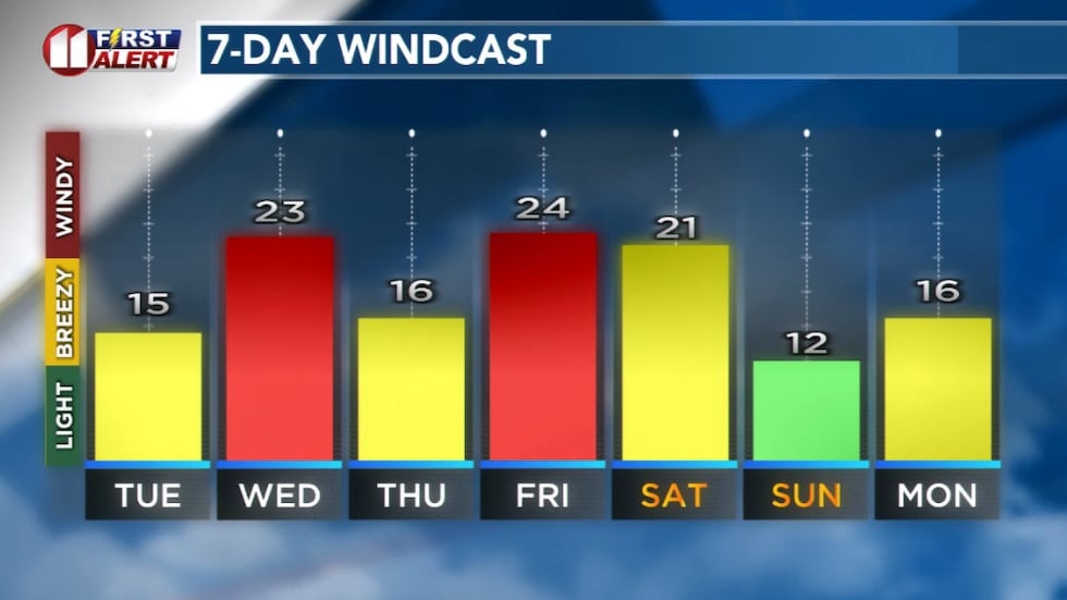 Forecast peak sustained winds are shown in this graph. Peak gusts will exceed the values shown here.(KCBD First Alert)
Looks like a good day to get outside and enjoy the weather.
Another Round of Storms
By Friday, another system will approach from the west, and rain chances will return. Showers and thunderstorms are possible late Friday into early Saturday. Once again, the greater potential will be along and east of I-27.
The rain chance will accompany a cold front, which will end – for a bit – this week’s warm weather.
Cooler and Drier
Easter weekend is looking cooler but much quieter. After the cold front passes early Saturday, we’ll see drier conditions and temperatures near average for the start of April.
 Warm through the work week, cooling to near average Easter Weekend.(KCBD First Alert)
Stay with us for updates as we fine-tune the timing and impacts of these systems.
Copyright 2026 KCBD. All rights reserved.