
LUBBOCK, Texas (KCBD) – A strong surface low rapidly deepening over eastern Colorado will bring gusty winds and precipitation chances to the region Wednesday, with the greatest storm potential developing east of the Caprock.
 KCBD(KCBD)What to Expect Wednesday
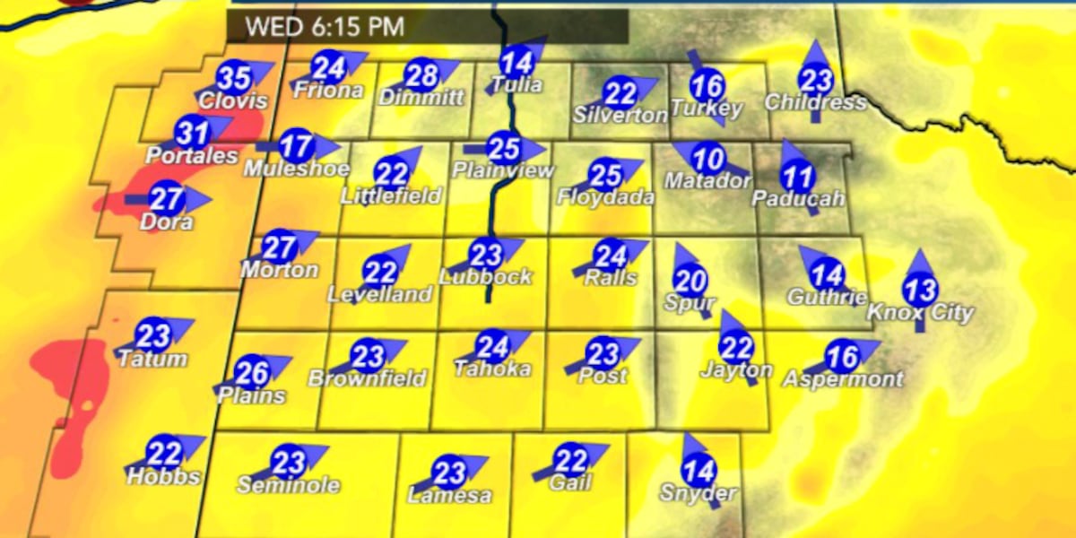
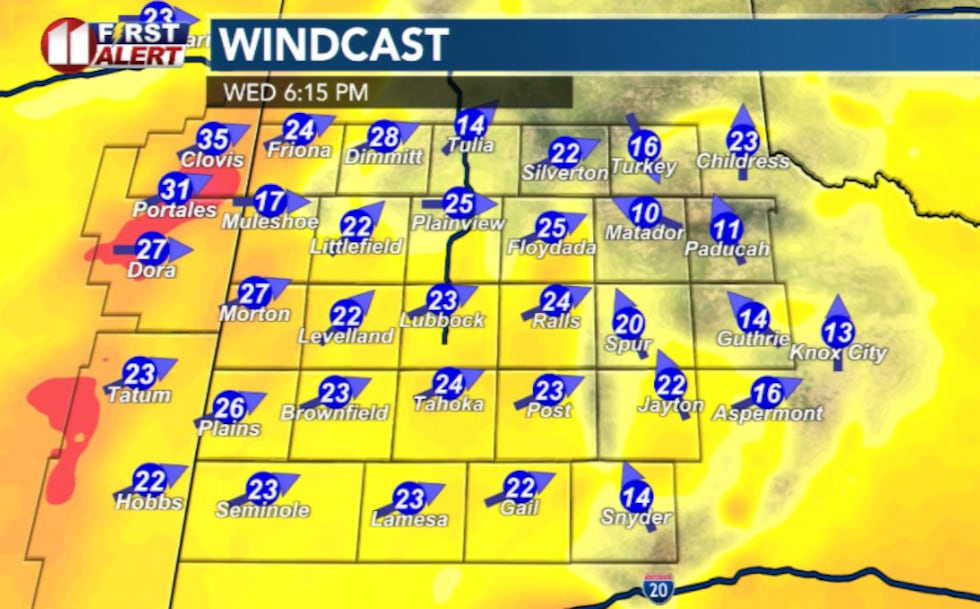
Sustained winds are expected to reach or exceed 30 mph Wednesday afternoon and evening, particularly near the Texas-New Mexico state line.
 KCBD(KCBD)
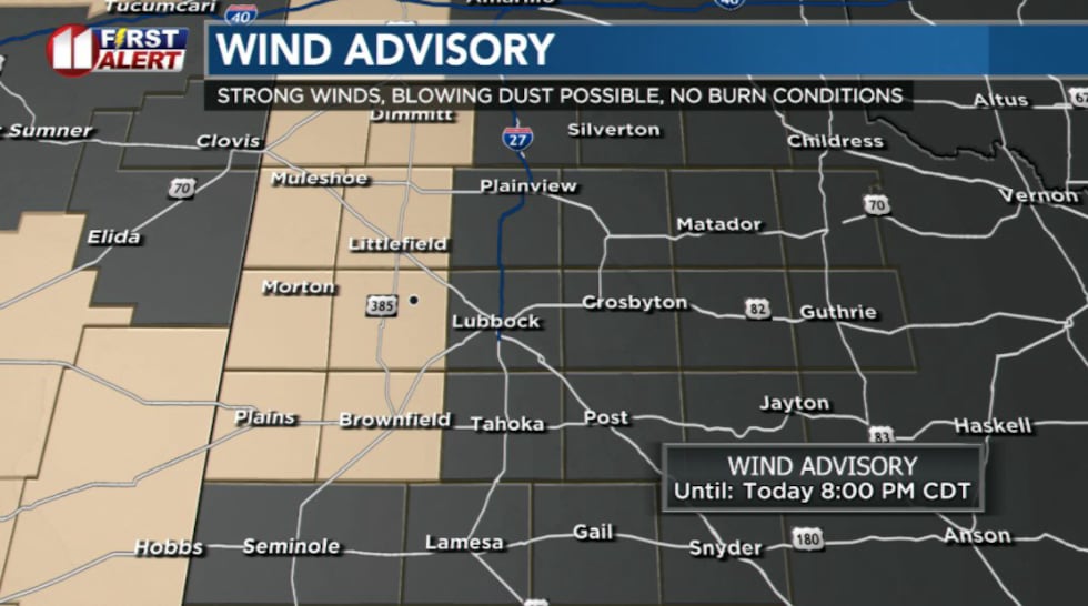
A Wind Advisory has been issued for western portions of the Caprock as the modified Pacific front pushes eastward through the region by early evening.
 KCBD(KCBD)
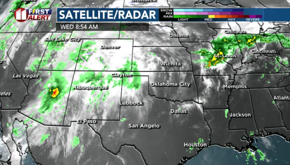
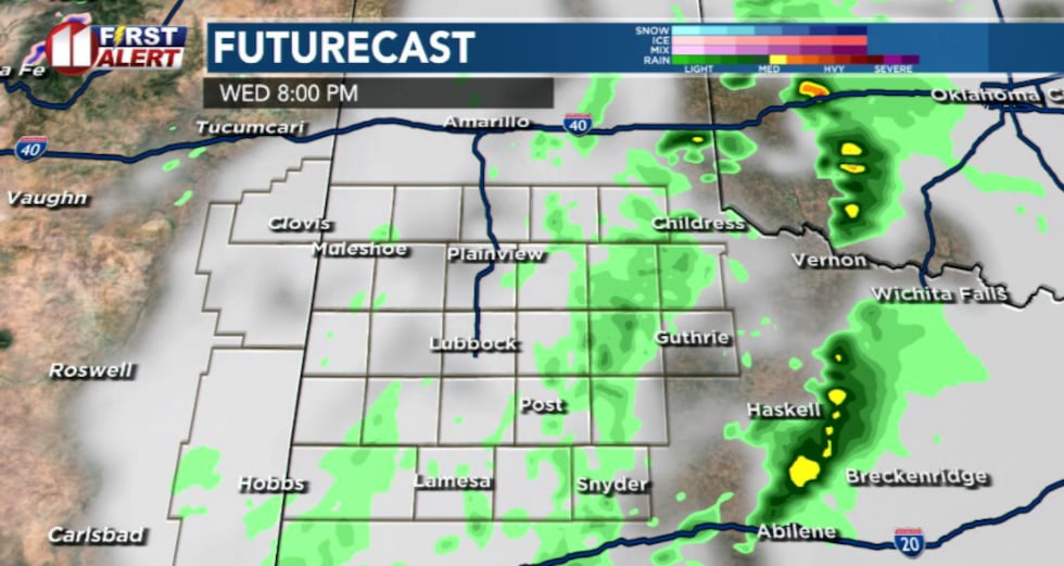
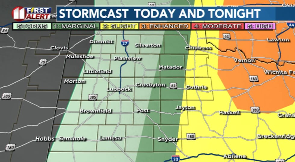
While most areas along and west of I-27 will likely remain mostly dry, a broken line of thunderstorms is expected to develop after 4 p.m. These storms will move rapidly eastward and exit the forecast area by midnight.
 KCBD(KCBD)
Storms will have the potential to become severe, a few damaging wind gusts and instances of large hail are possible before storms exit to the east.
 KCBD(KCBD)Fire Weather Threat Remains Critical
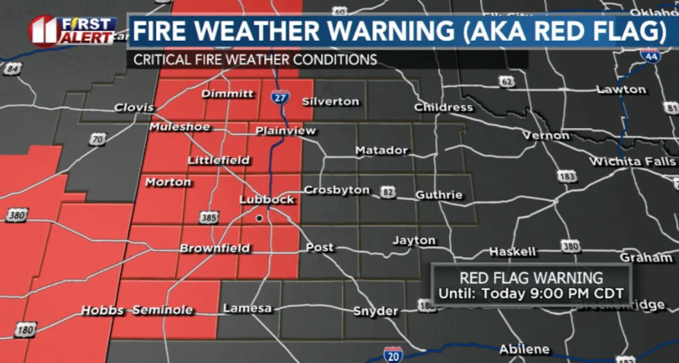
Critical fire weather conditions are expected to develop over much of the Caprock Wednesday afternoon and evening as winds strengthen and the lower atmosphere dries. Despite potential cloud cover and light rain, humidity values will fall below 20 percent.
A Red Flag Warning has been issued for most areas west of I-27 for Wednesday afternoon and evening. The combination of strong winds, very dry fuel states, and critically low humidity will result in favorable conditions for rapid fire spread, especially over areas that have not received precipitation over the past several days.
 KCBD(KCBD)Looking Ahead
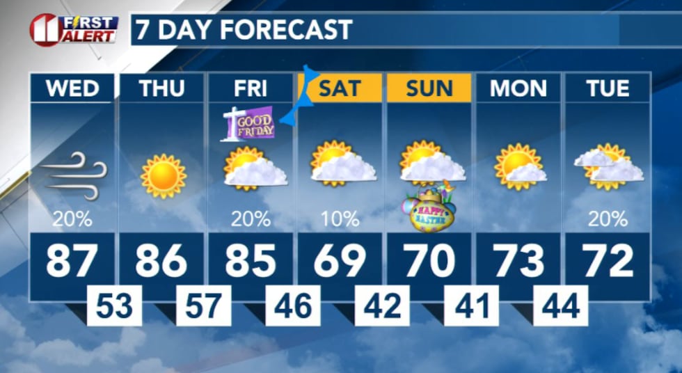
Additional shower and thunderstorm chances are expected Friday evening. Elevated-to-critical fire weather conditions will continue through the end of the week.
 KCBD(KCBD)
Copyright 2026 KCBD. All rights reserved.