
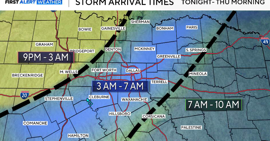
Storms organizing to our west late Wednesday evening move into North Texas overnight.
First Alert Weather Day: Wednesday night and very early Thursday morning
Storms will form along a dryline to our west and organize into a line as they move east. The greatest impact will be west of I-35 first, then spreading into the metroplex overnight.
Right now, the main window looks to be around 3 a.m. to 7 a.m. on Thursday for the DFW area. This will be a high coverage event, meaning many areas will see rain.

A few storms could become strong to severe, with:
Damaging wind gusts up to 60–65 mph Quarter-size hail or larger, especially west Heavy rainfall, which could lead to localized flooding
The tornado threat is low, but not zero, with a brief spin-up possible.

Storms are expected to gradually weaken as they move east, but will still produce heavy rain overnight.
Thursday
By 8 a.m. Thursday morning, storms will be shifting east and southeast, though some lingering rain is possible, especially across southern and eastern counties. Clouds will gradually clear from northwest to southeast through the day, although some areas may stay cloudy longer.
By the afternoon, most of North Texas turns quieter, with highs in the upper 70s to low 80s.
Second First Alert Weather Day: Friday into Saturday
We’re watching a more widespread round of storms beginning Friday afternoon, but especially Friday night into Saturday.
Some of these storms could become strong to severe, with:
Large hail Damaging winds Low tornado threat Heavy rainfall, which could lead to flooding
There is also a 10–20% chance that some locations could receive more than 3″ of rain.

A cold front moves through Saturday, with storms gradually ending from west to east. It will stay breezy and cooler behind the front.
Easter Sunday outlook
By Easter Sunday, most of the rain clears out. We’ll see more sunshine, lighter winds, and quieter conditions, with only a very low chance for a leftover shower.
