
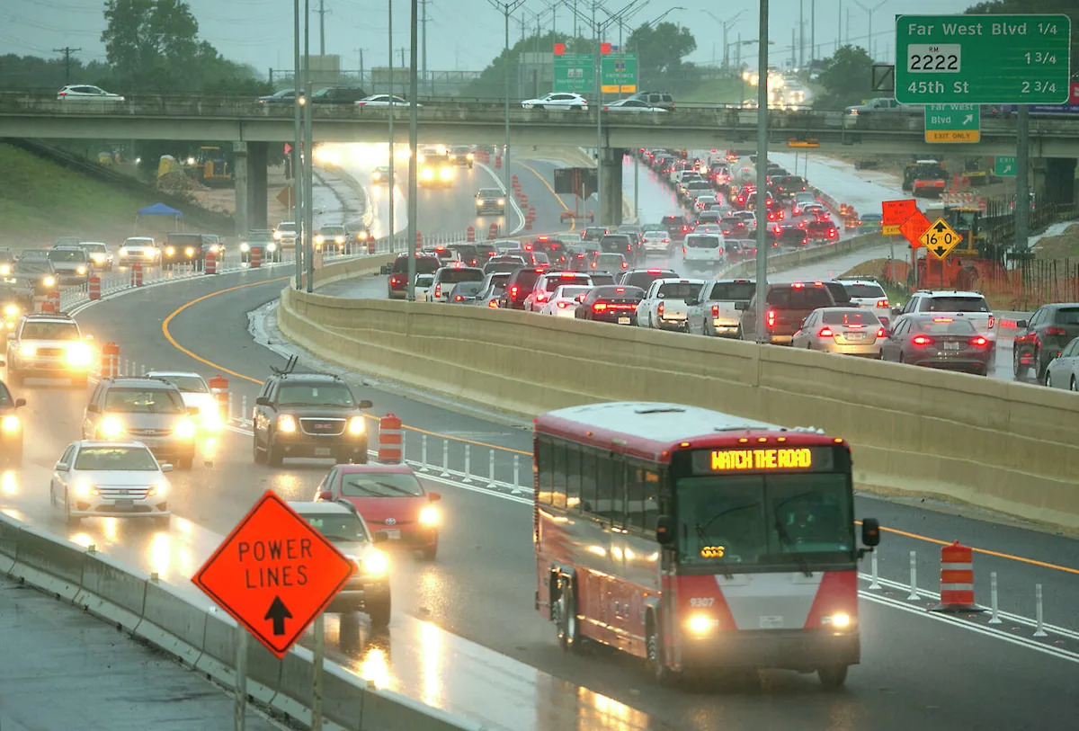
Austin’s first meaningful rain in weeks arrived with a boom Thursday morning, bringing strong winds and heavy showers that left standing water on some roads and raised concerns about flooding.
Rain is expected to taper off Thursday afternoon before returning Friday evening. Storms could intensify over the weekend, with the potential for severe thunderstorms Saturday and Sunday.
AUSTIN FLOOD MAP: See real-time updates
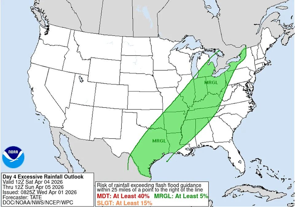
Heavy rain is likely with this weekends storm. Additional rain totals between 1 and 2 inches are possible. (Weather Prediction Center)
Despite the expected rainfall, the National Weather Service has placed parts of Central and East Texas under a Level 1 of 4 risk for flash flooding. That means there is about a 5% chance that rainfall could exceed flash flood guidance within 25 miles of a given point.
If you’re heading out, check real-time road conditions through local emergency management agencies or the Texas Department of Transportation before your commute.
Rain is expected to taper off Thursday afternoon and will return Friday evening, coming back in full force on Saturday and Sunday with the potential for severe thunderstorms. Despite the heavy rainfall expected, the National Weather Service currently designates parts of Central and East Texas under a level 1 out of 4 risk of flash flooding. This means the area at risk has a 5% chance that rainfall could exceed flash flood guidance within 25 miles of any point there.
If you’re wondering whether it’s safe to make your morning commute, take a look at the road conditions using the real-time updates available through local emergency management agencies and the Texas Department of Transportation.
Showers and thunderstorms may linger into Sunday, with rain chances diminishing by Monday.
Several dry days are expected next week before another potential storm system develops next weekend.
Newsroom meteorologist Mary Wasson contributed to this report.