
Don’t forget your umbrella this Thursday, April 2, morning. The National Weather Service (NWS) radar shows storms entering San Antonio.
The NWS says rain chances in and around the Alamo City will be highest before 1 p.m., with a 50 percent chance through that period. Much of the Hill Country and the Interstate 35 corridor began seeing a band of showers and storms roll through at around 6:55 a.m.
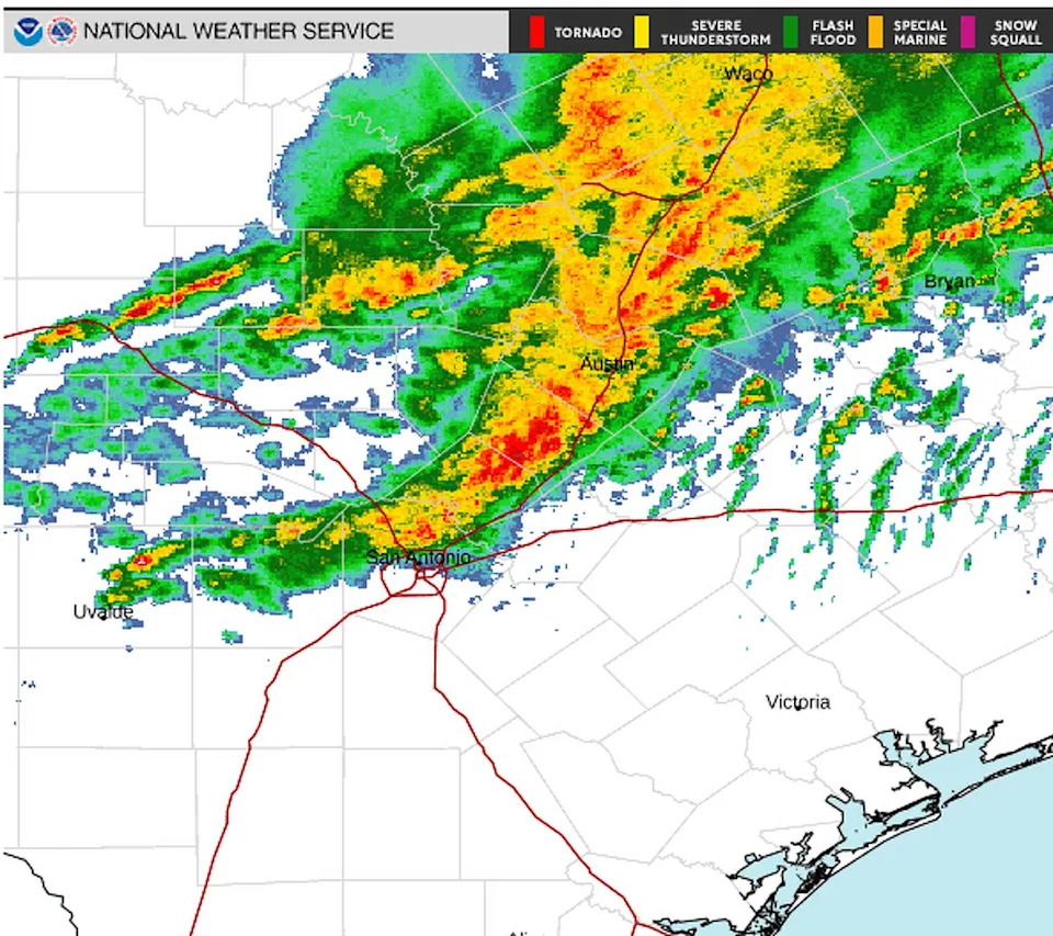
The National Weather Service radar shows storms entering San Antonio, Texas, on Thursday, April 2, 2026. (Courtesy of the National Weather Service)
The system is moving in from the west, putting areas north of Interstate 10, including Fredericksburg, Austin, and Georgetown, at probabilities of 58-74 percent.
“Some storms may be strong to severe and produce pockets of locally heavy rainfall,” the agency said in a post on X.
Currently, meteorologists predict between a tenth and a quarter of an inch, though higher amounts are possible during thunderstorms. A sweater wouldn’t be a bad idea. Southeast winds will be up to 15 mph, bringing gusts of up to roughly 25 mph.
“The forecast will trend drier as we head into the afternoon hours,” the NWS says. “It will be warm and breezy again with highs in the lower 80s to lower 90s.”
At night, the low will be 68 degrees with wind gusts up to 30 mph, per the NWS. Rain chances disappear then return during the evening hours of Friday, April 3. As of now, the chance of precipitation is 40 percent.
This article originally published at Radar shows storms entering San Antonio.