
A strong cold front could bring Houston a few strong storms, localized flooding and a much cooler Easter Sunday.
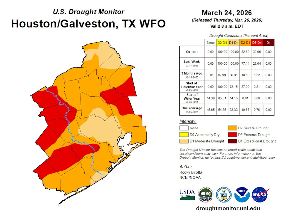
Despite cloudy skies, Friday stays dry for most neighborhoods. The potential for heavy rain arrives Saturday and could last into early Sunday morning. As drought across Southeast Texas worsens, how much beneficial rain could fall?
Friday: Houston stays mostly dry
Rain remains light for the Houston area Friday.
Early in the day, you may notice some spotty showers or drizzle on the drive into work or school. Mostly cloudy skies are expected with morning temperatures only falling into the lower 70s.
Isolated to widely scattered showers might bubble up during the afternoon as highs rise to around 85 degrees. A clap of thunder or a briefly heavy downpour is possible at any point of the afternoon, though it should be few and far between.
The day also will be quite breezy. Southeasterly winds could occasionally gust to 25 or 30 mph at times.
Saturday: Strong storms, flood risk arrives
Saturday is the day to be weather aware.
The morning remains dry in most of areas, aside from a passing sprinkle or two. Rain chances begin to climb by the afternoon, especially north of Interstate 10. By 5 p.m., a weakening line of thunderstorms could reach from College Station to Austin.
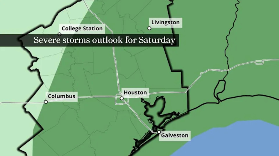
This map of Southeast Texas shows NOAA’s Storm Prediction Center severe storms outlook for Saturday. A line of gusty storms could reach Houston Saturday evening. (NOAA’s Storm Prediction Center)
Models suggest a line of storms reaching Houston Saturday evening, likely between 6 p.m. and midnight. Because this line is coming in during the evening hours when instability is lower, the risk of severe thunderstorms is low. Much of Southeast Texas is under a level 1 of 5 risk for isolated severe thunderstorms – the lowest risk level from NOAA’s Storm Prediction Center – meaning only a few storms could reach severe thresholds.
Heavy rain could result in localized pockets of flooding, particularly in areas that are flood-prone or have poor drainage.
LEAVING HOUSTON: After 15 years in Houston, Space City Weather’s Matt Lanza is leaving. Here’s what prompted the move.
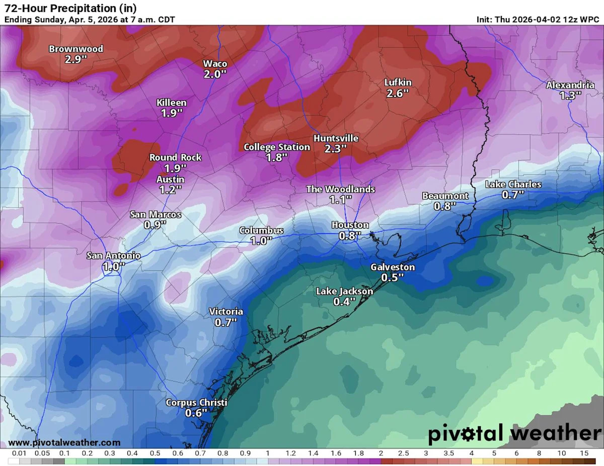
Rainfall totals will be quite varied from north to south. Along the coast, most locations will pick up between a quarter-inch and three-quarters of an inch of rainfall. Totals higher than an inch are most likely north of Lake Livingston, but totals of a half-inch to slightly more than an inch could occur in Houston and Harris County.
Easter Sunday: Spotty showers early
Confidence remains relatively high that showers will taper through the day Sunday.
Easter sunrise services may be damp, especially near and south of Houston where lingering showers are expected. As northerly winds sweep showers south of Houston, dry conditions are expected to return by the afternoon, though cloudy skies are likely to continue.
Sunday will be noticeably cooler, with many neighborhoods not getting out of the 60s.
This article originally published at Storms could hit Houston at a tricky time before Easter. Here’s the latest forecast..