
SAN ANTONIO – Cold front is just north of our area and making quick progress south ready to deliver some rain to our region, cooler temperatures and gusty winds.
The severe storm risk today is low and favors mainly our eastern half of the area where we cannot rule out an isolated strong storm with wind gusts and hail. This outlook barely overlaps into Bexar County (marginal outlook).
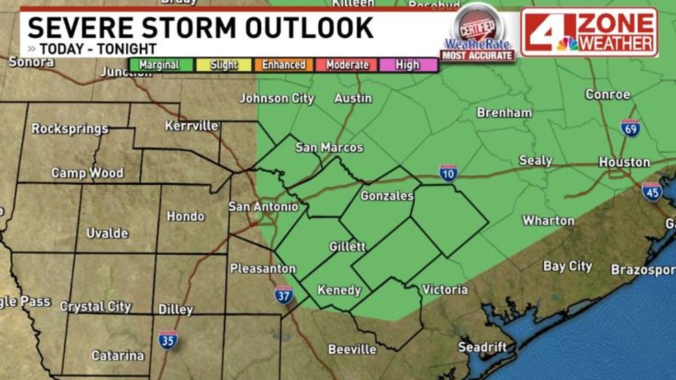
Severe storm outlook today favors eastern half of the area.{ } Level 1 of 5 risk
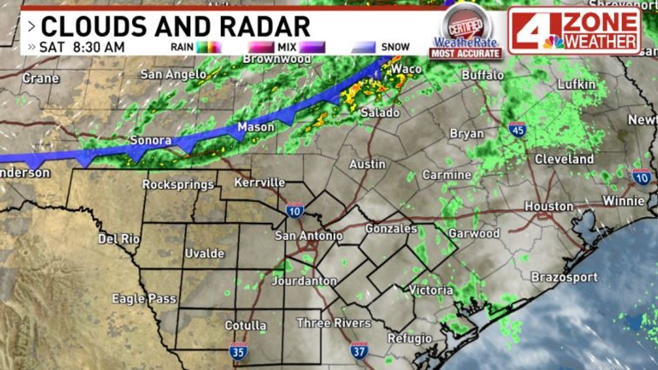
As of this morning, the front is almost to our Hill Country counties. Mostly cloudy skies with a few sprinkles or really light showers south of the front have popped up but only in a few spots. More widespread shower activity with an occasional lightning strike is along the front early this morning.

Cold front moving south this morning
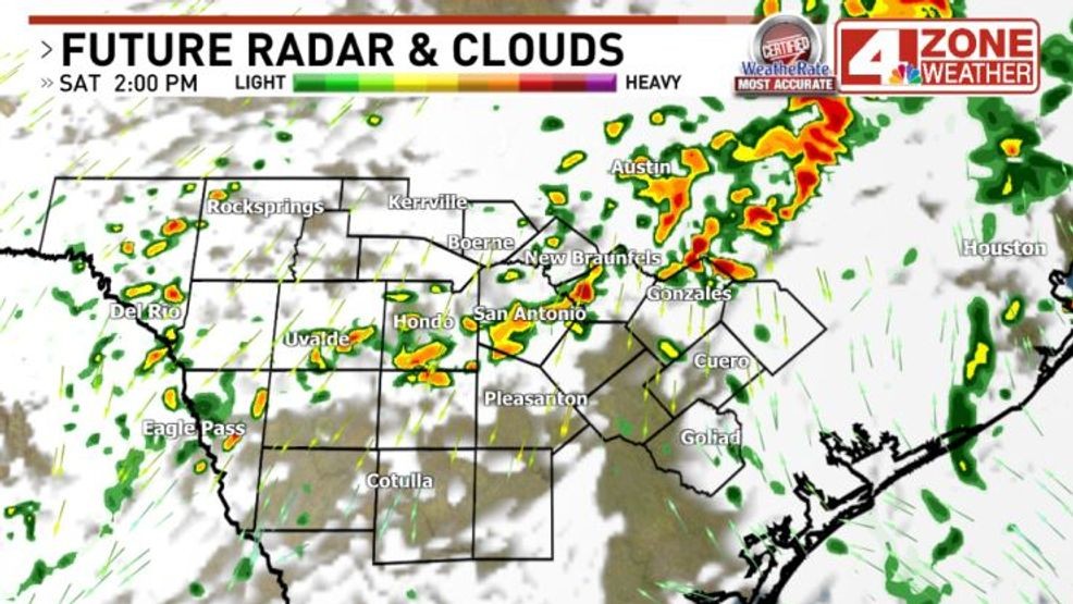
The front moves into the Hill Country and will kick up scattered showers or a few thunderstorms. There is not much severe risk in the Hill Country if you do see a thunderstorm. This will also be your highest rain chance for the day as chances will drop behind the front in the Hill Country later this afternoon and into the evening.
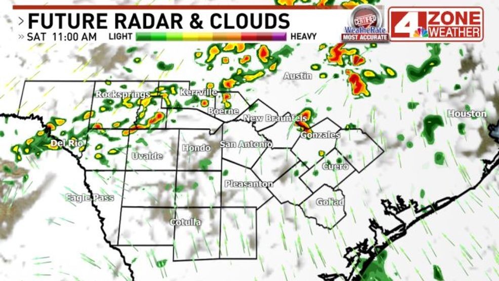
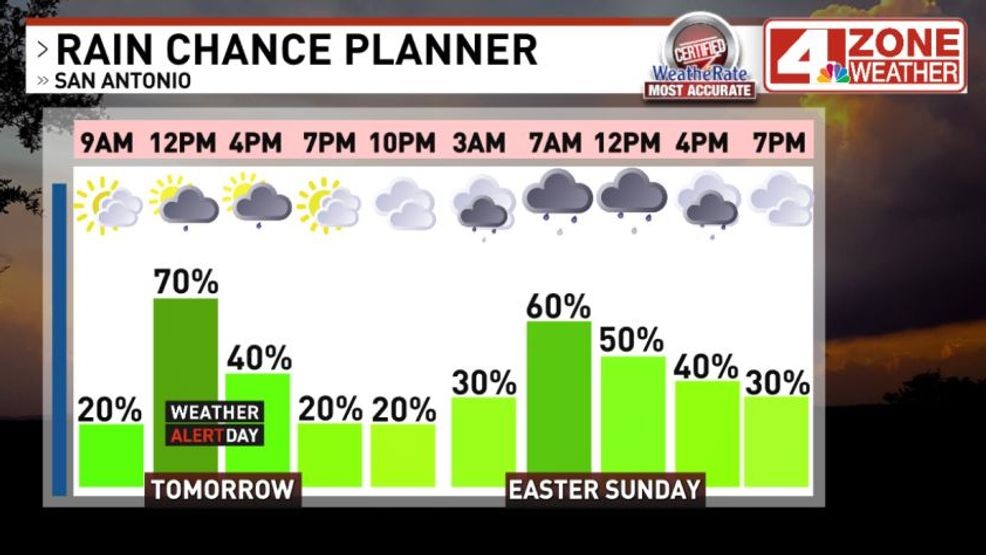
Around San Antonio and Bexar County, the front will push in between Noon – 2PM. As it arrives, the chance for scattered showers or thunderstorms will increase to 70%. It’s important to note, today’s rain chance at 70% is only for a few hours in the middle of the day as the chance decreases later in the afternoon and this evening to isolated 20% chance.
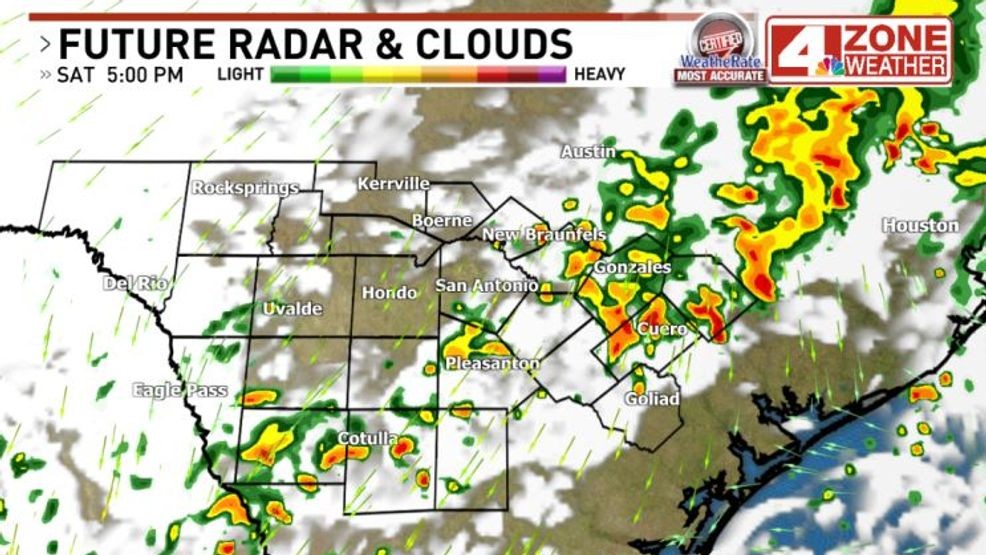
Behind the front, winds will switch to the north and gust 25 – 35mph with an isolated gust over 35mph possible. Temperatures will drop down into the low to mid 60s this evening.
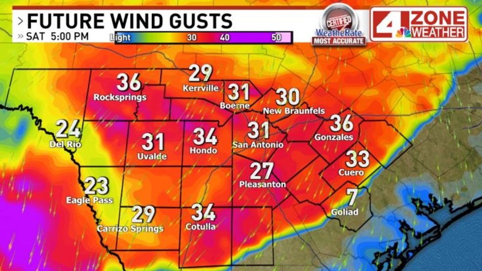
Forecast wind gusts later today
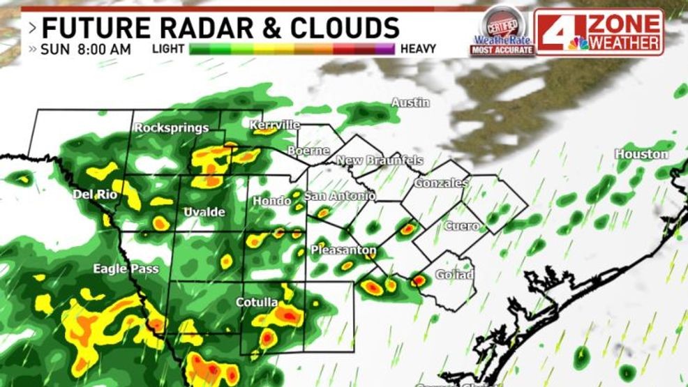
Easter Sunday, cloudy skies with sprinkles and some patchy rain developing. Temperatures will start in the mid 50s and only warm to the low to mid 60s later in the day. Patchy rain Easter Sunday into the early afternoon then tapers off.
 Comment with Bubbles
BE THE FIRST TO COMMENT
Total rainfall this weekend will range from .25″ to 1.25″+. This does not include totals already seen in our area over last two days.
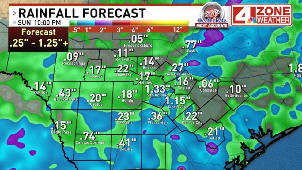
Forecast rainfall this weekend