
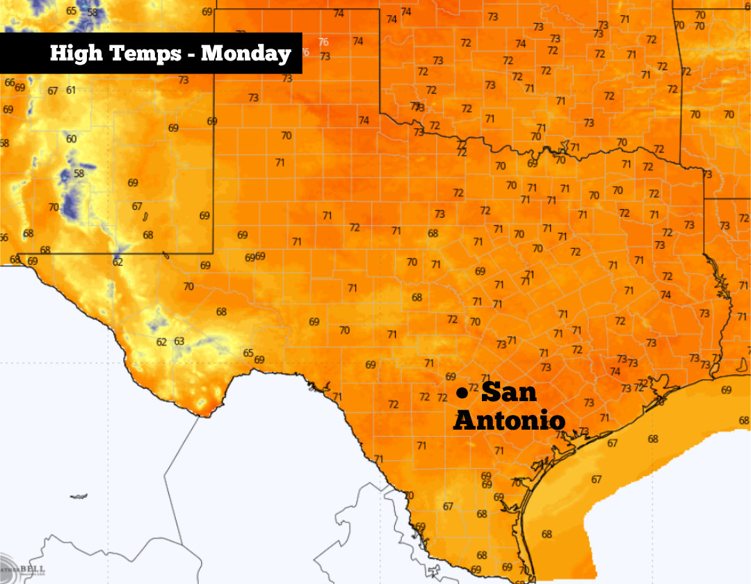
A strong cold front swept through South Texas on Saturday, which made for a cool and damp Easter weekend. Now on Monday, San Antonio will still be feeling some effects from the cold front, as northeast winds continue to transport cool air into the region. High temperatures are expected to stay several degrees below average for early April.
However, the cool and calm weather will not last for too long. Big forecast changes are expected to start by the second half of this week, and it may lead to an unstable and stormy forecast leading into next weekend as well. Here’s a breakdown of what you can expect.
You may want a jacket before walking out the door early Monday, as San Antonio temperatures will hover in the low to mid-50s through 9 a.m. The Hill Country will be even cooler, as temps will fall into the 40s from Kerrville to Fredericksburg.
Skies will be mostly cloudy through the morning, and there is a chance of a light shower or drizzle, mainly between 6 and 9 a.m. Overall rain chances will only be 10-20%, so most of us will stay dry.
By the late morning and heading into midday, skies will begin to clear, giving way to mostly sunny conditions by the afternoon. San Antonio temperatures will reach the mid-60s by noon before topping out in the low to mid-70s by the late afternoon. Very low humidity is also expected throughout the day, making for beautiful conditions to spend time outdoors.
Below-average temperatures will continue through the evening. San Antonio will fall back into the 60s after 7 p.m., eventually dropping back into the low 50s overnight and into early Tuesday.
Cool weather is expected to continue Tuesday, as morning lows in the low 50s transition into the low 70s by the afternoon. Partly to mostly cloudy skies are anticipated, but rain chances will be slim to none.
By Wednesday, temperatures will start rising back to normal levels, as highs rise into the upper 70s. Winds will also shift direction and start moving in from the south, bringing Gulf moisture and higher humidity back into South Texas. An isolated shower is possible, but rain chances will stay under 20%.
Temperatures will continue to rise Thursday and Friday, as highs will likely reach the low 80s across the San Antonio metro area. Morning lows will also become much more mild, only falling into the low to mid-60s each day.
Additionally, the atmosphere will become increasingly unstable, and with moisture continuing to stream in from the Gulf, chances of showers and storms will rise. San Antonio rain chances will reach 30-50% by Friday, with rain chances continuing into the upcoming weekend as well. Some storms could be strong, but widespread severe weather is not currently expected.
A fairly active weather pattern is likely to continue into the following week. According to the Climate Prediction Center’s outlook, San Antonio has a greater than 80% chance of near to above-average rainfall during the week of April 12-18.