
Cooler-than-normal temperatures will stick around Houston through the first half of the week.
That follows a helpful round of rain over the weekend. Much of the area picked up around 1 inch on Saturday – the most since March 11 – trimming the yearly rainfall deficit to just over 1 inch. A gradual return of warmth and humidity begins by midweek, with rain chances increasing late in the week as a more unsettled pattern develops.
Cooler weather lingers in Houston through midweek
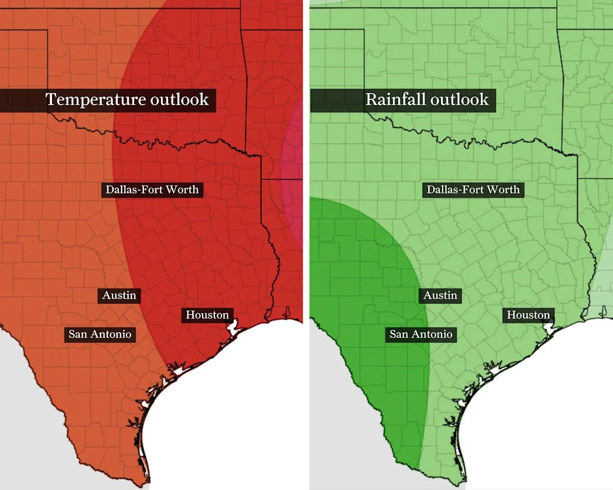
Let’s start with the short-term outlook: Temperatures will trend slightly below normal through midweek, offering a brief break from recent warmth along the Gulf Coast.
Highs will remain on the cooler side for this time of year, with most neighborhoods only reaching into the mid-70s through Tuesday. Morning conditions stay relatively comfortable with lower humidity and lows generally in the low to mid-50s.
The cooler temperatures won’t be dramatic, but they will be noticeable – especially after March was Houston’s third-warmest on record.
Overall, it’s a quieter and more comfortable start to the week before more typical Houston weather returns.
Humidity brings the return of storm chances
Temperatures begin to climb by midweek as winds shift back onshore, bringing Gulf moisture into Southeast Texas.
By Thursday and Friday, highs return to the low 80s across much of the Houston area, while dew points rise into the 60s – a sign of increasing humidity and a more summer-like feel.
That added moisture will also help fuel rain chances late in the week.
SPRING STORMS: Track Houston-area showers and storms this week with the Chronicle’s interactive tracker.
A larger-scale weather system is expected to move into the region, increasing the likelihood of showers and thunderstorms by Thursday, with the best chances arriving Friday. While it’s too early to pin down exact timing or coverage, the pattern supports a more active end to the week.
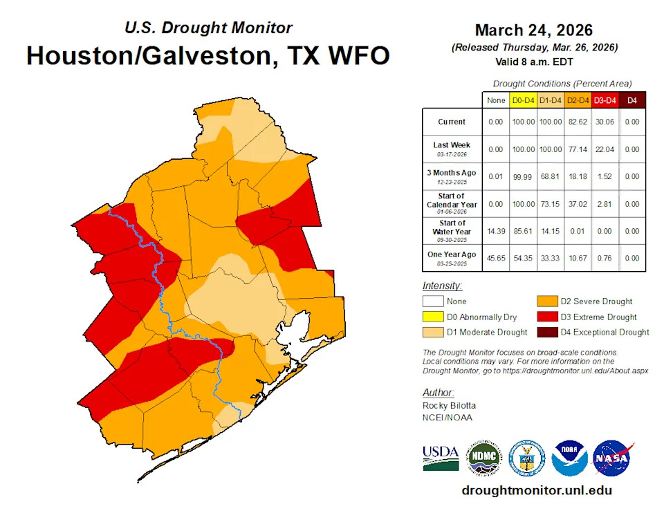
Rain is sorely needed across Southeast Texas, as the extent of extreme drought – the second-highest drought level – has nearly doubled since the end of March, increasing from about 30% to more than 50%. Drought is most prominent near and west of the Brazos River Valley, though extreme drought conditions extend eastward toward Beaumont.
For now, the forecast splits in two: cooler and comfortable conditions early in the week, followed by a warmer, more humid and increasingly unsettled pattern heading into the weekend.
This article originally published at Cooler weather settles into Houston after rain, with storms possible later this week.