
Shown are Southeast Texas rainfall totals through the upcoming weekend, according to NOAA’s Weather Prediction Center. The heaviest rainfall through the weekend is likely to occur west of Houston.
NOAA’s Weather Prediction Center / Pivotal Weather
Thursday brings the highest rain chances of the week so far, but storms could become more frequent by Friday.
The risk of downpours Thursday comes as a coastal atmospheric disturbance churns along the middle and lower Texas Gulf Coast. While not everyone will get rain, chances increase by Friday as another storm system crosses the state.
Here’s when storms are most likely to slow down commutes through the end of the week in Houston.
Article continues below this ad
Thursday: Showers west and south of Houston
Grab the umbrella before leaving for work or school Thursday, but don’t be surprised if you end up not using it.
The highest chance for a passing shower or storm will be found south of the Interstate 10 corridor and west of the Brazos River. Even in Wharton or Beeville — locations more likely to see rain than Houston — the chance of a stray shower only gets to around 30%.
SUPER EL NIÑO: The potential for a strong El Niño to develop in 2026 has risen, a new forecast shows. Here’s what it means for Texas.
Article continues below this ad
Early morning showers are most likely from Matagorda Bay to Corpus Christi, before potentially reaching I-10 by late morning. As temperatures climb toward 80 degrees during the afternoon, showers might get heavier or bring a few rumbles of thunder. Rain coverage still looks mainly hit-or-miss, but downpours might be more disruptive during the afternoon or evening commute.
Storms will be mainly driven by daytime heating, meaning that showers should dissipate once the sun dips below the horizon around 7:30 p.m.
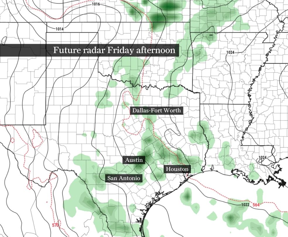
Friday: More storms likely in Houston
Rain chances peak Friday as a weak system in the upper atmosphere pivots over Texas.
Morning showers or storms are most likely between I-10 and the coast. As temperatures climb to near 80 degrees during the early afternoon, daytime heating will help spark more scattered storms. This time of year, these diurnally driven storms become increasingly common, as the sun’s warmth makes the atmosphere more unstable and allows clouds to build into showers or thunderstorms.
Article continues below this ad
This map of Texas shows how future weather radar could look Friday afternoon. Scattered downpours are likely across Southeast Texas.
Pivotal Weather
Saturday could be the driest day across Southeast Texas, as shown by this future weather radar image of Texas.
Pivotal Weather
Isolated to widely scattered downpours are expected Sunday, but this far out, confidence is low on where exactly storms could develop. In any case, neither weekend day is likely to see nonstop rain.
Pivotal Weather
While flooding and severe weather aren’t expected, any storm could produce briefly gusty winds or rainfall heavy enough to result in localized pooling of water on area roads. Storms should fade after sunset, similar to Thursday.
Tricky weekend forecast as storm chances linger
Storm chances persist through the upcoming weekend, which isn’t bad news, given the ongoing drought across Southeast Texas.
If you have outdoor plans, Saturday is likely to be the drier of the two weekend days as an upper-level ridge of high atmospheric pressure builds. Storms early in the weekend should be sparse, confined mainly to areas south and west of Houston. For most neighborhoods, Saturday features partly cloudy skies and highs near 80 degrees.
Article continues below this ad
RAIN TRACKER: You can track this weekend’s storm potential wherever you are using the Chronicle’s interactive storm map.
Sunday’s weather has the potential to be more unsettled, but to what extent remains uncertain for now. While storm chances are slightly higher Sunday than on Saturday, no day looks to be a total washout.
The pattern of daily storms lingers into next week, when the chance for a few strong storms could arise again in Houston by Tuesday.