
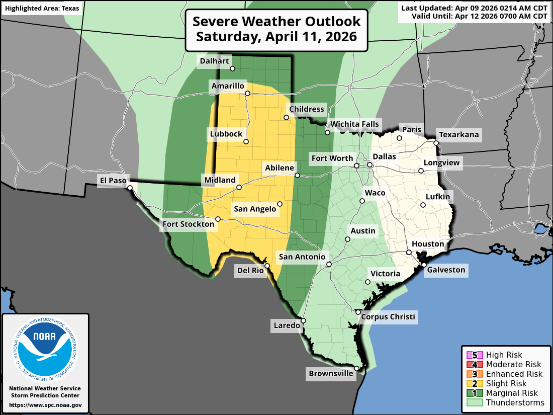
Strong to severe thunderstorms are expected across West Texas on Saturday, kicking off an active period of weather for the United States.
Initial Storm Prediction Center outlooks predict that isolated severe hail and severe wind gusts will be the main threats.
“Thunderstorms with isolated large hail and severe wind gusts will be possible on Saturday across parts of west Texas and far eastern New Mexico,” the Storm Prediction Center said. “A marginal severe threat will also be possible across parts of the central Plains and mid Missouri Valley.”
The Midland National Weather Service notes that timing for the severe storms looks to be late Saturday afternoon and into Saturday night with storms exiting the region or decaying by early Sunday morning.
Sunday will also feature a similar dryline setup, though the SPC severe weather outlook shows that storms are expected to remain east of Midland towards Big Spring.
“A similar dryline-like pattern holds for Sunday afternoon as well, but details on exact timing and locations for storms are less clear as convection from the day before may have implications on Sunday`s activity,” the Midland/Odessa NWS said.
Flash flooding will also be a concern due to anomalously high atmospheric moisture.
This will be part of an active period of severe weather for Texas in general, with the Dallas/Fort Worth area under a 15% severe weather risk from Sunday through Wednesday, April 15. So far, the only day when severe weather may approach West Texas is Tuesday, April 14, though this is also more towards the Big Spring area.