
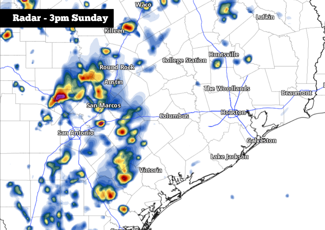
Shown is the potential future radar at 3 p.m. Sunday, as scattered strong to severe storms move through South Texas.
Pivotal Weather
Active weather is setting up across the Lone Star State on Sunday, as potential strong to severe thunderstorms will occur in two rounds.
First, a cluster of early morning storms is expected to push through the Texas Hill Country and into a large part of the Interstate 35 corridor. Then, after a break in activity, a second round of storms is possible by midday and into the late afternoon.
Article continues below this ad
The entire region is under a Level 2 of 5 risk of severe thunderstorms, as set forth by the Storm Prediction Center. That means that a few storms may be capable of producing large hail and damaging wind gusts, up to 70 mph. Here’s a close look at what you can expect.
Round 1: Early morning storms
A large cluster of thunderstorms developed across West Texas Saturday night, and these storms will form into a line and move over parts of Central Texas and the Hill Country during the predawn hours early Sunday.
A severe thunderstorm watch has been issued for the Hill Country – including Kerrville, Fredericksburg, Llano, and Austin – until 8 a.m. Sunday morning. The cluster of storms will also progress farther north across the state, likely affecting Waco and the Dallas-Fort Worth metroplex.
Article continues below this ad
A severe thunderstorm watch has been issued for the highlighted region until 8 a.m. Sunday morning
National Weather Service
San Antonio will also have a chance of showers and thunderstorms during the early morning hours, especially between 4 and 9 a.m. While severe storms are not likely during this time, some storms may stick pack a punch, capable of quick downpours, small hail, and frequent lightning. Be sure to stay indoors as storms work through the region Sunday morning.
Storm chances in San Antonio will be around 50% during the morning hours. While not everyone will see strong storms, a large part of the metro area will have a good chance of picking up some beneficial rainfall. Rain chances in Austin will be slightly higher, near 60 to 70%.
Article continues below this ad
Round 2: Afternoon and evening
After the initial cluster of showers and storms moves through, a short period of drier weather is expected from the late-morning into the early afternoon. San Antonio will see high temperatures rise into the upper 70s with partly to mostly cloudy skies overhead.
Shown are the potential rainfall totals through Sunday, according to the National Blend of Models.
Pivotal Weather
The next round of storms is expected to start after 1 p.m., as daytime heating and an unstable atmosphere lead to storm development. This activity may last into the early evening, with scattered storms possible across South and Central Texas. Rain chances in San Antonio will once again be around 50%.
Article continues below this ad
Any storms that form Sunday afternoon will have the potential to intensify quickly and become severe, capable of producing large hail and strong wind gusts. However, if skies remain cloudy through the day, the atmosphere will stay more stable, potentially lowering the overall severe weather risk.
For San Antonio specifically, a low to moderate hail risk is expected throughout Sunday afternoon. If a severe thunderstorm warning is issued for your area, be sure to take shelter immediately.
San Antonio rain chances will decrease after sunset, down to around 20%. A few strong to severe storms may form near the Rio Grande, but this activity is likely to stay south of San Antonio.
Article continues below this ad
What’s coming next?
Rain chances will decrease slightly by the start of next week. However, with atmospheric moisture levels staying high, a few scattered showers and storms will stay possible each day. Overall rain chances from Monday through Wednesday will be about 20 to 30% each day.
Temperatures will be quite warm throughout the week. On Monday, San Antonio will likely see high temps reach 83 to 85 degrees, under partly cloudy skies. Tuesday and Wednesday will be similar, with highs continuing in the low to mid-80s. Temps will rise a few more degrees by the second half of the week, reaching the upper 80s Thursday and Friday.
Article continues below this ad