
The Storm Prediction Center (SPC) said ongoing showers and isolated thunderstorms across central and east Texas are complicating the forecast, with mesoscale factors expected to play a significant role in storm development later today.
Forecasters expect redevelopment along the southern and western edge of ongoing storms from southeast and south-central Texas into southwest Texas later this afternoon and evening.
The agency said moist advection, modest daytime heating, and limited low-level convergence will support redevelopment. Moderate to strong instability and moderate vertical shear could support supercells if storms remain discrete, with large hail possible early in the convective cycle.
Storms may cluster over time, which could limit the persistence and coverage of robust rotating updrafts, but damaging wind gusts may still occur, especially if bowing segments develop.
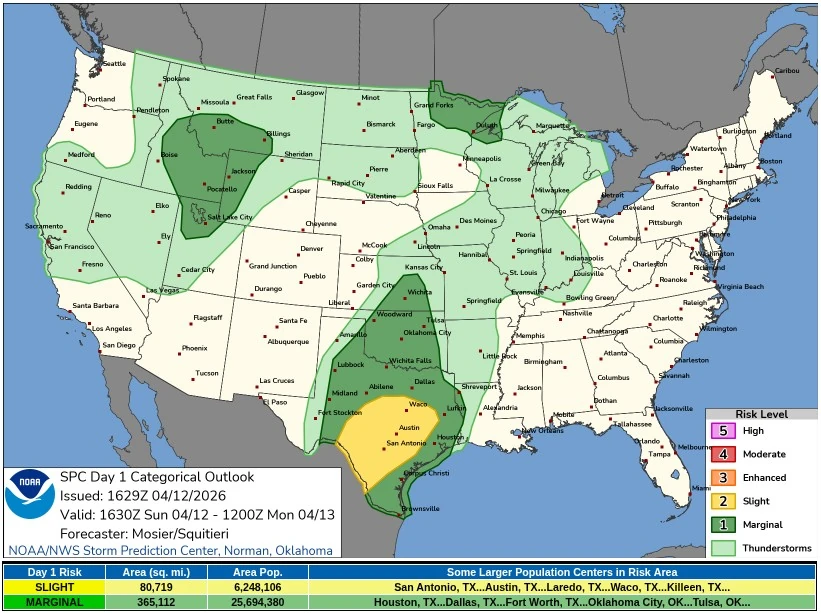 SPC Categorical Outlook valid 16:30 UTC on April 12 to 12:00 UTC on April 13, 2026. Credit: NOAA/SPC
A broader Marginal Risk also remains in place farther west across parts of west and southwest Texas near the dryline.
The SPC said the environment there is conditionally supportive of supercells capable of all severe hazards, with mixed-layer CAPE of 1 500–2 000 J/kg and 30–40 kt of deep-layer shear. However, mid-level height rises, subsidence, and modest convective inhibition are expected to limit storm initiation across much of that corridor.
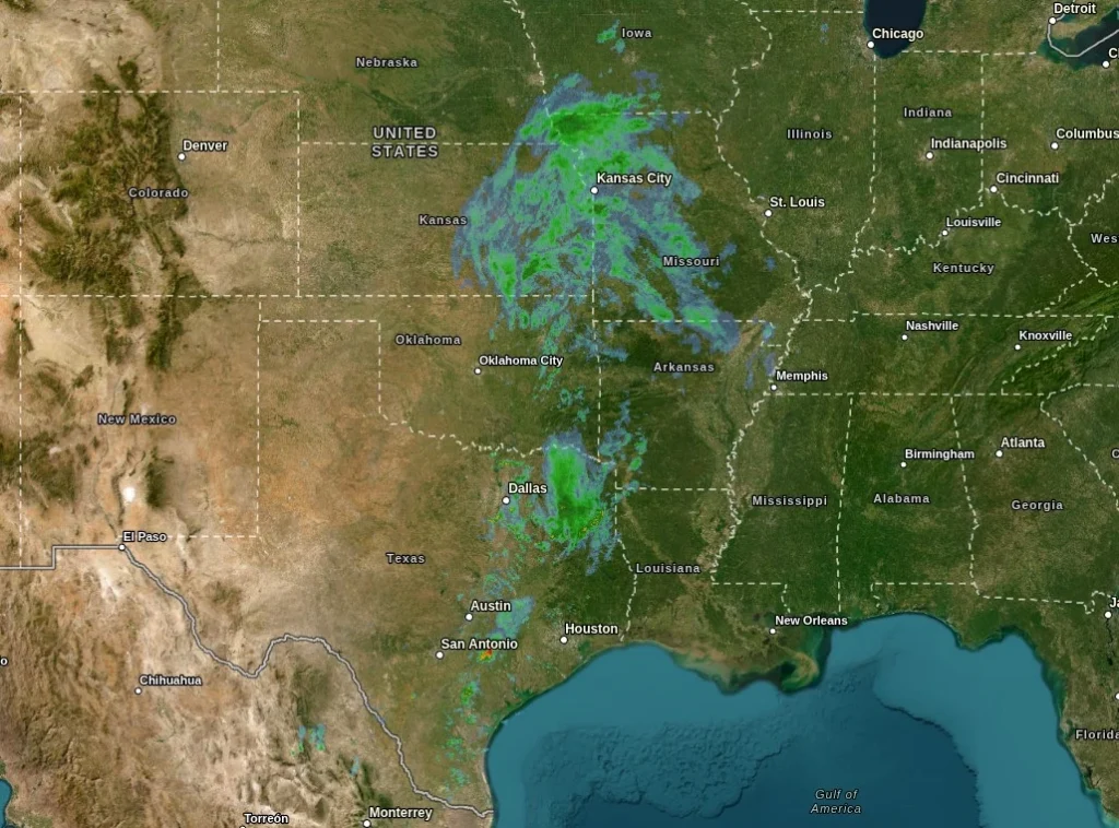 Radar image valid 16:30 UTC on April 12, 2026. Credit: NWS, The Watchers
The Day 2 outlook, valid from 12:00 UTC on April 13 to 12:00 UTC on April 14, keeps parts of the southern Plains under a Slight Risk of severe thunderstorms, with the Texas component focused from the western and central parts of the state toward the Big Bend.
A conditional supercell environment will exist along and east of the dryline from western and central Oklahoma southwestward toward the Big Bend on Monday afternoon and evening.
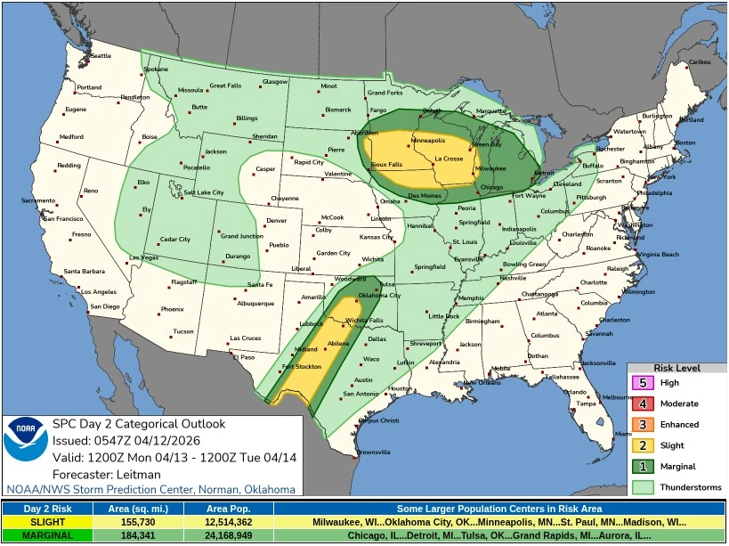 SPC Categorical Outlook valid 12:00 UTC on April 13 to 12:00 UTC on April 14, 2026. Credit: NOAA/SPC
Large-scale ascent will remain limited across the southern Plains on Monday because stronger height falls will stay displaced farther north. As a result, capping is expected to suppress widespread thunderstorm development for much of the day despite a strongly unstable air mass.
Strong daytime heating along the dryline will promote boundary-layer mixing, while confluence in the low-level flow and a modest strengthening low-level jet late in the day may be sufficient for a couple of storms to form.
Storm coverage is expected to remain isolated, but if a storm can develop, the environment would support supercells capable of producing large hail, strong wind gusts, and perhaps a tornado.
While Monday’s severe risk in Texas remains conditional, the persistence of dryline-related instability means parts of western and central Texas could face another round of late-day severe weather concerns after today’s more mesoscale-driven setup farther east and south.
References:
1 Day 1 Convective Outlook – NWS/SPC – Issued at 16:29 UTC on April 12, 2026
2 Day 2 Convective Outlook – NWS/SPC – Issued at 05:47 UTC on April 12, 2026