
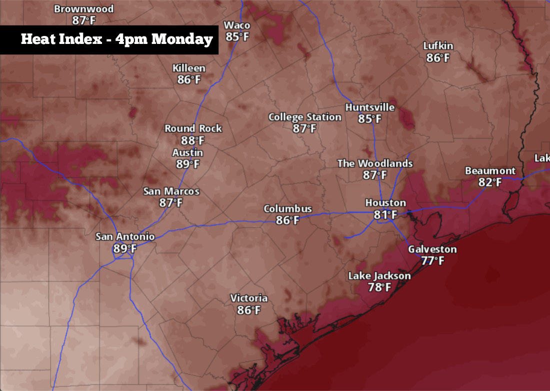
While the weather pattern is quieting, atmospheric moisture will continue to surge northward from the Gulf. This will result in the most humid conditions San Antonio has experienced in several months, and it could even allow for a few isolated thunderstorms throughout the week.
Here’s a breakdown of what you can expect.
As you walk out the door early Monday morning, be prepared for muggy conditions and very mild temperatures. San Antonio lows will hover near 70 degrees — more than 10 degrees warmer than average for mid-April. Skies will be cloudy, and there’s a chance of patchy fog at times, especially in the Hill Country.
As skies stay cloudy, temps won’t rise much through the morning, with readings still in the mid-70s by 11 a.m. By the afternoon, however, more sunshine is expected. San Antonio will reach 80 degrees just after noon, and highs will likely top out at 85 degrees by late afternoon.
South winds at around 10 mph will continue to transport high levels of Gulf moisture, leading to dew points in the upper 60s to low 70s. That added moisture will cause the air to feel warmer, with heat index values expected to rise to near 90 degrees.
A few isolated storms are possible during the afternoon and early evening, though San Antonio’s overall rain chances will stay low at around 20%. An isolated strong storm is also possible in the Hill Country, but much of the region will stay dry.
Similar conditions are expected on Tuesday, as high temperatures will once again rise into the mid-80s under partly to mostly cloudy skies. Wind speeds will increase slightly, with gusts expected to rise up to 25 mph during the afternoon.
An isolated storm is not out of the question across South Texas, but overall rain chances will only be 10% to 20%. Much higher storm chances are anticipated in West Texas — especially from San Angelo to Abilene — where a few storms could produce large hail and damaging winds.
Storms will increase in coverage slightly Wednesday, with overall rain chances in San Antonio expected to be around 30%. Otherwise, expect morning temps in the low 70s rising back into the mid-80s by the afternoon.
Temperatures are expected to rise slightly higher by Thursday and Friday, with highs topping out at 88 to 89 degrees. Drier air will also move in, sending rain chances to less than 10%.
Long-range weather models are starting to suggest that a cold front may slide through the state by next weekend. This front has the potential to bring high temperatures back into the mid-70s by Sunday, as well as bring scattered storm chances back into the region.
A good deal of uncertainty still exists with this front in terms of exact strength and timing. Stay up to date at expressnews.com/weather as those details become more clear in the coming days.