
Wet and stormy weather will continue across the Lone Star State as an active weather pattern settles in this week. Not everyone will experience heavy rainfall or strong thunderstorms, but Central Texas will see ongoing chances for unsettled weather throughout the work week.
Over the weekend, some areas picked up heavy rainfall, prompting a flood watch Sunday that ended early Monday.
Among the few severe thunderstorms that also developed, one produced a microburst near Schulenburg, in Fayette County, along Interstate 10 between San Antonio and Houston.
A broad upper-level trough of low atmospheric pressure in the southwestern United States has been driving the recent unsettled weather. It will remain in place for several more days, along with a warm and humid air mass across Texas.
Persistent southwesterly flow in the upper atmosphere will maintain daily storm chances. The greatest potential for storm development will be in the afternoon and early evening as daytime heating increases atmospheric instability. At the surface, southerly winds will help boost temperatures while continuing to supply the air moisture needed to fuel showers and thunderstorms.
Although most of the storm activity is expected to stay west of Central Texas, the region could still see periods of rain and a few isolated storms, with rain chances ranging from 20% to 40%.
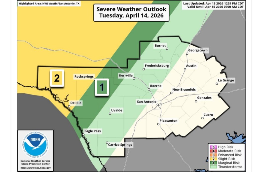
A stronger piece of atmospheric energy will swing across the southern Plains by Wednesday and into Thursday with an increase in potential storms across Central Texas.
“The favored area for storm development is focused north of our region, but medium range (forecast) models show extension of potentially a broken line of storms extending to areas north of the I-10 corridor sometime late Wednesday into early Thursday,” meteorologists at the National Weather Service wrote in their daily discussion for Austin and San Antonio. “Isolated threats for severe weather and excessive rainfall are possible with this activity.”
Temperatures will run warmer than normal and feel quite muggy, with mornings this week in the 60s and 70s and afternoons climbing into the 80s to near 90 in some spots — which would be about 10 degrees above April’s average daily temps.
A brief break in the rain is possible late in the week before a frontal boundary moves in, bringing renewed chances for rain and storms along with cooler weather behind it.
“Rain and thunderstorms are probable on this (cold) front, but it is too early to gauge the severe weather and heavy rain risk,” the weather service wrote on Monday. “A period of below-average temperatures is possible behind the front, with air spilling south from the Rockies, switching up the air mass over South-Central Texas to a drier and cooler one.”