
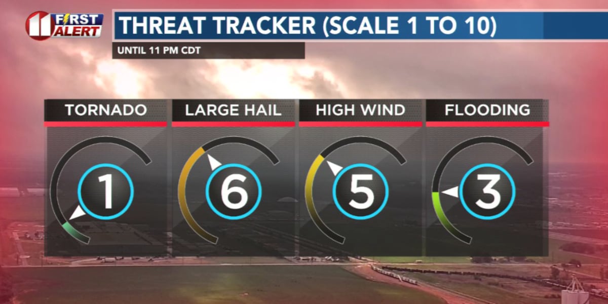
LUBBOCK, Texas (KCBD) – Severe thunderstorms are possible across the eastern and southeastern viewing area until late evening. The greatest threat is large hail. Less threatening weather, but with elevated wildfire conditions, returns for the remainder of the work week before a cold front brings much cooler temperatures for the weekend.
Severe Storm Threat
The potential for thunderstorms, possibly severe, will continue through mid-evening across the eastern and southeastern KCBD/FOX34 viewing area.
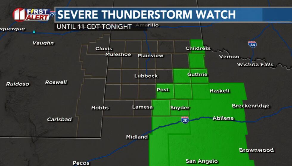 A Severe Thunderstorm Watch is in effect until 11 PM CDT for the eastern and southeastern KCBD viewing area.(KCBD First Alert)
The greatest threat with this evening’s storms is large hail. Some strong and damaging wind gusts and locally heavy rain also are possible. The tornado threat in the viewing area is low. Be weather aware. Watch and listen for warnings which may be issued.
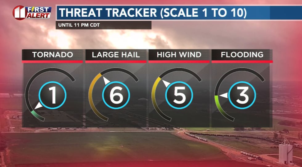 The main severe weather threat in the viewing area this evening is large hail.(KCBD First Alert)
Storms are expected to move east of the viewing area by late evening, clearing the way for drier conditions to follow.
Windy and Dry
Strong winds will return tomorrow. The westerly component will push the more moist air to the east with relative humidity dropping significantly, possibly into the single digits.
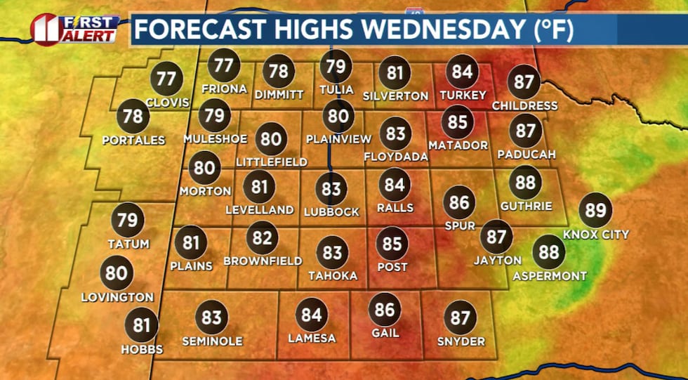 Another very warm and windy afternoon.(KCBD First Alert)
Breezy to windy southwest winds will continue through sunset, with gusts around 35-40 mph possible. Overall conditions will be dry, but wind gusts and blowing dust may impact travel.
With temperatures again peaking in the 80s, Wednesday is a NO BURN DAY.
Fire Weather
The dry, breezy, and warm pattern will continue Thursday and Friday. Naturally, even with the recent rain, the grassland fire danger will remain elevated both days.
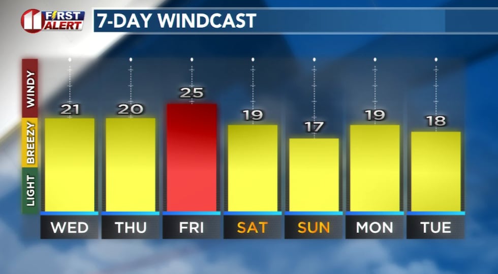 Forecast peak sustained winds are shown in this graph. Peak gusts will exceed the values shown here.(KCBD First Alert)
Postpone outdoor burning plans and be extra cautious with any activity that might generate a spark or excessive heat.
Cooler Pattern
A seasonally strong cold front will move through the viewing area late Friday into Friday night. Behind, much cooler temperatures for the weekend.
 First Alert Weather App(KCBD)
Stay with KCBD for the latest updates on this developing weather situation. We’ll continue to monitor the severe threat and provide you with timely updates as we get closer to Friday night and Saturday.
Copyright 2026 KCBD. All rights reserved.