
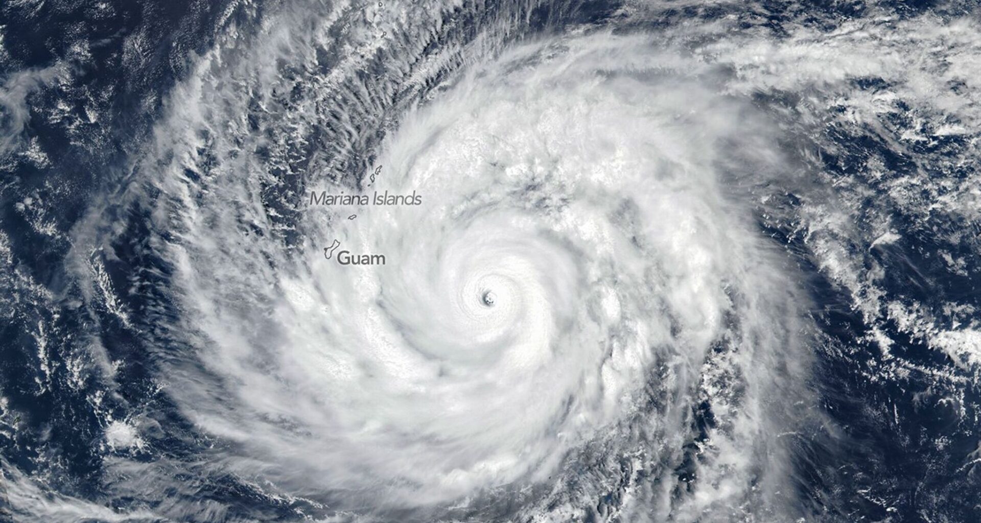
Super Typhoon Sinlaku was photographed by a weather satellite over the North Pacific Ocean on Monday, a day before reaching the Northern Mariana Islands.
National Aeronautical Space Administration
Super Typhoon Sinlaku’s explosive intensification could be an early signal of an emerging “super El Niño” — a shift in heat energy that could influence both hurricane development and weather in Texas. That shift is already beginning at a critical time of year, just weeks before the June 1 start of the Atlantic hurricane season.
Sinlaku this week rapidly strengthened into the most powerful storm system on Earth so far in 2026 before striking the Northern Mariana Islands as a high-end Category 4 typhoon. But its importance extends well beyond the western Pacific.
EARLY SEASON OUTLOOK: 2026’s first authoritative hurricane season forecast is out. Here’s what it means for Texas.
Article continues below this ad
The same unusually warm ocean waters that fueled Sinlaku are now helping shift heat across the Pacific, a key step in the development of El Niño.
Sinlaku’s landfall in extreme ocean heat
Sinlaku’s eyewall passed directly over Saipan and Tinian late Tuesday, bringing sustained winds near 145 mph and gusts approaching 175 mph.
The storm’s rapid intensification — from a weak system to a Category 5-equivalent typhoon in roughly three days — points to an ocean loaded with heat energy. Sea-surface temperatures in the region were well above average, and that warmth extended deep below the surface. It’s part of a broader pattern that has pushed global ocean temperatures to record highs in recent years.
Article continues below this ad
THREE YEARS LATER: Category 5 Otis slammed into Acapulco in 2023 after rapidly intensifying. Could that happen along the Texas coast?
That subsurface heat is critical. It not only fuels storms like Sinlaku but also serves as the foundation for larger-scale changes now underway across the Pacific.
A shift already underway in the Pacific
That heat is now beginning to shift eastward — and storms like Sinlaku are helping move it.
Sinlaku developed alongside other tropical systems on both sides of the equator, a setup that can disrupt the normal trade winds. When those winds weaken or reverse, they can trigger what’s known as a westerly wind burst, a key mechanism in the early stages of El Niño.
Article continues below this ad
Ocean heat content across the western Pacific Ocean shows deep, warm waters capable of fueling rapid intensification of any tropical cyclone. The black square marks Sinlaku’s approximate location Wednesday morning, and the red line its approximate path.
NOAA’s Next Generation Visualization Tool / Justin Ballard
Those bursts act to push warm water eastward along the equator. That movement doesn’t happen at the surface. Instead, the heat travels below it as a Kelvin wave — a slow-moving pulse of warm water that propagates across the Pacific before eventually rising in the central and eastern basin.
That process helps shift the ocean-atmosphere system toward El Niño. Similar patterns were observed ahead of the 1997-98 event, one of the strongest on record.
Current outlooks give El Niño roughly a 60% chance of developing by late summer or fall, with the potential to strengthen into winter.
Could this become a ‘super El Niño?’
Sinlaku highlights how much heat is currently stored in the Pacific.
Article continues below this ad
When El Niño events reach their strongest levels, they tend to produce the most pronounced shifts in global weather patterns — including storm tracks, rainfall and temperature extremes.
Sinlaku developed alongside atmospheric patterns that help push warm water eastward, a key step in El Niño formation, echoing processes observed ahead of the 1997-98 event.
This chart shows the probability forecast for El Niño, according to NOAA’s Climate Prediction Center. Red bars show the likelihood of El Niño conditions for each three-month period through early 2027, with odds rising significantly by autumn 2026.
NOAA’s Climate Prediction Center
Despite the signals, uncertainty persists because forecasts during this time of year are limited by a series of unstable meteorological factors collectively known as the spring predictability barrier. While many models support El Niño development, a few indicate it will intensify into a “super” event — typically defined by temperature anomalies of around 3 degrees above average in the tropical Pacific.
El Niño and the 2026 Atlantic hurricane season
For Texas, the first potential consequences become evident during hurricane season, which begins June 1.
Article continues below this ad
El Niño typically increases wind shear across the Atlantic and Caribbean, making it harder for storms to organize and intensify. That often leads to fewer hurricanes overall and reduces the likelihood of rapid intensification of tropical cyclones in the Gulf of Mexico.
Historically, strong El Niño years have been relatively quiet for Texas. Since 1850, only one storm — Hurricane Audrey in 1957 — approached the region during El Niño conditions, making landfall in Louisiana.
This map shows the path of Audrey, the only hurricane to approach Texas during El Niño. Audrey made landfall in far southwest Louisiana in 1957.
National Hurricane Center
But it doesn’t eliminate the risk. It only takes one storm to make a Texas landfall to make our season miserable.
However, timing remains a key factor. If El Niño develops later in the season, its influence on the period of peak hurricane activity could be limited.
A strong El Niño could shape Texas winter
The more consistent signal for Texas arrives in winter.
A strengthening El Niño typically shifts the jet stream south, increasing storm activity across the southern United States. For Texas, that often means wetter conditions and a higher risk of flooding, especially across Southeast Texas.
Past strong events — including 1982-83, 1997-98 and 2015-16 — show a clear pattern. Houston recorded significantly above-normal rainfall during the 1997-98 winter, while parts of Southeast Texas have seen precipitation totals climb to more than double the seasonal average in particularly strong years.
Farther north, the consequences can include colder periods and heavier snowfall across the Panhandle as storm tracks shift.
While temperatures can vary from one El Niño winter to another, the signal for increased precipitation across Texas is consistent.
What it means for Texas
Texas is entering a transition period.
La Niña’s influence is fading, opening the door to a different set of weather patterns. A quieter hurricane season is possible, depending on how quickly El Niño develops. By winter, the odds favor a shift toward wetter, more active conditions.
Sinlaku’s rapid intensification is a signal of how much heat the oceans are holding — and how quickly that energy can reshape weather patterns.
As that heat shifts across the Pacific, the effects won’t stay there. They could begin showing up in Texas as soon as this hurricane season — becoming more pronounced by winter.