
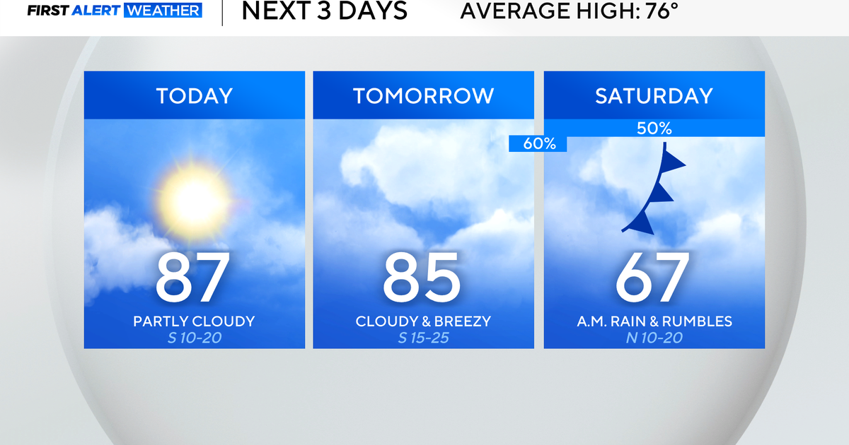
It’s a much quieter Thursday, as partly cloudy skies make way for temperatures in the mid-80s.
North Texas will see a nice break from any rain before chances quickly return late Friday to Saturday. Some areas of fog will be possible for the Friday morning commute with temperatures in the 60s.

Winds will start to increase on Friday ahead of a strong cold front building overnight into Saturday. There is a small severe threat as these storms move through into early Saturday, with wind and hail being the main threats.
The tornado risk is very low but not zero.
Expect to wake up to showers and storms as the cold front moves in, but it looks like the heaviest of the rain will move out of the metroplex by midday at the latest. Some southern counties may see lingering rain in the afternoon.


Highs on Saturday will struggle to escape the 60s. It will be a cool, damp and rainy day for most.
The big story behind this cold front will be how much cooler it will be on Sunday. Temperatures that morning will dip down into the mid to upper 40s.

After Sunday, temperatures stay below average for a few days before the 80s return by next Wednesday.
After looking at the latest data, rain forecasts for early next week have decreased. Expect a small chance of showers Monday through Wednesday.
