
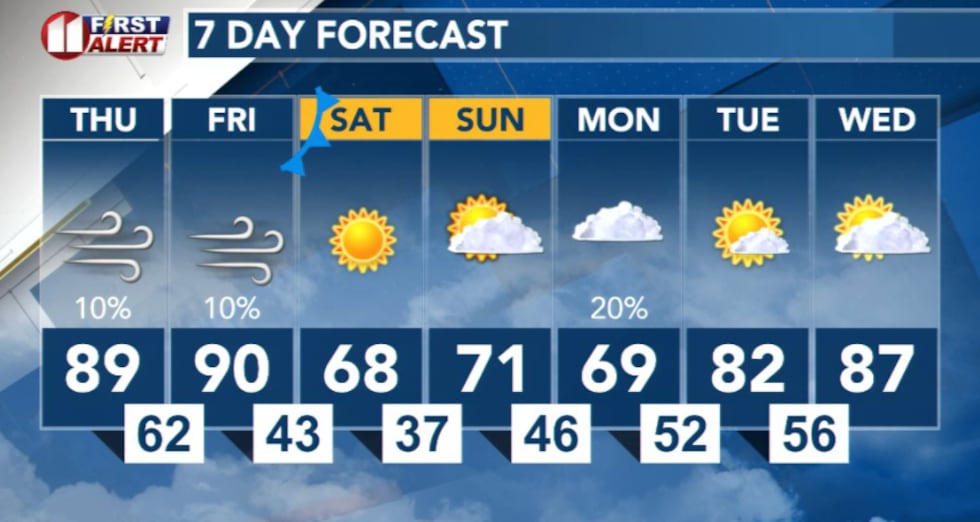
LUBBOCK, Texas (KCBD) – Warm temperatures and gusty southwest winds will create critical fire danger across the region through Friday, with a strong cold front set to bring much cooler air this weekend.
 KCBD(KCBD)
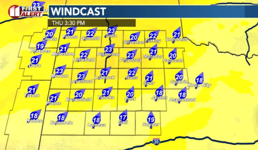
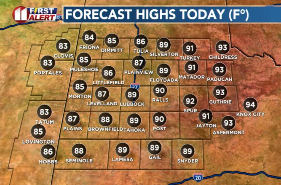
On Thursday, southwest winds between 20-30 mph combined with very low humidity below 10 percent will create dangerous conditions for rapid wildfire growth and spread, particularly across the Caprock. Highs will reach the mid-80s to low-90s.
 KCBD(KCBD)
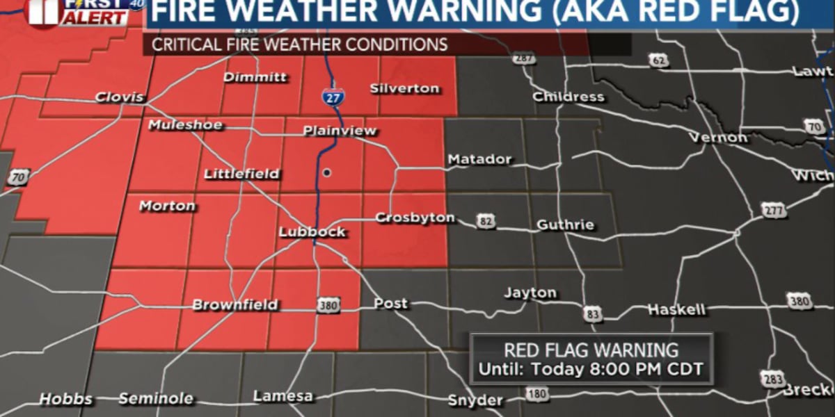
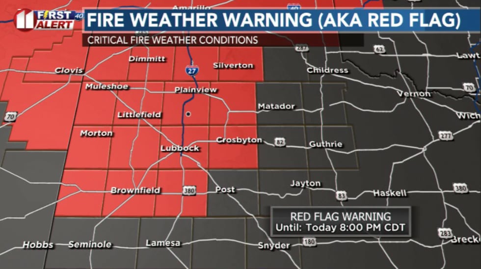
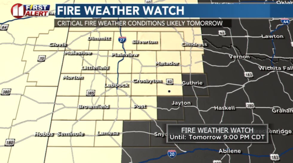
A Red Flag Warning is in effect from noon to 8 p.m. Thursday for areas on the Caprock, with a Fire Danger Statement in effect for adjacent counties. Avoid any outdoor burning and anything else that could potentially start a wildfire.
 KCBD(KCBD)
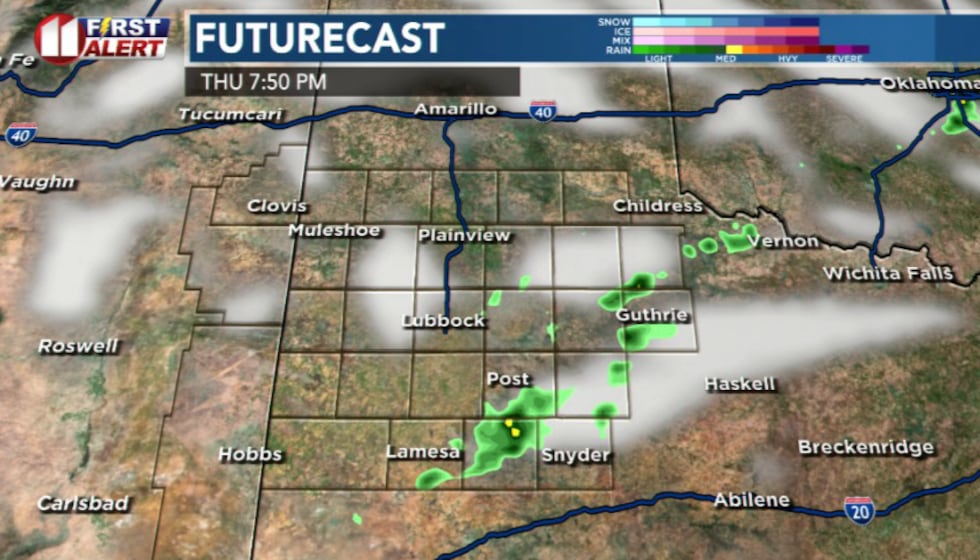
There is a slight chance for showers and thunderstorms for the southeastern portion of the viewing area Thursday evening. The severe threat is low at this time and some models are indicating showers will develop outside of the viewing area.
 KCBD(KCBD)
Friday will bring similar fire weather concerns, with a Fire Weather Watch in effect for most of the forecast area. Winds will be slightly stronger Friday afternoon, with some areas potentially seeing fire danger indices near 7-8.
 KCBD(KCBD)
A few isolated storms are possible Friday night as moisture begins to return to the region, primarily off the Caprock, but widespread rain is not expected.
Relief arrives this weekend
A strong cold front will move through the region Friday night, bringing much cooler temperatures and ending the critical fire danger threat. Relative humidity is already expected to recover significantly overnight Thursday into Friday morning, rising above 90 percent for most areas.
 KCBD(KCBD)
Copyright 2026 KCBD. All rights reserved.