
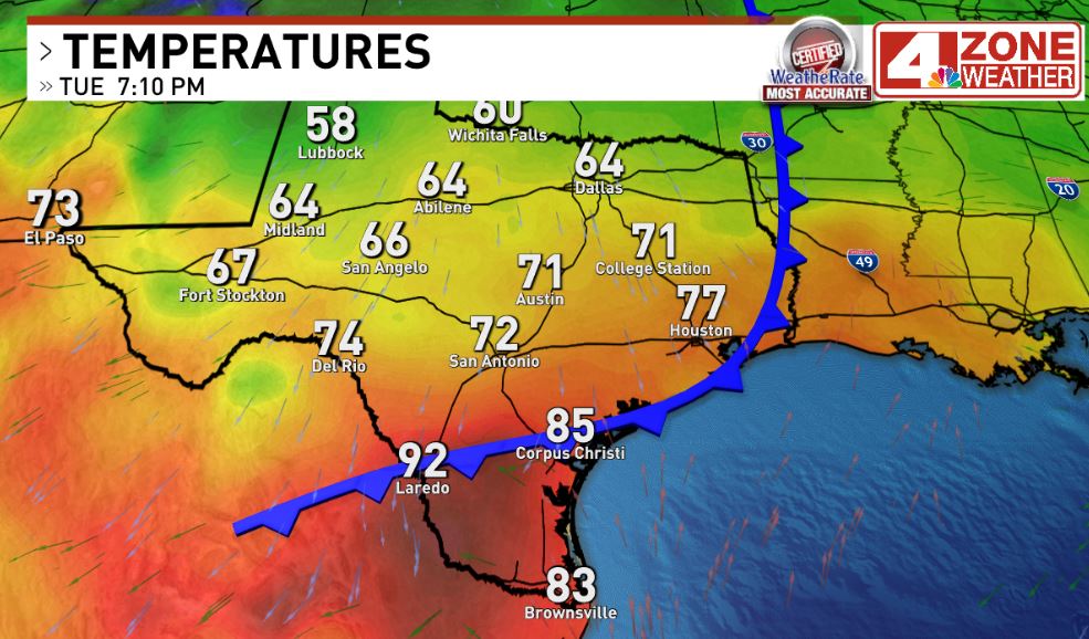
SAN ANTONIO – We managed to set a daily record high today just before the cold front arrived at 91 degrees. This broke the old record of 90 set in 1931. Moving forward, there certainly will be no record highs ahead behind this front but we do have some big weather impacts for our 4 Zones.
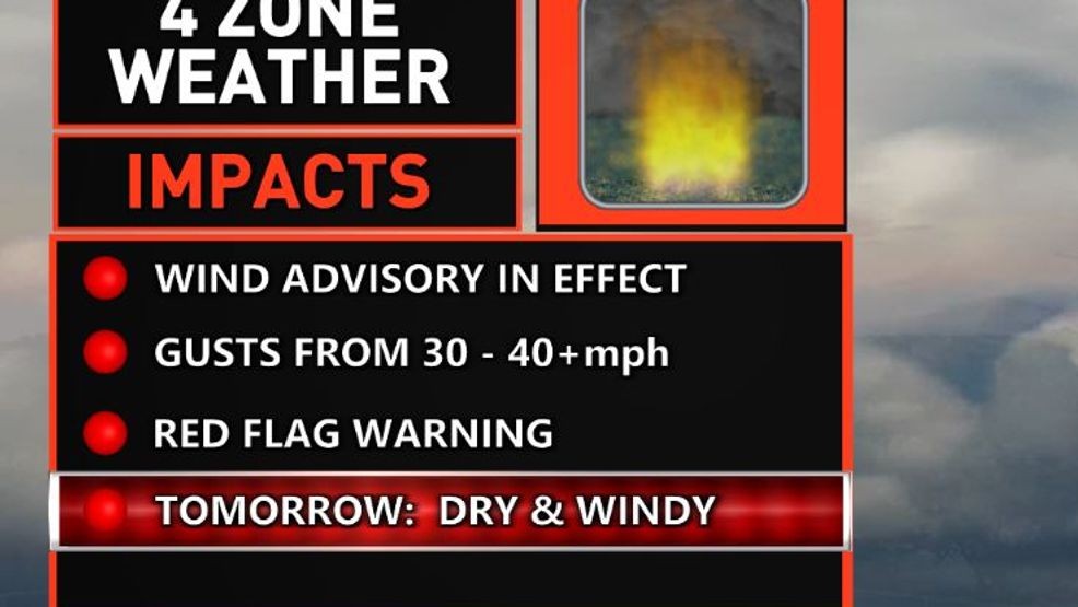
4 Zone Weather Impacts behind cold front
The cold front is now pushing into deep South Texas and will eventually push through Brownsville. The air mass behind this front is not arctic but a combination of Pacific cool air with a little weak push of polar air. The end result, this is the type of front that will deliver us our classic jackets/coats to short sleeves daily weather.
Cold front pushing into deep South Texas as of 7pm
The only issue with frost or freeze conditions will be in the Hill Country with typical colder valleys early Thursday and Friday morning. Otherwise, while the rest of the area sees some colder mornings, there will be no freeze issues and really not expecting frost either unless there’s a very random typically cold location that can sneak toward the mid 30s Thursday or Friday morning.
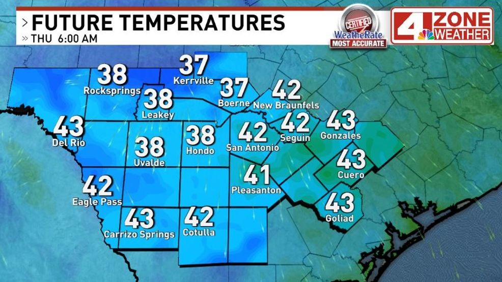
Cold to chilly morning lows Thursday
Afternoons will warm into the upper 60s Wednesday then a daily diet of 70s the rest of the week through the first part of next week.
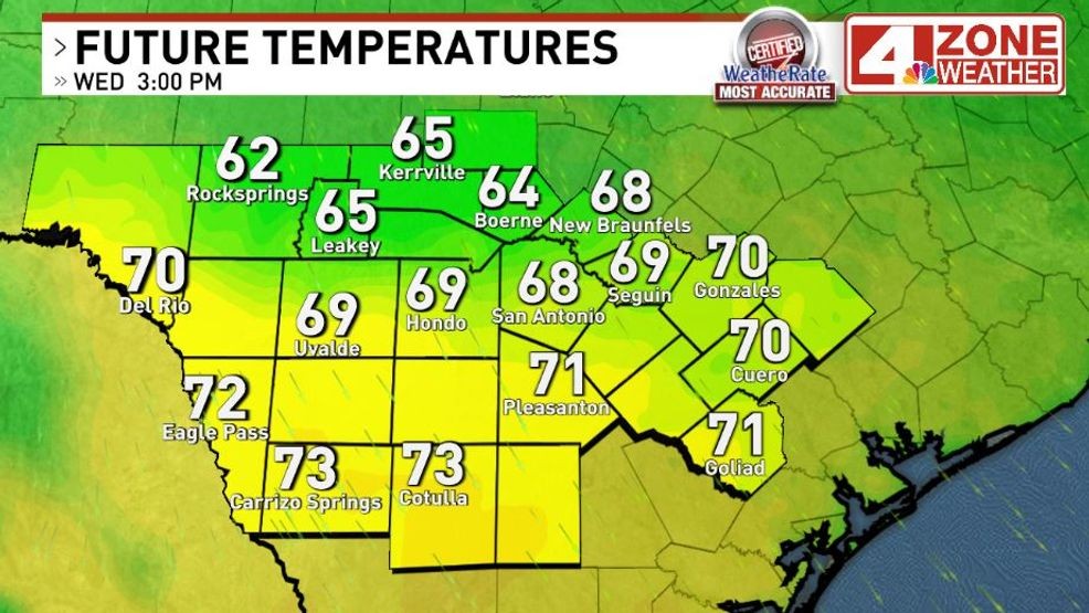
High temperatures Wednesday
We will be under a Wind Advisory tonight through 7pm Wednesday with gusts of 30 – 40+mph. We’re also under a Red Flag Warning with nearly ideal fire weather conditions between the windy conditions and extremely dry air moving in along with existing drought conditions. Please be very careful with anything that can spark a fire Wednesday as conditions can rapidly spread that fire.
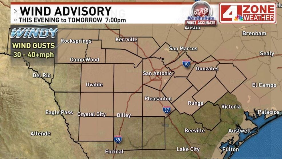
Wind Advisory in effect now through Wednesday 7PM
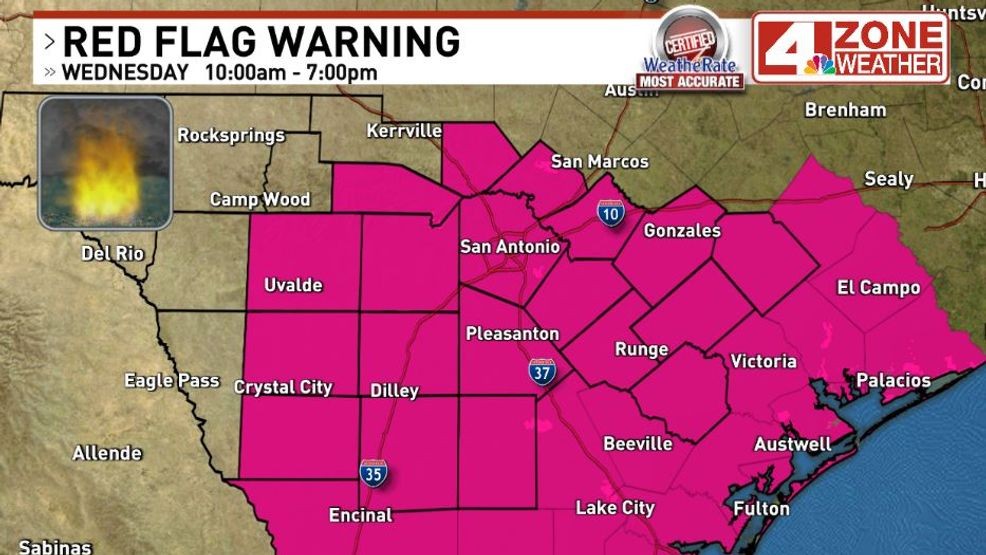
Red Flag Warning Wednesday
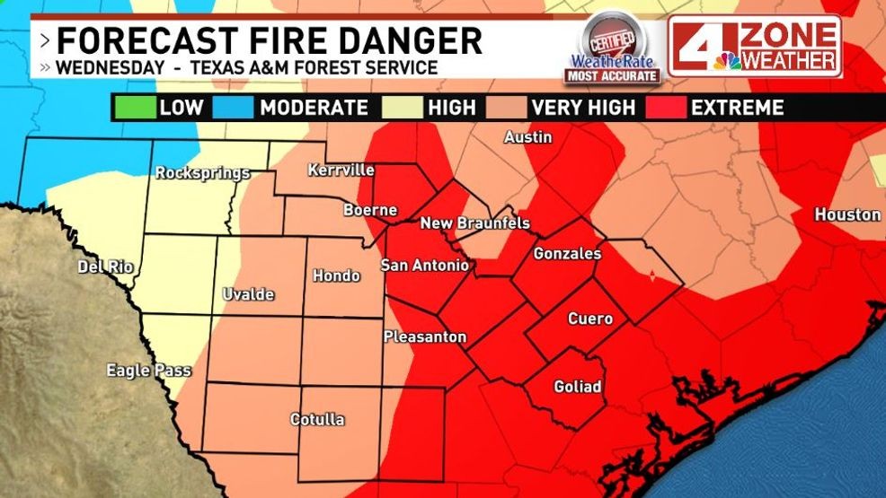
Fire danger Wednesday from the Texas A&M Forest Service
Comment with Bubbles
BE THE FIRST TO COMMENT
Our next rain chance will arrive Saturday as a weak upper air system passes by. This will be much lighter and more scattered than our last big rain we saw. I expect a general .01″ – .50″ rainfall in our region at this time. Some areas will not see any rain too.