
Happy cold front day to all those who celebrate!
If you’re heading out for errands or sporting events, don’t forget a jacket or sweatshirt, you may not need it during the first half of the day, but you’ll be glad to have it later in the day as temperatures tumble into the 50s by the afternoon.
Hour-by-hour forecast for Saturday
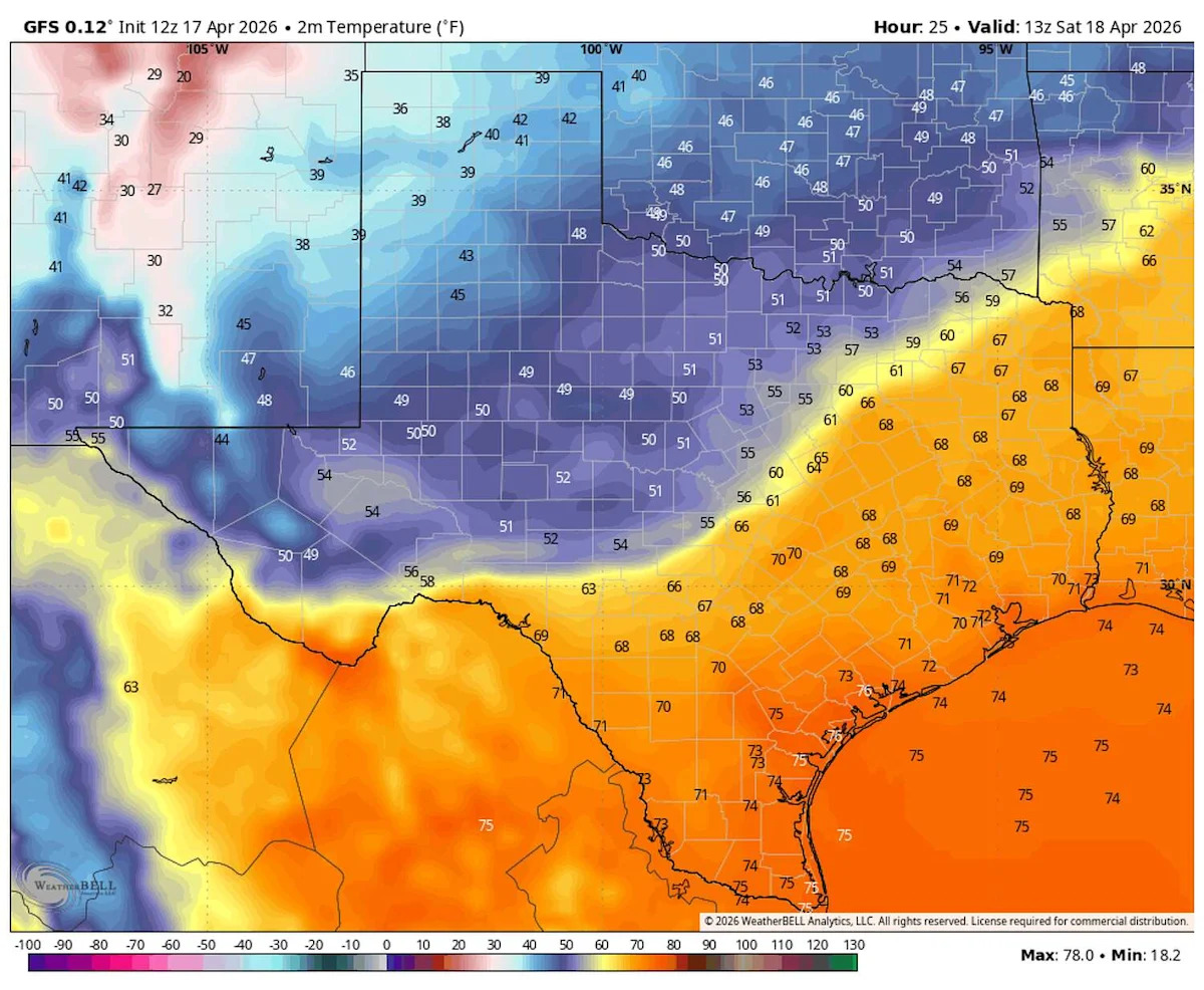
We’ll start the day with mostly cloudy skies, light south winds, and muggy temperatures in the upper 60s to low 70s.
By sunrise, the cold front will be knocking on the door of the Hill Country, reaching Austin by mid-morning. Temperatures will begin to fall quickly, dropping into the mid-60s by around noon. A few light showers may develop along the front as it moves through, but they should be brief and spotty early on.
Winds will quickly shift out of the north, sustaining wind speeds between 10 and 20 mph, including gusts of up to 25 mph.
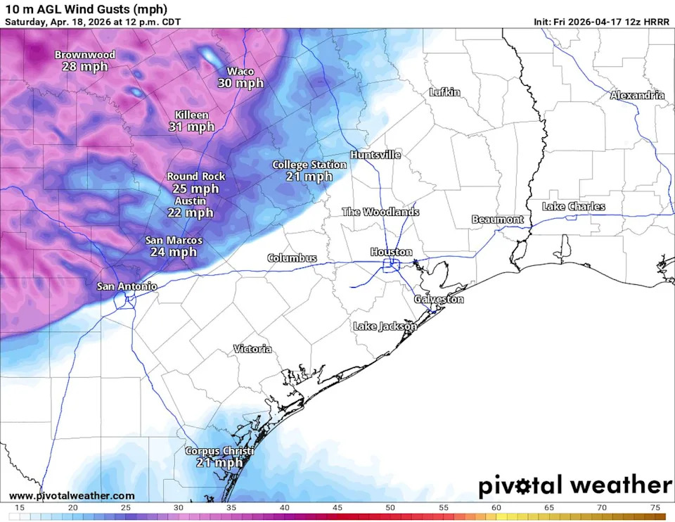
A surge of strong winds in Texas will accompany Saturday’s cold front, with gusts nearing 40 mph. (Pivotal)
As the front pushes through South-Central Texas during the afternoon, winds will strengthen further, with peak gusts possibly reaching 40 mph. By around 4 p.m., temperatures will have fallen into the mid-50s. This is when you’ll be glad you grabbed a jacket earlier, as it’ll come in handy amid the chilly and robust breezes.
WHAT IS A ‘SUPER EL NIÑO’?: Typhoon Sinlaku could be early clue for Texas hurricane season
While the temperature drop will be a big story, don’t overlook the rain chances. Austin will have a 60% chance for showers and thunderstorms, with light rain possible in the morning and early afternoon.
A stronger cluster of storms will develop west of Austin around 3 p.m., then drift toward the Interstate 35 corridor by early evening and continue into the overnight hours.
Sunday forecast
Showers may linger into early Sunday morning before shifting south, leaving Austin with drier weather and a bit more sunshine in the afternoon. Morning lows will be chilly, in the upper 40s to lower 50s, before warming into the upper 60s and lower 70s. North winds will remain breezy at 8 to 15 mph, with gusts near 25 mph.
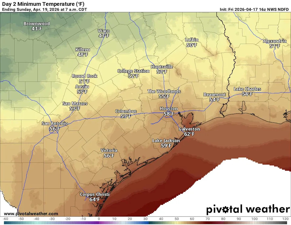
Sunday morning will bring the coolest temperatures of the weekend, with lows dipping into the 40s in the Hill Country. (Pivotal)
More rain next week
After a mostly dry Sunday, another disturbance will move north out of Mexico and into Texas early next week. This system will spark showers and thunderstorms west of the region Sunday night before shifting east on Monday, bringing a solid chance of rain and storms back to Central Texas.
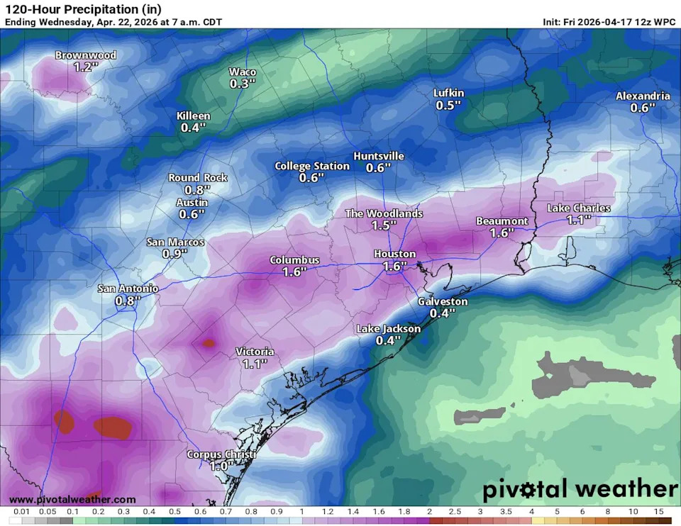
Rainfall totals in Central Texas could approach an inch, with slightly higher amounts expected across South Texas from Saturday through Wednesday morning. (Pivotal)
Temperatures will remain cooler than April’s average of 80 degrees through the middle of next week. Then the return of southeast winds will bring a warming trend back to the area with highs in the lower to mid-80s.