
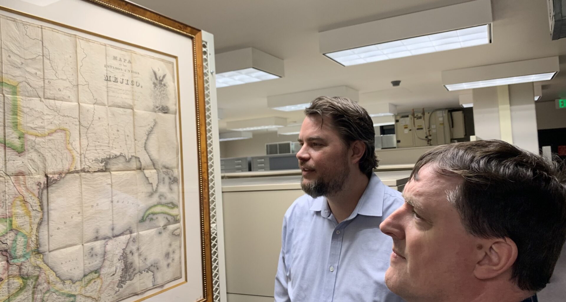
James Harkins and Mike Miller examine one of the rare maps from the Frank and Carol Holcomb Map Collection at the Texas General Land Office.
Michael Barnes/American-Statesman
It’s not every day that a cache of historic maps of Texas and the Western Hemisphere — appraised at $3.5 million — passes from private to public hands.

That’s what happened recently: After years of developing a relationship with the map-loving Houston owners, the Frank and Carol Holcomb Map Collection was donated to the Texas General Land Office.
Article continues below this ad
Frank, the primary map collector, died in 2024.
The Holcomb Collection includes 76 historic maps along with numerous atlases, books and pamphlets, dated from 1513 to 1904.
Images are already posted online at the GLO website for all Texans to examine. In the not-too-distant future, the physical maps will be on display in a special gallery or at Texas museums.
Twelve of the most intriguing maps are now displayed in the windowless map storage room in the Stephen F. Austin State Office Building on the Capitol Mall. The agency that manages the state’s lands plans to construct an easily accessible dedicated map gallery just off the building’s lobby.
Article continues below this ad
Even better, talks are underway for more public map exhibitions across the street at the Bullock Texas State History Museum.
“Some of them are extraordinarily rare,” says James Harkins, senior deputy director for heritage at the GLO, while pointing to the dozen Holcomb maps currently on the walls. “Almost any map here would be the centerpiece of any collection.”
What’s in the map collection
The 1830 Tanner/Austin Map is among the jewels of the Frank and Carol Holcomb Map Collection.
Texas General Land Office
Spend a little time with the 12 maps now on display — or the whole collection online — and one begins to understand why the acquisition inspires such praise.
Article continues below this ad
“The Frank and Carol Holcomb Map Collection represents a historic milestone for the Texas General Land Office and for the people of Texas,” said Commissioner Dawn Buckingham in a statement. “This remarkable map donation — spanning nearly four centuries of Texas history — further strengthens the GLO’s collection as one of the premier resources for understanding the history, exploration and development of Texas.”
The collection spans from early depictions of the Western Hemisphere to maps of Texas produced during the Spanish colonial era, the Mexican national period, the Republic of Texas, and statehood.
Among the jewels from the collection:
Very early maps of New Spain that barely register the presence of the Texas coast with any degree of accuracy.
Spanish maps that show the sharp contrast between densely populated Mexico and the barely settled Texas, claimed by Spain but controlled by Native Americans.
An 1830 map purchased from a descendant of a man who lived in the Austin Colony. This image helped form the idea of Texas for the world.
A map of the De Cordova Grant based on an original kept in Mexico and never published.
Article continues below this ad
About Frank and Carol Holcomb
Twelve of the rarest maps from the Frank and Carol Holcomb Map Collection are on temporary display in the map storage room at the Texas General Land Office.
Texas General Land Office
“Frank was a Texan, a Son of the Republic, and had ancestors who settled in East Texas in the early 1830s, including a relative who served in Sam Houston’s army at San Jacinto,” said Carol Holcomb in a statement. “Maps were his passion, and as our collection grew, we hoped it would one day find a home in a public institution. Our long-standing relationship with the GLO made it the obvious choice.”
Frank and Carol were married Feb. 19, 1977, a year before their map collection began. They were ardent supporters of the historic Moravian village of Old Salem, North Carolina, and the Museum of Early Southern Decorative Arts in Winston-Salem, N.C., where Frank served on the advisory board. Carol is a docent at the Bayou Bend Collection and Gardens, a cultural treasure in Houston put together by the late philanthropist Ima Hogg, and Frank served on the Bayou Bend Collection Subcommittee.
Article continues below this ad
“Frank was obsessed,” Harkins says of the tax attorney whose wife helped with the family business. “He wanted only the best. He tracked auctions. He made a wish list. He worked with map dealers.”
Carol and Frank Holcomb of Houston collected rare maps, especially those that illuminated Texas history.
Texas General Land Office
The Land Office was not the only institution vying for the maps. The Witte Museum in San Antonio and the Museum of Southern Decorative Arts talked with the Holcombs about their future.
“Maps are sometimes ancillary objects in other places,” says Mike Miller, formerly archivist and manager at the Austin History Center, now director of public services for archives and records at the Land Office. “For the GLO, they are primary. We are better prepared to deal with maps.”
Article continues below this ad
Yale University owns a famous collection of Texana. Why not there?
“And they should be in Texas,” Harkins says. “Frank always thought it was a shame that Texans would have to go to Connecticut to do Texana research. That was one of the reasons he wanted to keep their collection at a public institution in Texas.”
The maps came with a $300,000 gift for preservation and display.
Article continues below this ad
Carol Holcomb told Harkins: “It’s exactly what he would have wanted.”