
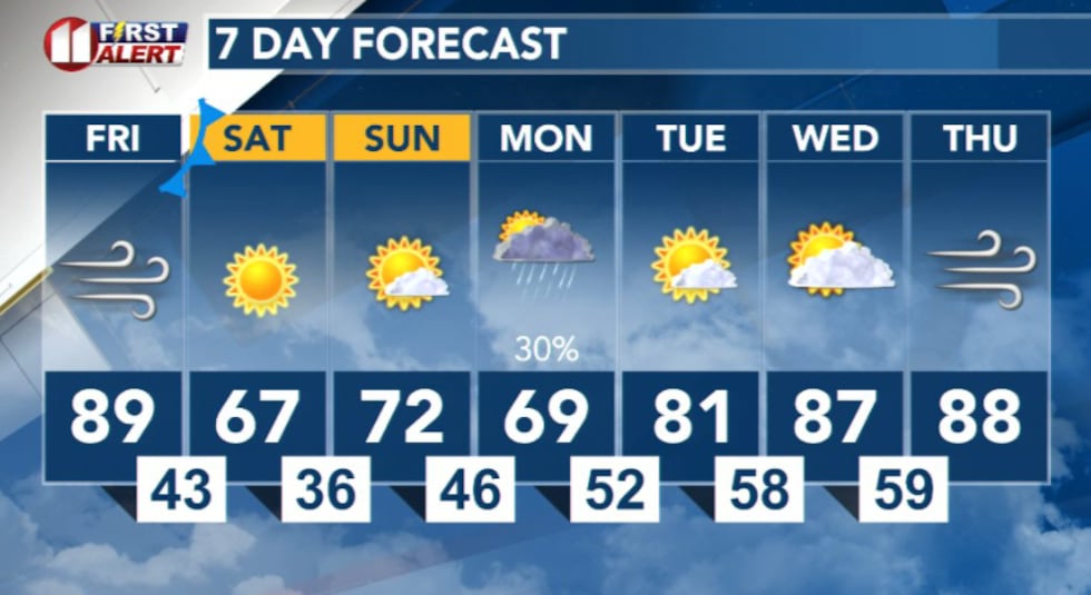
LUBBOCK, Texas (KCBD) – Warm temperatures and critical fire danger will dominate Friday across the region before a potent cold front arrives Friday night into early Saturday.
 KCBD(KCBD)
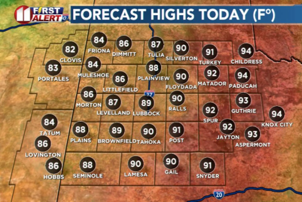
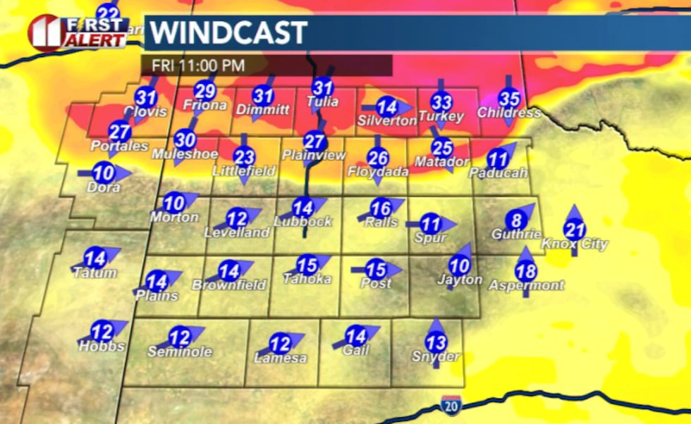
Afternoon highs Friday will reach the upper 80s to lower 90s with southwest winds gusting up to 40 mph.
 KCBD(KCBD)
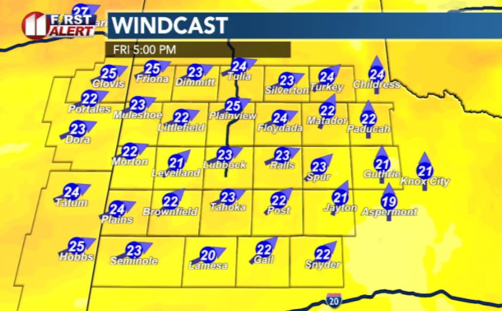
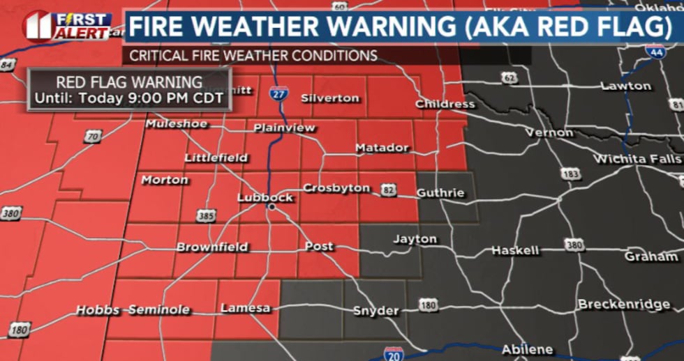
The combination of warm air, low humidity and strong winds will create another day of critical fire weather conditions across much of the area. A Red Flag Warning remains in effect from noon until 9 p.m. Friday. Relative humidity is expected to dip as low as 6 percent by afternoon, further elevating fire danger.
 KCBD(KCBD)Cold Front Arrives Friday Evening
The cold front is expected to reach the Texas Panhandle near sunset Friday and move southward through the evening hours.
 KCBD(KCBD)
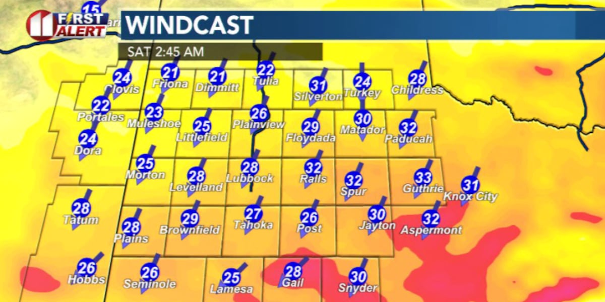
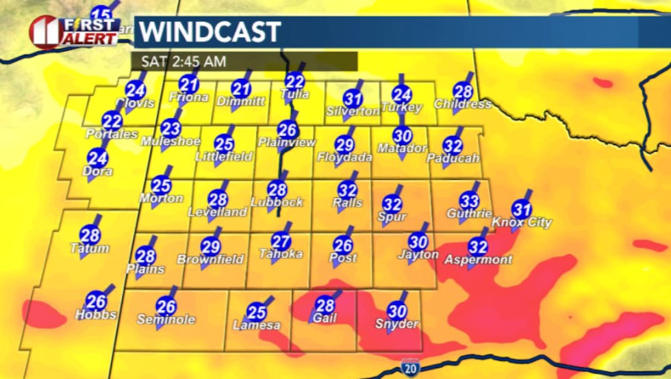
The primary impact will be a period of strong north winds Friday night into overnight Saturday, with sustained speeds of 30 to 40 mph possible. Wind gusts could reach 55 mph in some areas.
 KCBD(KCBD)
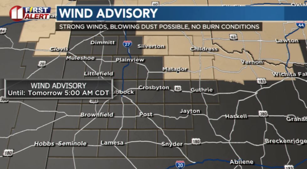
A Wind Advisory is in effect from 10 p.m. through 5 a.m. for areas off to the northeast.
 KCBD(KCBD)
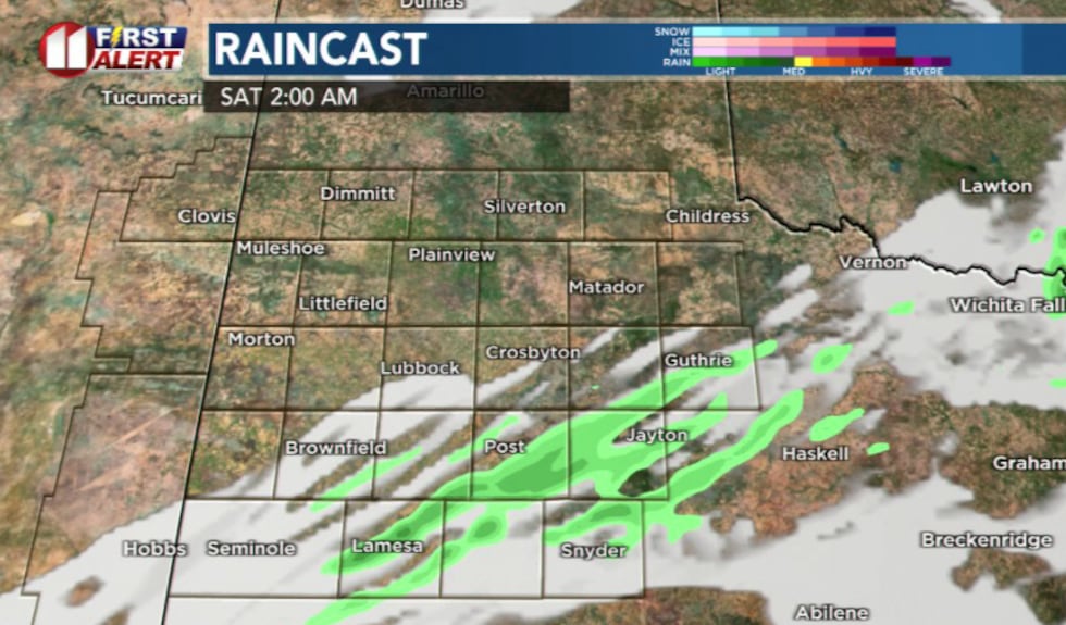
While the warm, dry air mass in place will limit precipitation for most of the region, a few showers and thunderstorms may develop over the southeastern portion of our region as the front arrives.
 KCBD(KCBD)Weekend Outlook
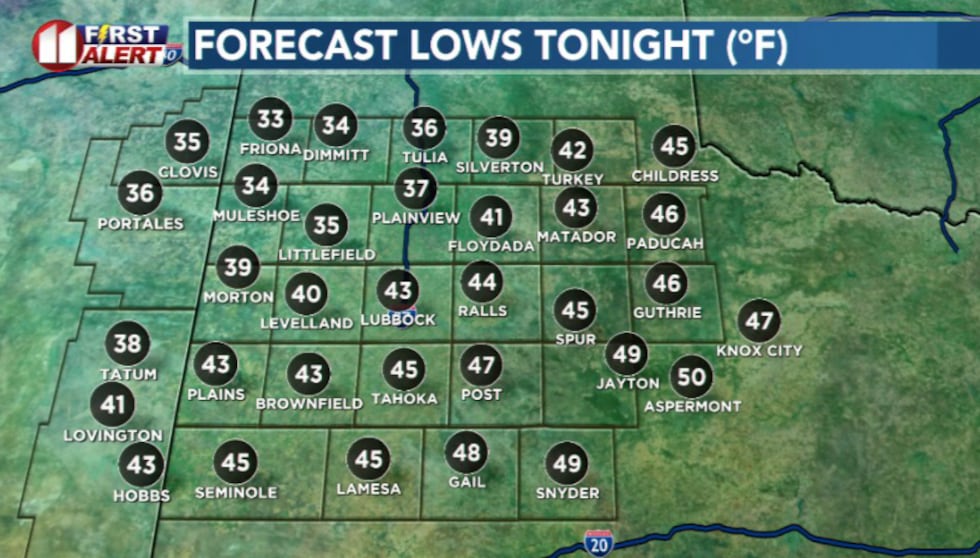
Saturday morning will bring cooler, dry conditions with a large temperature gradient across the region.
 KCBD(KCBD)
Northern counties will see lows in the 30s, while southern counties will likely see lows in the 50s. Temperatures will gradually warm into the 60s and 70s Saturday afternoon under mostly clear skies.
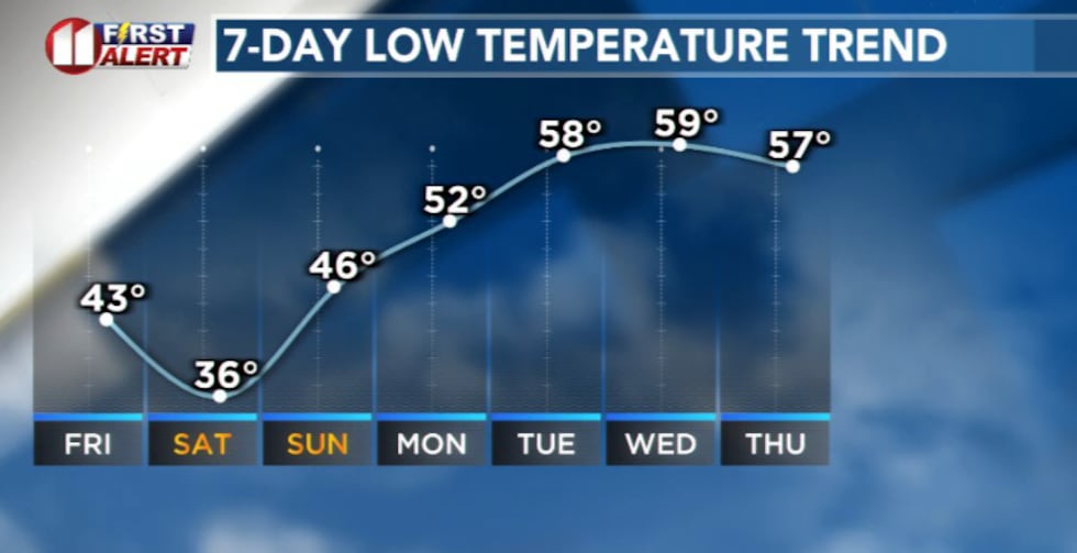
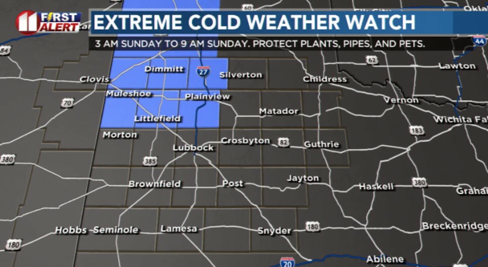
Freeze Possible Early Sunday
Strong cold advection behind the front will bring a rapid drop in temperatures through the night. Some locations off to the northwest and the north may approach freezing early Sunday morning.
 KCBD(KCBD)
A Freeze Watch is in effect from 3 a.m. Sunday until 9 a.m. Sunday for this area, which is near the average last freeze date.
 KCBD(KCBD)
Sunday will stay cool with the new air mass in place, and afternoon highs in the 70s.
 KCBD(KCBD)
Copyright 2026 KCBD. All rights reserved.