
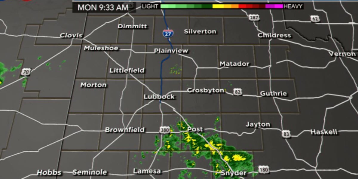
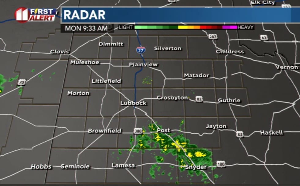
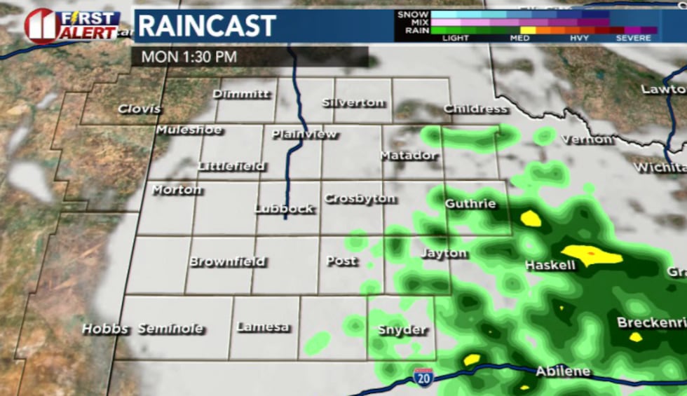
LUBBOCK, Texas (KCBD) – Isolated showers are already developing over the south and southeastern counties this morning, but don’t expect widespread rain.
 KCBD(KCBD)
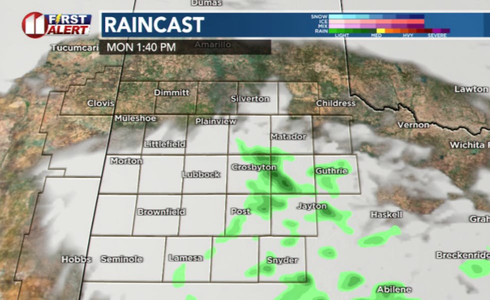
The bulk of Monday’s precipitation will stay south through mid-morning before showers and thunderstorms gradually fill in across the east & off the Caprock through the afternoon. Activity will remain isolated to scattered at best, and the severe weather threat remains low.
 KCBD(KCBD)What to Expect Monday
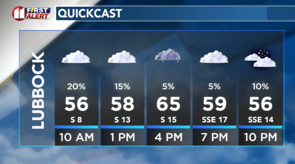
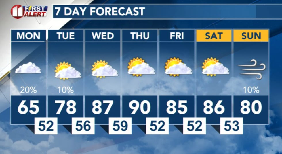
Highs will reach only the 60s and 70s thanks to lingering cloud cover throughout the day. The combination of cool temperatures and persistent clouds will keep conditions damp and dreary, though actual rainfall amounts will be light and some areas may only see sprinkles or drizzle.
 KCBD(KCBD)
A stray thunderstorm or two is possible this afternoon, off to the southeast, but confidence remains low for significant storm development.
 KCBD(KCBD)Looking Ahead: Critical Fire Weather Wednesday and Thursday
While Monday brings moisture and cloud cover, conditions will shift dramatically by midweek. Elevated to critical fire weather conditions are expected Wednesday and Thursday as winds increase and humidity drops. Residents should prepare for dangerous fire conditions and avoid any outdoor burning during this period.
 KCBD(KCBD)
Copyright 2026 KCBD. All rights reserved.