
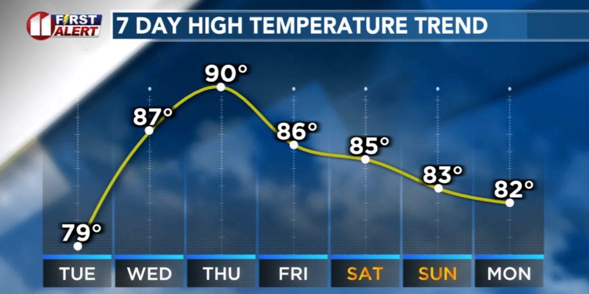
LUBBOCK, Texas (KCBD) – The next few days will bring a quick transition from dreary and cool to sunny and warm. The break from the heat is about to end.
Fog Tonight
Today’s low clouds will hang tight overnight. Areas of fog are likely, especially where rain fell, and that may lead to patches of low visibility late tonight and early Tuesday morning. Visibility could drop significantly in some spots, so allow extra drive time if you will be traveling during that time frame.
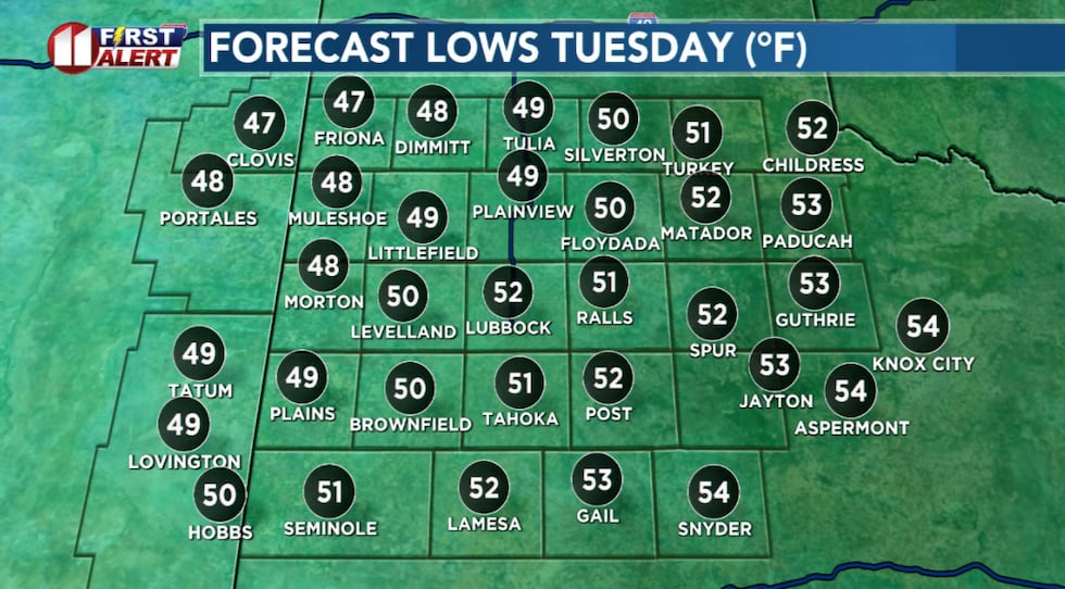 Quite cool but lows slightly above average for late April.(KCBD First Alert)
Lows will be mild and a little above average, for the season, under the blanket of clouds.
Clouds to Sun
After the low clouds and fog mentioned, skies will become mostly sunny on the Caprock Tuesday afternoon. The south-southwesterly breeze (around 10 to 20 mph with some gusts near 30 mph) and sunshine will help temperatures recover to near to slightly above average.
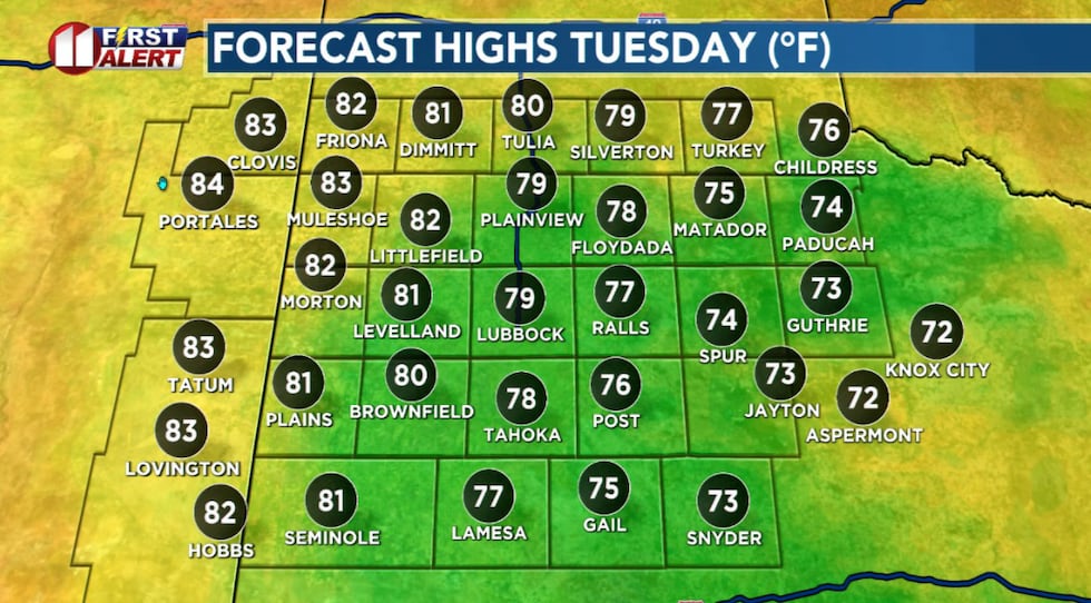 Warm up on the way. Temps peak near to a bit above average Tuesday afternoon.(KCBD First Alert)
Areas east of the Caprock are likely to remain under cloud cover through most, if not all, of the afternoon. This will keep temperatures there much lower than across the rest of the KCBD/FOX34 viewing area.
Clouds Return
Low clouds are likely, and patchy fog possible, to return late Tuesday night and linger through much of Wednesday morning. The clouds again will keep overnight lows mild.
Familiar Pattern
The clouds and fog will clear out for Wednesday afternoon. From then through the remainder of the week, and through the weekend, a familiar pattern takes over.
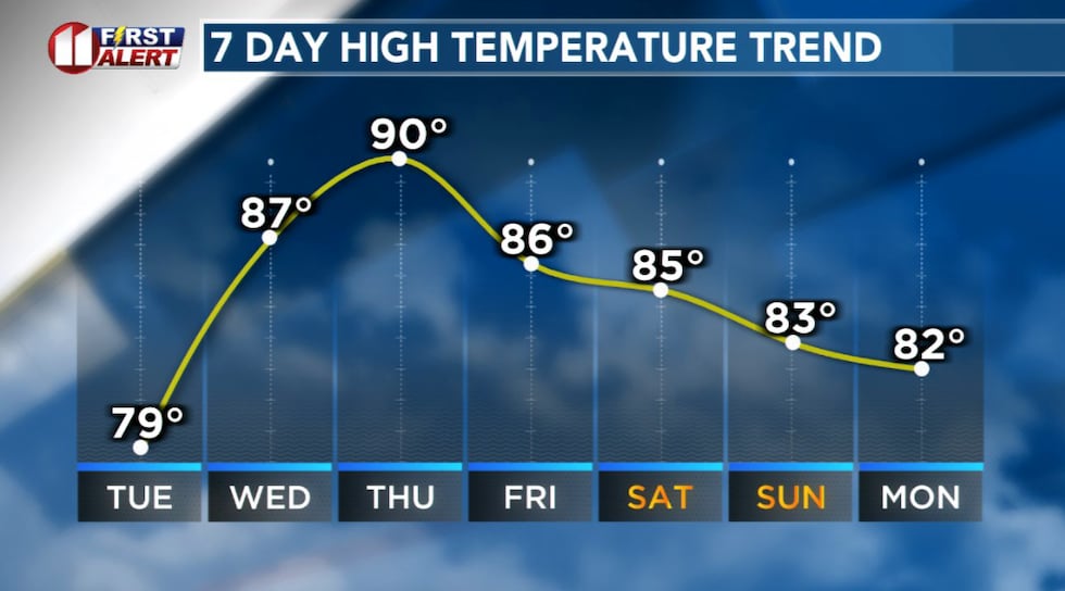 Heat returns to Lubbock and the area.(KCBD First Alert)
From Wednesday afternoon onward, expect breezy to windy conditions paired with very warm to hot afternoons. The weather pattern that has dominated the past several months across West Texas.
The stronger winds, sunshine, and warmth, combined with mostly dry fuels, will bring elevated to critical wildfire conditions back to West Texas. Be mindful if you are thinking spending time outdoors.
Wind and Heat
Thursday is expected to be the windiest day. Southwesterly winds may increase to 30 to 30 mph with gusts of 40-45 mph possible.
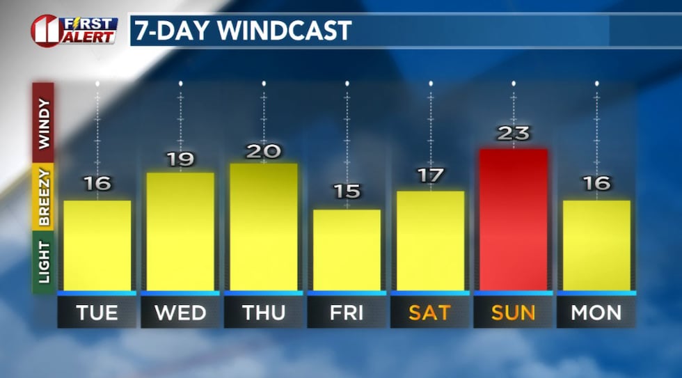 Forecast peak sustained winds are shown in this graph. Peak gusts will exceed the values shown here.(KCBD First Alert)
Skies will remain mostly sunny with temperatures climbing into the upper 80s and low 90s.
West Texas Weekend
Friday, Saturday, and Sunday, brings a similar setup with warm afternoons and breezy conditions. Each afternoon won’t be quite as warm as our mid-week, but currently I don’t expect much of a cool down.
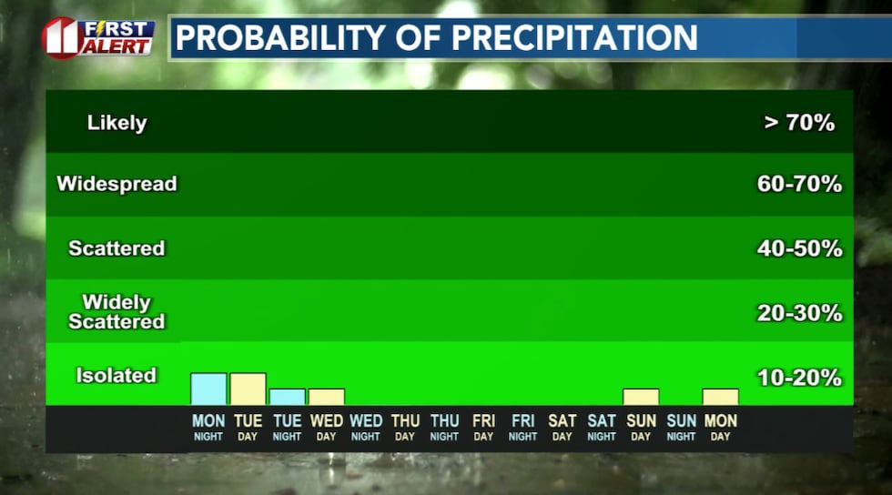 Significant rain is not expected through the weekend.(KCBD First Alert)
Temperatures will remain unseasonably warm, mostly in the 80s.
Stay with KCBD for the latest updates
On This Date
On this date in 1989, a high-based late-afternoon thunderstorm, accompanied by intense microbursts, frequent lightning, and hail as large as golf balls, moved across Lubbock County. Winds of 60 mph, golf ball-size hail, but very little rain, was reported in Lubbock. Winds from this storm overturned cotton trailers in O’Donnell.
(Source: National Weather Service, Lubbock)
Copyright 2026 KCBD. All rights reserved.