
DALLAS – North Texas is preparing for the first significant cold front of the season and a windy week ahead, with wind gusts expected to reach more than 40 mph and early-morning wind chills dropping into the 30s.
Tuesday Forecast: Cold Front Arrives, Wind Advisory in Effect 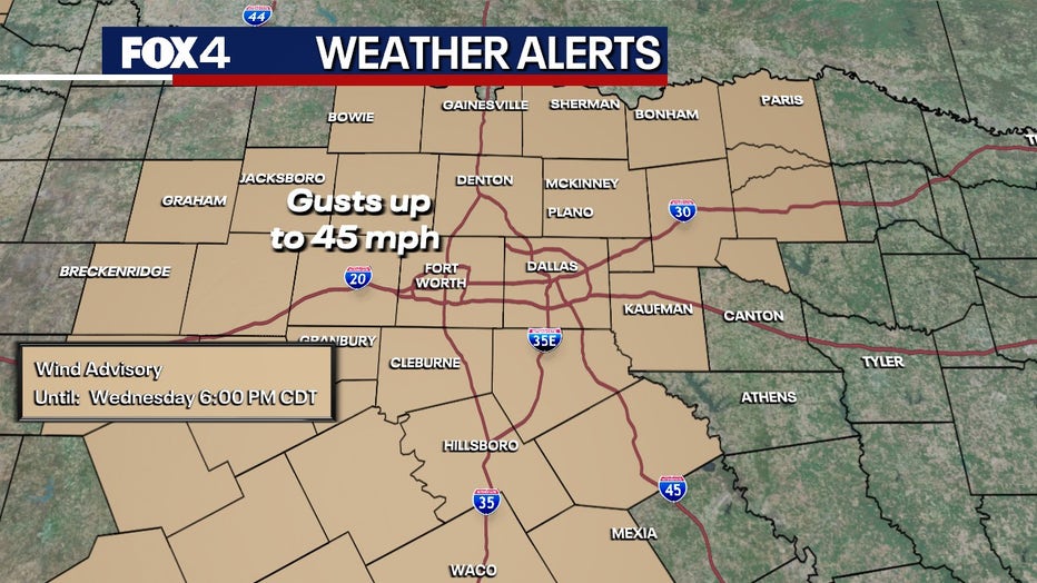
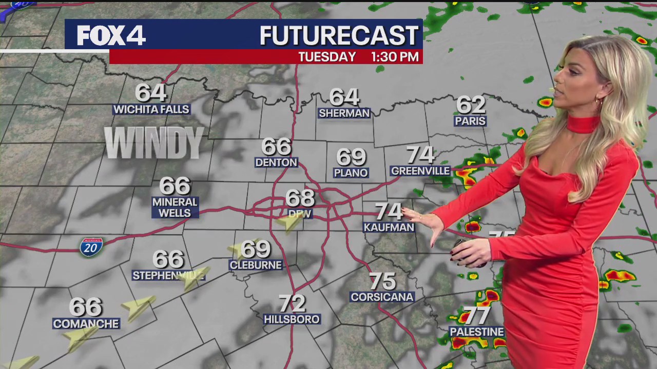
The season’s first major cold front arrives Tuesday and is expected to linger through Halloween. The front will reach areas far west of Dallas-Fort Worth around 9 a.m. and areas east around 2 p.m., meaning the region will experience the cooler temperatures between 11 a.m. and noon.
Skies will range from partly to mostly cloudy, bringing a low chance of showers to the Dallas-Fort Worth area. Rain chances will rise to about 30% farther east.
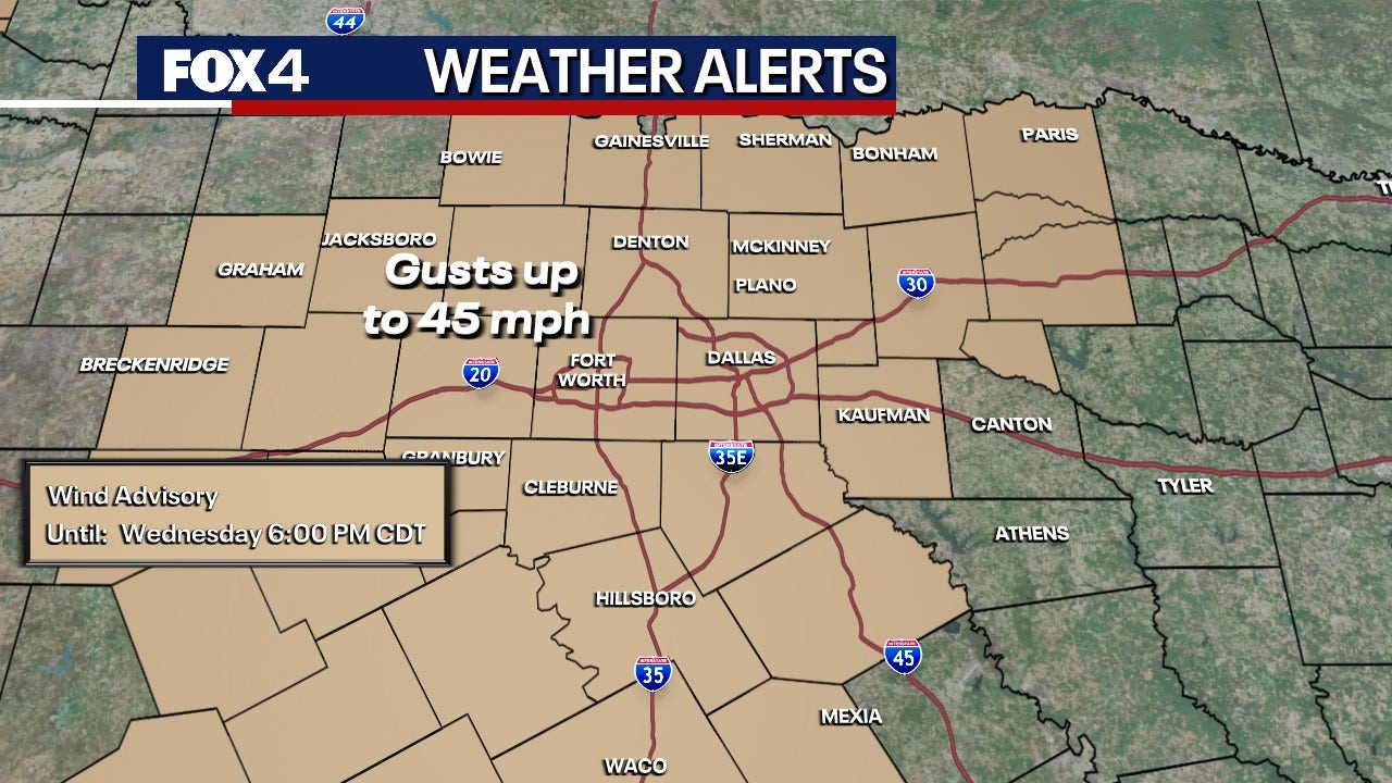
Strong winds with gusts up to 40 mph are expected during the afternoon. Temperatures will slowly fall into the 60s as the sun returns. Tuesday night will become windy and chilly, with overnight dew points dropping into the 30s.
A Wind Advisory is in effect until 6 p.m. Wednesday.
7-Day Forecast: Windy and Chilly 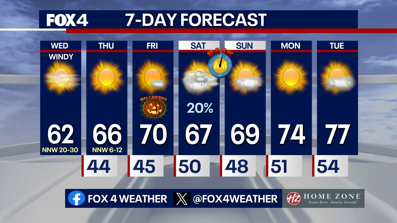
Wednesday morning will be very windy and dry, with temperatures in the low 40s and wind chills in the 30s. This blast of cold air will be a significant change for North Texans, who have not experienced this type of weather since last spring.
Wednesday will remain windy and chilly, featuring sunny morning skies and some evening clouds. High temperatures are expected to hover just above 60 degrees.
Overnight breezes Wednesday will keep temperatures in the low 40s. In sheltered areas where winds are lighter, temperatures could drop into the mid-30s, creating the potential for frost.
Thursday morning will be cold before temperatures warm into the mid-60s under sunny skies and lighter winds.
Halloween Forecast
Halloween will be sunny with a few clouds and light wind. The air will be dry, and high temperatures are forecast to be near the seasonal average of 70 degrees.
Saturday will bring increasing clouds and a low chance of passing showers. High temperatures are forecast to remain in the 60s.
Hurricane Melissa on Catastrophic Path toward Jamaica
Hurricane Melissa is hours away from its expected late Tuesday morning or early Tuesday afternoon landfall in Jamaica, and the storm has already been deadly.
The hurricane is forecast to strike Jamaica as a catastrophic Category 5 storm, which the Associated Press reports would be the strongest to hit the island since recordkeeping began 174 years ago.
According to FOX Weather, the Category 5 hurricane’s destructive, 175-mph winds are likely too strong for many buildings, with officials warning the winds could lead to “total structural failure” near the core of the storm.
The National Hurricane Center issued a stark warning to residents in its latest forecast discussion, stating: “Failure to act may result in serious injury or loss of life.”
The Source: Information in this article comes from the National Weather Service.