
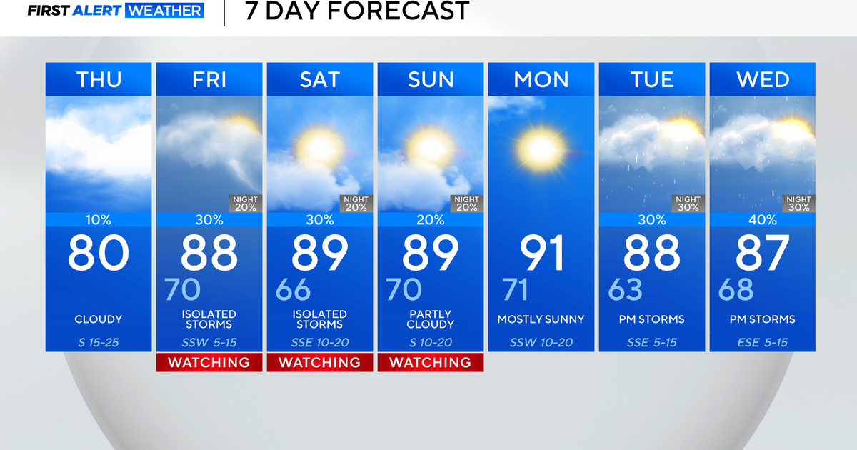
Thursday is off to a quiet and mild start, with temperatures in the upper 60s. Expect plenty of clouds and breezy winds by the afternoon, with highs right around 80°.

There is a slim 10% chance of an isolated strong-to-severe storm north and west of the metroplex, but with a strong CAP in place, it should remain dry. Hail would be the main threat.

Looking ahead to Friday and into the weekend, there’s a chance of isolated severe storms. In fact, most will remain dry as storm chances will stay between 20-30%.
On Friday, with a dryline out to the west and a strong CAP in place, the best storm chances will be coming for the northeast counties. Wind and hail are the two main threats, along with a non-zero tornado risk.

Saturday afternoon and evening look to be the best chance for DFW to see strong to severe storms fire up. If you have outdoor plans, please have a plan in place for where to go if you hear thunder.

The threat of severe storms continues Sunday, mainly to the north.
Monday looks clear with temperatures returning to the 90s. Expect a dip in humidity by Monday afternoon, which will help temperatures rise, along with southwest winds. Chances of storms quickly return on Tuesday and Wednesday.
