
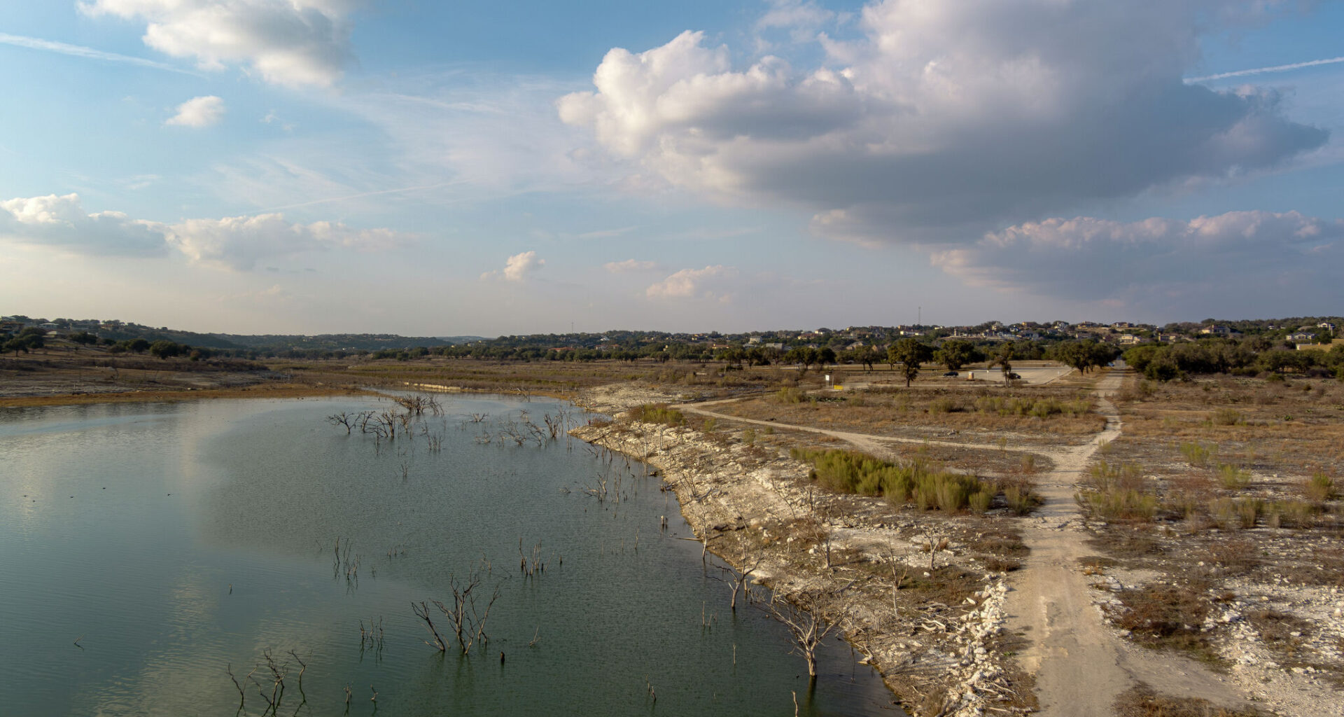
Two months ago, in February 2026, Canyon Lake at Boat Ramp 23, on North Cranes Mill Road, was closed because of low water levels. Despite the recent rainfall, the amount of water flowing into Canyon Lake was relatively limited.
Sam Owens/San Antonio Express-News
South Texas has recorded one of the rainiest Aprils in recent weather history. In San Antonio, 7.34 inches of rain have fallen so far this month, including 6.04 inches in the past five days alone. And with a week still to go, this month is already San Antonio’s third-rainiest April since 1960.
The city’s annual rainfall total is up to 9.24 inches, which is actually 1.55 inches above the average through this point in the year. However, while drought conditions have improved, the region is still far from being completely drought-free.
Article continues below this ad
According to the latest update from the U.S. Drought Monitor, San Antonio and Bexar County remain in severe drought. That’s a big improvement from the extreme and exceptional drought — the two highest levels of drought — that had affected the Alamo City in the past 18 months, dating back to October 2024.
Data from the U.S. Drought Monitor’s April 23 update shows improvement for San Antonio, which is now under severe drought, the second-lowest level of drought.
National Drought Mitigation Center
More specifically, central and northern Bexar County have been downgraded to severe drought. Meanwhile, southern Bexar County remains under the extreme drought as rainfall totals over the past week were lower across the South Side.
Several other areas saw improvement. Much of the drought in Comal, Guadalupe and Wilson counties also was downgraded to severe status. In the Hill Country, Kendall, Gillespie, Kerr, and Bandera counties also saw significant drought improvement.
Article continues below this ad
What about lake levels?
Area lake levels did improve over the past week, but not by as much as many people might expect. Canyon Lake – which had already fallen by more than 2.2 feet in 2026 – has risen by just 0.21 feet or about 2.5 inches, over the past week.
With this modest rise, the lake now sits with a surface elevation of 886.55 feet above mean sea level. That is more than 22 feet below capacity, leaving the lake just 58.6% full. Canyon Lake had risen up to 69% full following the July 2025 Hill Country flooding, but it has been steadily declining ever since.
Article continues below this ad
So why has the increase been so small, even with historically high rainfall totals this month? A big reason comes down to where the heaviest rainfall actually occurred.
Shown are the estimated rainfall totals over the past seven days across South and Central Texas.
nws austin/san antonio
Since Saturday, 4 to 7 inches of rain fell across an area that includes northern Bexar County and southern Comal County. However, rainfall totals were much lower – around 1 to 3 inches – near the headwaters of the Guadalupe River in Kerr County.
Canyon Lake’s main source of water is inflow from the Guadalupe River. So, with lower rainfall totals along the river, the amount of water flowing into Canyon Lake was also relatively limited.
Article continues below this ad
This particular weather system, despite bringing a sustained rain event, produced only mostly light to moderate rainfall rather than intense downpours. Because of that, a larger percentage of the rainfall was able to soak into the ground.
During heavier rainfall events, such as severe thunderstorms, the ground absorbs less water, leaving more runoff to flow into the river and eventually into Canyon Lake.
West of San Antonio, Medina Lake also saw a slight improvement in water levels, but this lake still remains in very poor shape. Its current surface elevation is 976.85 feet, also an increase of 0.21 feet since this time last week. The lake is more than 87 feet below capacity and is a paltry 3.9% full.
Article continues below this ad