
Earlier this week, Central Texas was enjoying its version of sweater weather, with highs in the 60s, but that cool stretch is quickly becoming just a fleeting memory. We are flipping the switch this weekend with temperatures surging into the 90s and heat index values, or humidity-driven “feels like” temperatures, nearing the 100-degree mark.
If you’re planning to take advantage of what may be our first mostly dry weekend in April with some outdoor activities, be sure to stay hydrated and take breaks in rooms with air conditioning.
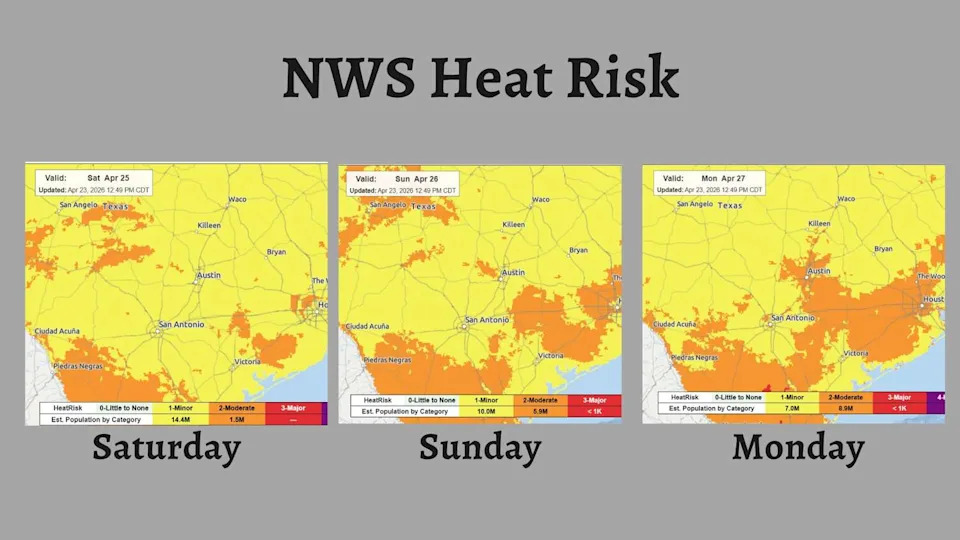
The National Weather Service’s Heat Risk map shows dangerous levels of heat increasing across Central Texas through the weekend and into early next week. (National Weather Service)
The National Weather Service has placed Central Texas under a level 1 to 2 out of 4 heat risk this weekend. These minor to moderate levels mainly affect those who are more sensitive to heat, as well as anyone without proper cooling or hydration resources.
Saturday morning in Austin will start off cloudy, muggy, and unseasonably warm, with morning temperatures around 70 degrees. On average, mornings in late April should be in the low 60s. The clouds will begin to thin around lunch with a mix of sun and clouds expected throughout the late afternoon.
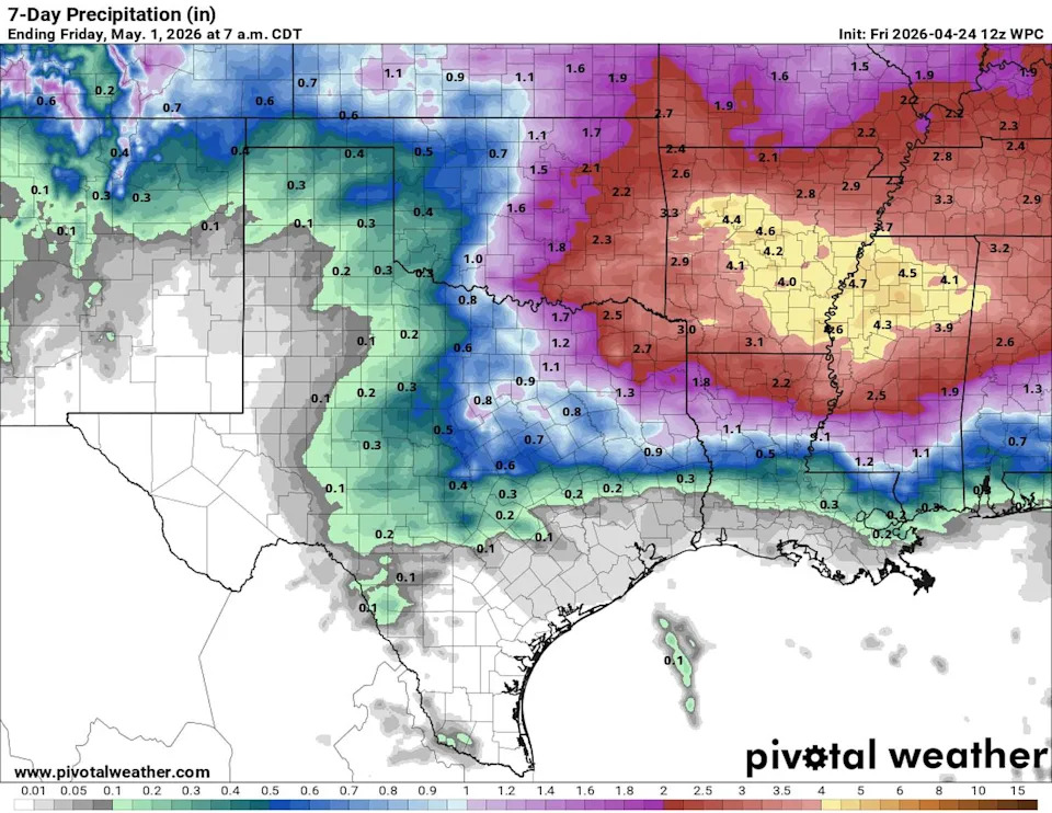
Rain chances across Texas continue through next week with the heaviest rainfall expected to be just north of Austin. (Pivotal)
Just like Friday, we may have to watch out for a few isolated thunderstorms across Central Texas, especially west of Austin. An active dry line separating arid and humid air masses stretches over Central Texas into the Rio Grande. Meanwhile, a hot and moist air mass dominates the Austin metro area, pushing temperatures into the 90s and “feels like” temps into the mid- to upper 90s.
“This scenario brings the probabilities of storms developing over parts of the Hill Country into the Rio Grande Plains if the cap breaks,” meteorologists at the National Weather service wrote in their forecast on Friday. The cap referred to is essentially a layer of warm air in the lower atmosphere that can keep thunderclouds from forming in the upper atmosphere.
“So, once again, if any storm develops, then it has the capability to become strong to marginally severe as it uses the plenty of instability there is around the local area,” forecasters said. “Main severe hazards will be large hail and damaging wind gusts.”
The warming trend continues from Sunday into the middle of next week, with the hottest temperatures expected on Monday and Tuesday. At the same time, humidity levels will remain high, as indicated by dew point temperatures in the 70s. These factors will push “feels like” temperatures into the 99-degree to 104-degree range from Sunday through Tuesday.
Sunday will stay mostly dry, with just a slight 10% chance of rain. As we head into next week, the dry line is expected to become more active just west of Austin, bringing a gradual increase in afternoon rain chances each day.
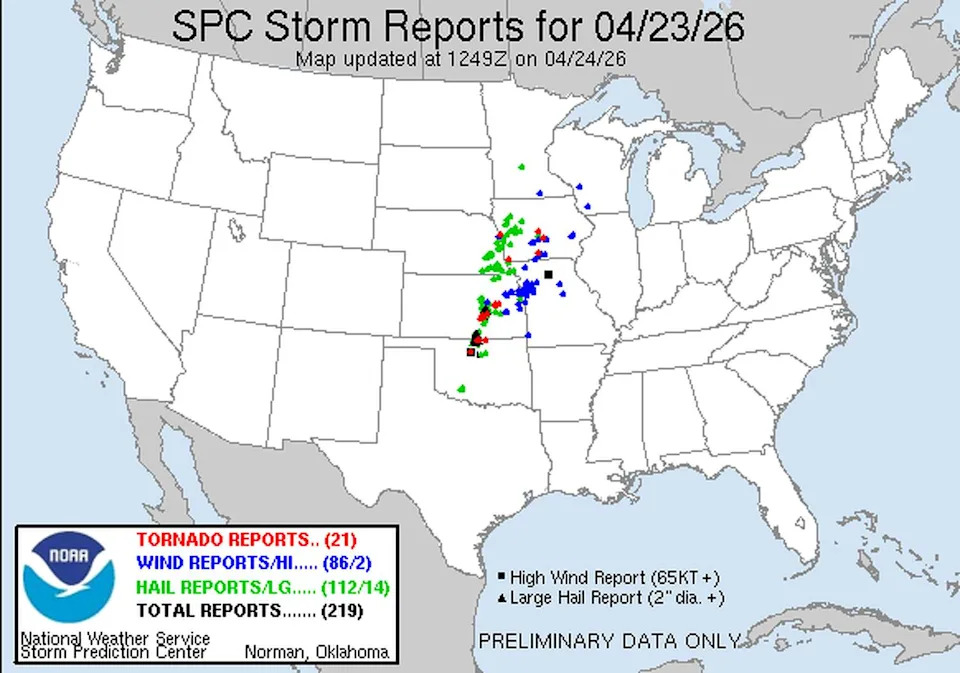
Severe storm reports from across the contiguous United States, as of Thursday. (Storm Prediction Center)
Severe weather outbreak
Multiple supercell thunderstorms swept across the central United States on Thursday, including one that generated a powerful EF3 tornado that caused considerable damage and many injuries at Vance Air Force Base in northern Oklahoma.
Outside of the Enid tornado, more than 250 severe weather reports were recorded, including 22 tornadoes, 125 reports of hail and 113 reports of damaging winds.
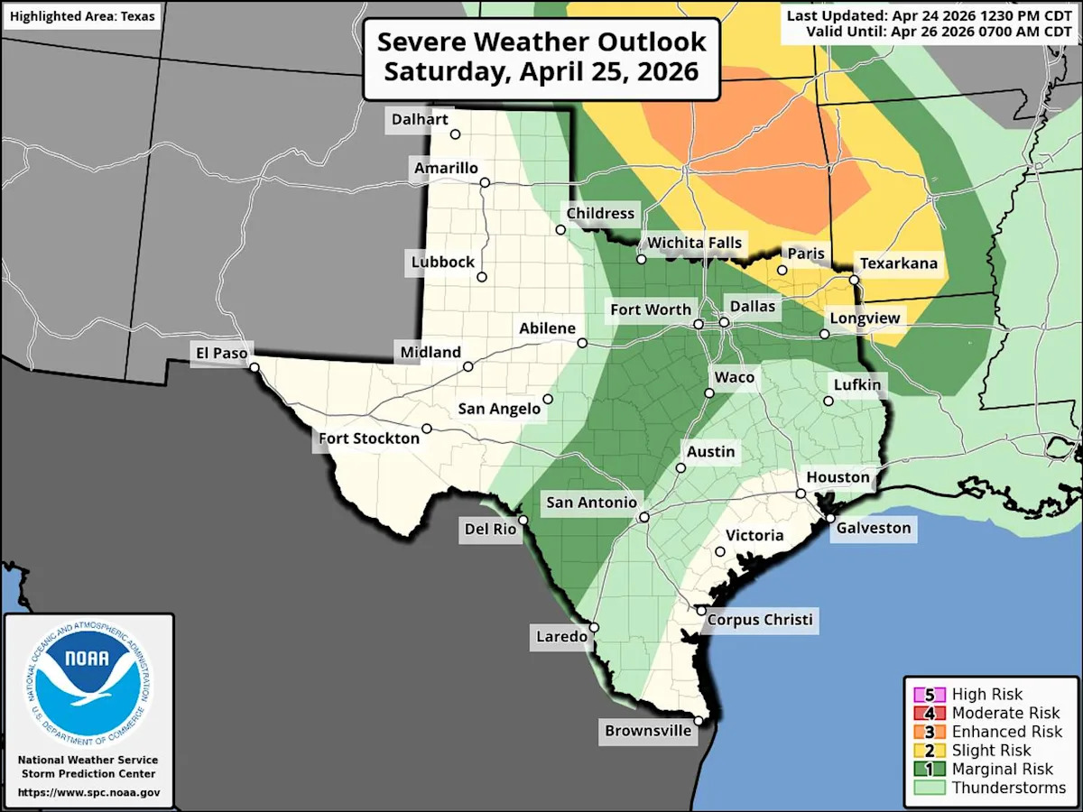
More severe weather is expected on Saturday and Sunday across the central Plains, including North Texas.