
LUBBOCK, Texas (KCBD) – After a warm and windy weekend with 90s and wind gusts in the 50 mph range, we’re relaxing some of that a little as we kick off the final few days of April this week.
TODAY
Temperatures will relax a little compared to the 93 degrees Lubbock saw Sunday afternoon.
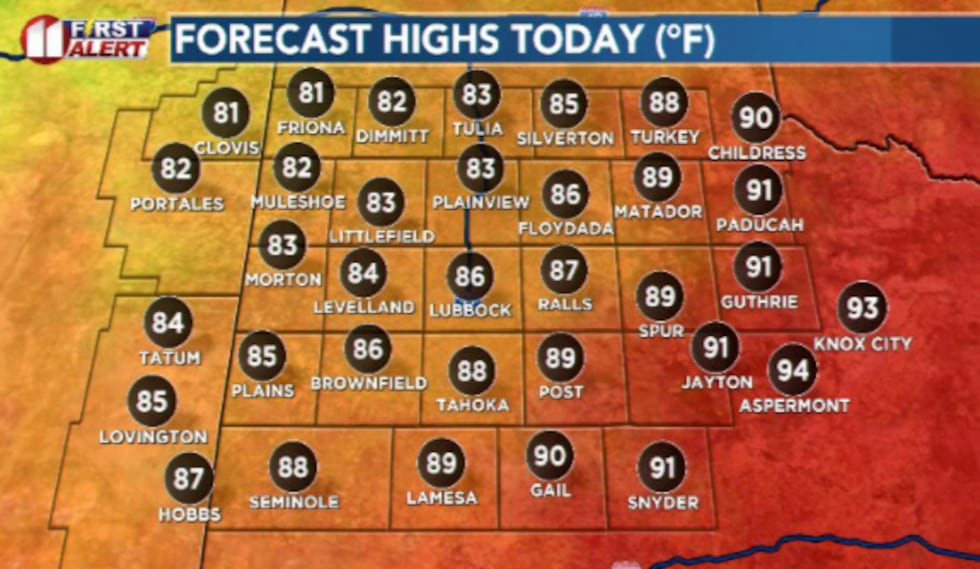 It’ll still be warm, just not as hot as Sundays highs with widespread low to mid 90s.(Dylan Smith)
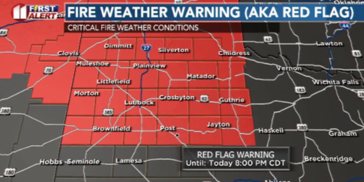
High temps this Monday afternoon will hit the mid to upper 80s with wind gusts of 35 to 40 mph expected this afternoon. This has led to a fire weather warning for the afternoon hours Monday.
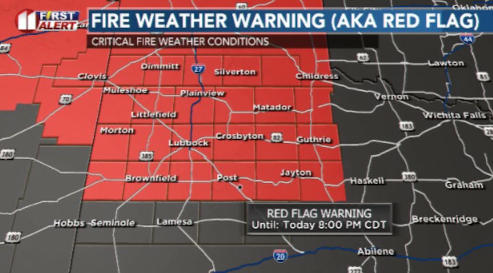 A fire weather warning has been issued from noon until 8:00pm for the area Monday afternoon.(Dylan Smith)
TONIGHT
Mild and breezy again, overnight lows remain in the 50s once again. Winds will stay generally between 10 to 20 mph.
UPCOMING WEATHER PATTERN
We’ve got one more day of critical fire weather possible for Tuesday before some significant changes head our way the rest of the week.
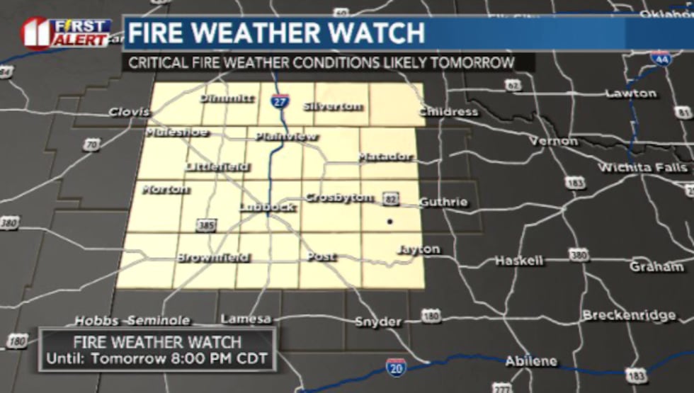 More critical fire weather is expected again Tuesday before a big cooldown arrives for the rest of the week(Dylan Smith)
A cold front arrives by Wednesday morning, dropping us into the 70s and then 60s for the remainder of the week and into next weekend.
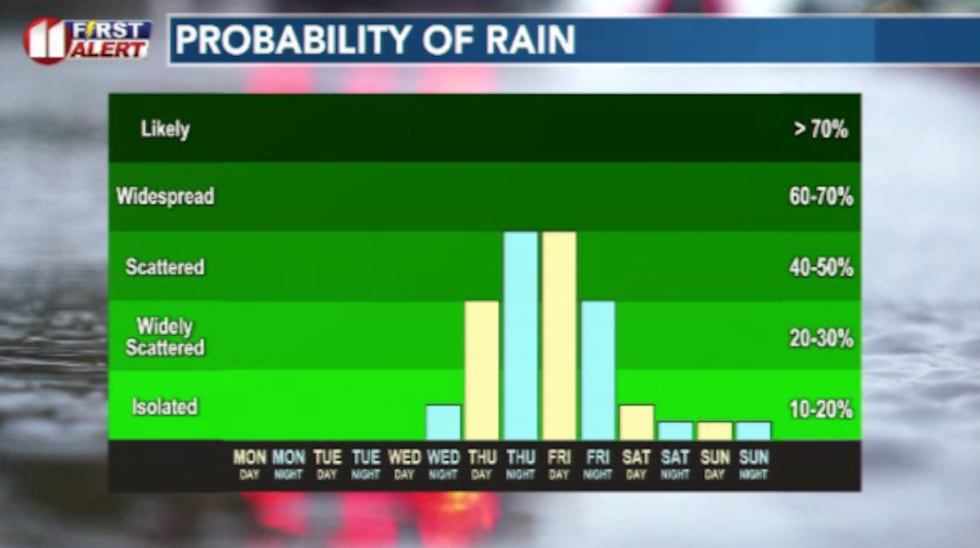 Rain chances peak for the South Plains heading into Thursday/Friday(Dylan Smith)
Rain chances will kick off on Thursday and peak Thursday night into Friday and possible linger into the first half of the day Saturday. A
Copyright 2026 KCBD. All rights reserved.