
Tuesday starts cloudy, warm and breezy, with temperatures in the 70s. Areas of fog are possible for the morning commute.
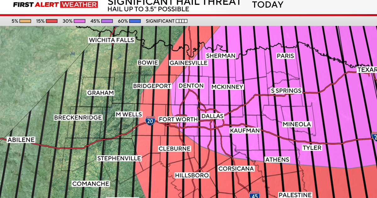
But it will once again be a busy afternoon with severe storms as a dry line and a cold front increase the potential for severe weather, prompting a First Alert Weather Day.

The two main threats are wind and very large hail, with the possibility of an isolated tornado. Hail up to 3.5″ will be possible. For reference, 2.75″ is the size of a baseball, and 4″ is the size of a softball.
The timing of Tuesday’s storms will be between 3 p.m. and 10 p.m., with 4 p.m. to 7 p.m. being the most likely timeframe for the Dallas-Fort Worth Metroplex.


The weather will quiet down overnight and cool down on Wednesday, with cloudy skies and highs in the 70s.
Looking ahead to Thursday, some showers are expected to begin after the morning commute, and then on Friday, rain chances will be steadier and heavier at times, likely to last all day. A First Alert Weather Day is possible on Friday due to disruptive rain. Highs on Friday may struggle to escape the 50s.
Over the next five days, at least 1″ to 2.5″ of rain will be possible, with heavier amounts to the south.

While some rain lingers overnight into the pre-sunrise hours on Saturday, things will dry out just in time for the weekend. Then, temperatures will soar back into the 80s by next Monday.
