
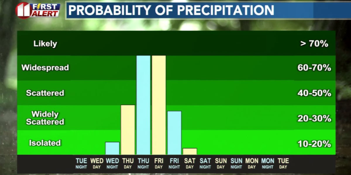
LUBBOCK, Texas (KCBD) – In short, the next few days will bring a significant shift in our weather pattern. Cooler, at times much cooler, weather is on the way. You may even need, or at least want, a jacket. The bigger story, however, is the rain which is likely late Thursday through Friday. Widespread and significant rainfall is possible during that time. While a few thundershowers are possible, at this time severe storms are not expected.
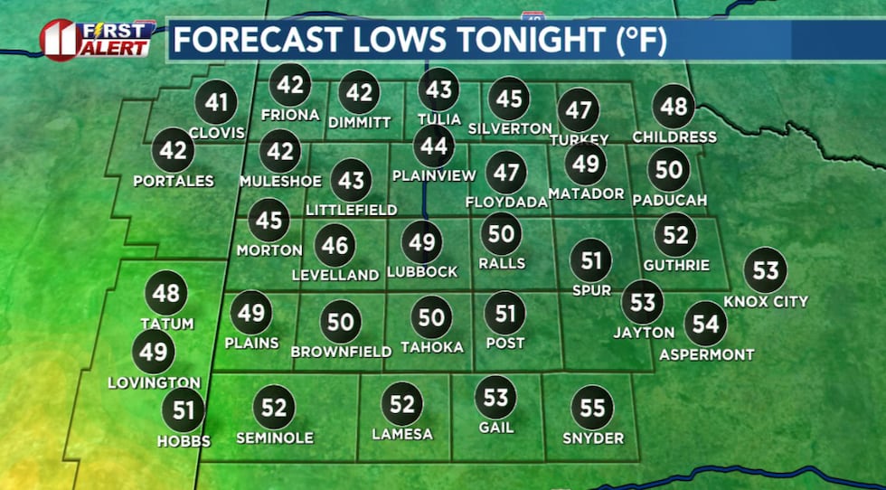 Chilly start to Wednesday.(KCBD First Alert)
Tonight into early Wednesday morning, a cold front pushes eastward across the KCBD/FOX34 viewing area. There’s a slight chance of a light sprinkle or drizzle early Wednesday morning under a cloudy sky. Most of the area will remain dry.
Wednesday afternoon will be mostly cloudy, breezy, and cool. I expect highs in the 70s. The forecast numbers on the map below range from nearly ten degrees below average in the northeast to near average in the southwest.
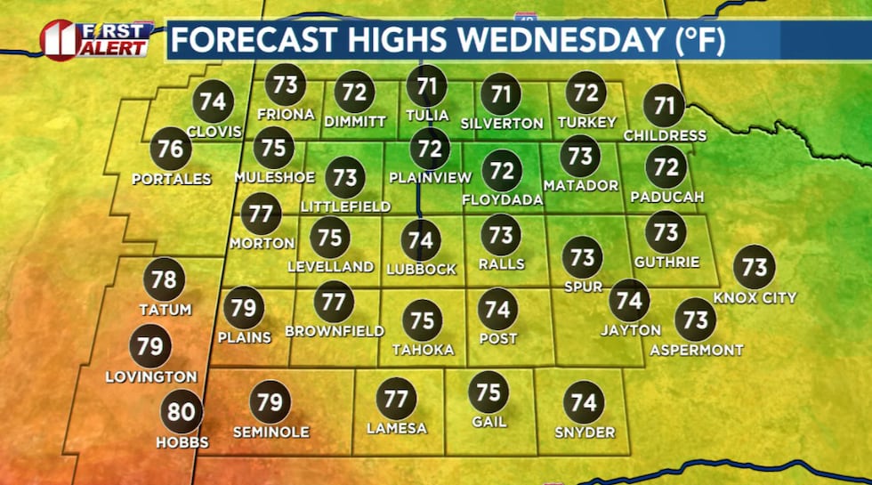 Highs as much as 20 degrees cooler than Tuesday.(KCBD First Alert)
The main weather story unfolds Thursday through Friday. A series of upper-level disturbances will move over the region, bringing occasional showers Thursday, then anticipated widespread rain Thursday night into Friday. This isn’t just a quick pop-up shower situation, rather an extended period of on-and-off rain.
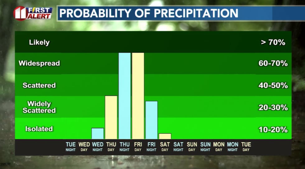 Rain is likely late Thursday through Friday.(KCBD First Alert)
Guidance continues to support a widespread rain, but also the potential for locally heavy rainfall. Based on current data, we anticipate much of the area may see at least a half-inch of rain, with some locations receiving much more. This is good news for our dry conditions, though it does mean you’ll want to keep an umbrella handy and plan accordingly if you have outdoor activities scheduled.
While a few thundershowers are possible, especially across southern portions of the region, severe weather is not expected. Due to the cooler air, the atmosphere will be relatively stable, which keeps the risk of strong storms low.
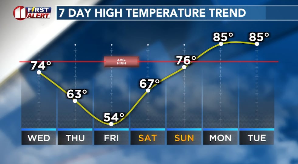 Cooler to much cooler days on the way!(KCBD First Alert)
Along with the rain comes unseasonably cool temperatures. Thursday’s highs will only reach the 60s, and Friday will be even cooler, with highs likely stuck in the 50s.
Overnight lows will be chilly, too. Temperatures could dip into the 30s over much of the northwestern KCBD/FOX34 viewing are by Saturday morning. If you have plants or sensitive outdoor items, you might want to keep an eye on forecast temperatures.
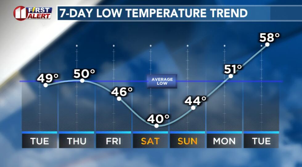 With a cooler pattern, chilly nights and mornings ahead.(KCBD First Alert)
Dry weather returns Saturday and Sunday. Highs Saturday will still be a bit cool, but we’ll gradually warm up heading into Sunday and next week.
Copyright 2026 KCBD. All rights reserved.