

Provided/ NWS Houston
National Weather Service Houston 2025 Halloween forecast.
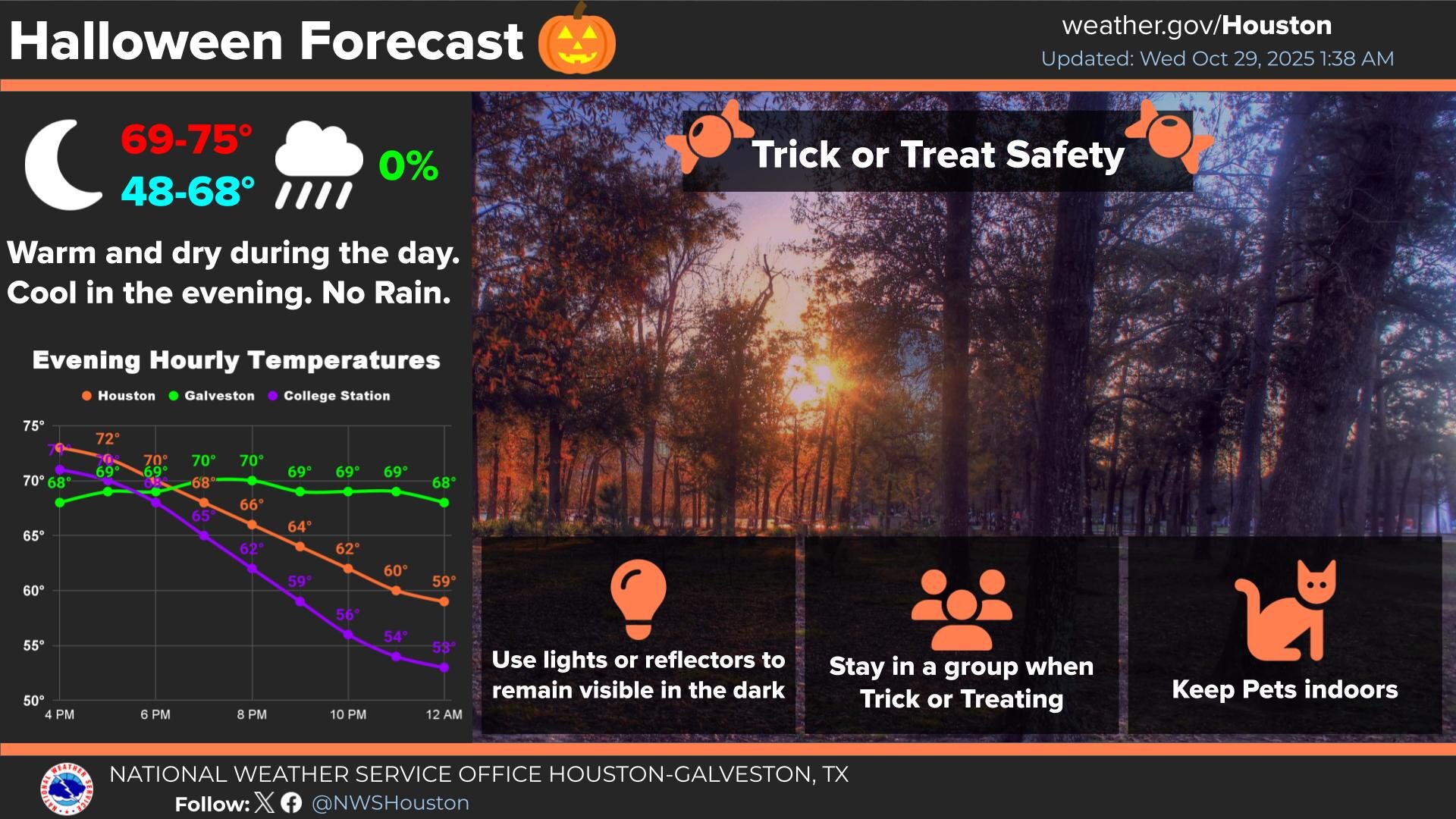
A cold front that arrived on Tuesday evening is expected to keep Houston-area temperatures lower than average through the end of the week, including on Halloween.
The long-awaited fall weather is capping off a potentially record-hot October.
According to the National Weather Service office for the Houston and Galveston region, temperatures are expected to stay below 70 degrees on Thursday and reach a high of 71 on Friday. Halloween night is forecast to be mostly clear with a low of 54.
National Weather Service meteorologist Cameron Self said temperatures may remain slightly below average into the weekend.
“They may try to become a little closer to normal this weekend, but it looks like there could be another cold front over the weekend,” Self said. “What does that mean? Generally highs in the 70s, lows in the 50s, but (Wednesday and Thursday) we’ll be struggling to hit 70 with overnight lows ranging from probably around 50 right in the heart of the urban heat island, with areas outside of Houston falling into the 40s.”
RELATED: Here are six ways to spend your Halloween and Dia de los Muertos weekend in Houston
So far, October has been on track to set a Houston-area record for average high temperature, Self said. This month’s daytime and nighttime average is 77.7 degrees, ahead of the previous October record of 77.5, established in 2004.
“So, it’s very close,” Self said. “Between 2004 and 2025, 2025 has a slight lead, but it could get knocked down just a bit with these below-average temperatures of the next couple of days.”
While the cold front has already pushed offshore, Self said an area of high pressure is creating gusty winds.
“We have a wind advisory today,” he said Wednesday. “We have wind gusts potentially over 40 mph. That can certainly knock down loose objects like trash cans or even Halloween decorations.”
The Texas A&M Forest Service said there is the potential for higher wildfire activity in the lower Gulf Coast and South Texas due to high winds and low relative humidity.