
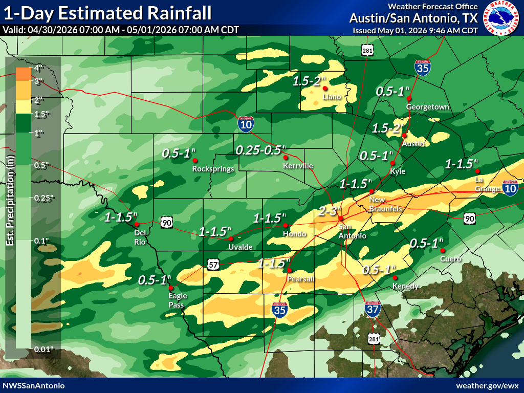
Now, this active pattern is shifting into a heavy rainfall event, and we’re already seeing the effects, with flash flood warnings and road closures reported in South Texas on Friday.
Farther southeast, Houston is also dealing with the aftermath of a strong thunderstorm that moved through overnight, producing a swath of quarter-size to ping pong ball-size hail from Rosenberg to Sugar Land, extending east toward Pearland and near Seabrook. They also picked up between 3 and 4 inches of rainfall east and northeast of Houston.
Here are some of the highest 24-hour rainfall totals in Central Texas, as of Friday morning, according to rain gauges monitored by the Lower Colorado River Authority:
Because of the heavy rainfall that occurred from Thursday through Friday morning, the LCRA has begun flood gate operations in Bastrop County.
More rain will fall throughout the rest of Friday, with a few more rounds of showers and thunderstorms moving across Texas into the evening.
A flood watch remains in effect Friday from West Texas to the Texas-Louisiana border, meaning conditions are favorable for flash flooding. Stay alert for rapidly changing weather, avoid driving through flooded roadways, and keep an eye on alerts in case warnings are issued for your area.